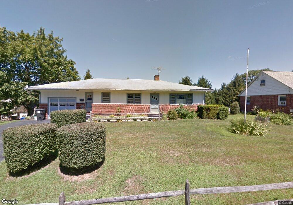
205 W Harmony Rd West Grove, PA 19390
Estimated Value: $320,000 - $347,586
3
Beds
1
Bath
1,302
Sq Ft
$258/Sq Ft
Est. Value
About This Home
This home is located at 205 W Harmony Rd, West Grove, PA 19390 and is currently estimated at $336,397, approximately $258 per square foot. 205 W Harmony Rd is a home located in Chester County with nearby schools including Penn London Elementary School, Avon Grove Intermediate School, and Fred S Engle Middle School.
Ownership History
Date
Name
Owned For
Owner Type
Purchase Details
Closed on
Nov 26, 1997
Sold by
Marston Frank W and Marston Mary F
Bought by
Kinsey Ronald F and Kinsey Brenda S
Current Estimated Value
Home Financials for this Owner
Home Financials are based on the most recent Mortgage that was taken out on this home.
Original Mortgage
$118,900
Outstanding Balance
$20,169
Interest Rate
7.26%
Mortgage Type
FHA
Estimated Equity
$316,228
Create a Home Valuation Report for This Property
The Home Valuation Report is an in-depth analysis detailing your home's value as well as a comparison with similar homes in the area
Home Values in the Area
Average Home Value in this Area
Purchase History
| Date | Buyer | Sale Price | Title Company |
|---|---|---|---|
| Kinsey Ronald F | $119,000 | -- |
Source: Public Records
Mortgage History
| Date | Status | Borrower | Loan Amount |
|---|---|---|---|
| Open | Kinsey Ronald F | $118,900 |
Source: Public Records
Tax History Compared to Growth
Tax History
| Year | Tax Paid | Tax Assessment Tax Assessment Total Assessment is a certain percentage of the fair market value that is determined by local assessors to be the total taxable value of land and additions on the property. | Land | Improvement |
|---|---|---|---|---|
| 2025 | $4,898 | $108,840 | $37,850 | $70,990 |
| 2024 | $4,898 | $108,840 | $37,850 | $70,990 |
| 2023 | $4,805 | $108,840 | $37,850 | $70,990 |
| 2022 | $4,688 | $108,840 | $37,850 | $70,990 |
| 2021 | $4,600 | $108,840 | $37,850 | $70,990 |
| 2020 | $4,460 | $108,840 | $37,850 | $70,990 |
| 2019 | $4,360 | $108,840 | $37,850 | $70,990 |
| 2018 | $4,260 | $108,840 | $37,850 | $70,990 |
| 2017 | $4,180 | $108,840 | $37,850 | $70,990 |
| 2016 | $2,941 | $108,840 | $37,850 | $70,990 |
| 2015 | $2,941 | $108,840 | $37,850 | $70,990 |
| 2014 | $2,941 | $108,840 | $37,850 | $70,990 |
Source: Public Records
Map
Nearby Homes
- 8 Prospect Ave
- 117 Railroad Ave Unit 10
- 135 Jackson Ave
- 400 N Guernsey Rd
- 504 Prospect Ave
- 9 Morningside Ct
- 423 N Guernsey Rd
- 25 Holly Dr
- 286 State Rd
- 603 Lamborn Ridge Dr
- 17 Nottingham Dr
- 403 E Glenview Dr
- 653 State Rd
- 735 W Glenview Dr
- 24 Caversham Dr
- 607 Martin Dr
- 11 White Oak Dr
- 622 Martin Dr
- 26 Inniscrone Dr
- 263 Schoolhouse Rd
- 203 W Harmony Rd
- 5 Friends Dr
- 1 Joseph Pyle Dr
- 3 Friends Dr
- 200 W Harmony Rd
- 202 W Harmony Rd
- 201 W Harmony Rd
- 204 W Harmony Rd
- 6 Friends Dr
- 4 Friends Dr
- 20 Maple Ave
- 117 W Harmony Rd
- 2 Joseph Pyle Dr
- 8 Friends Dr
- 115 W Harmony Rd
- 4 Joseph Pyle Dr
- 21 Maple Ave
- 206 W Harmony Rd
- 129 W Evergreen St
- 6 Joseph Pyle Dr