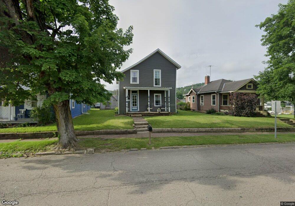
205 W Main St Bainbridge, OH 45612
Estimated Value: $130,231 - $176,000
3
Beds
2
Baths
1,432
Sq Ft
$107/Sq Ft
Est. Value
About This Home
This home is located at 205 W Main St, Bainbridge, OH 45612 and is currently estimated at $153,308, approximately $107 per square foot. 205 W Main St is a home located in Ross County with nearby schools including Paint Valley Elementary School, Paint Valley Middle School, and Paint Valley High School.
Ownership History
Date
Name
Owned For
Owner Type
Purchase Details
Closed on
May 9, 2006
Sold by
Jones Virgil R
Bought by
Woods Heidi L
Current Estimated Value
Home Financials for this Owner
Home Financials are based on the most recent Mortgage that was taken out on this home.
Original Mortgage
$40,903
Outstanding Balance
$23,905
Interest Rate
6.56%
Mortgage Type
FHA
Estimated Equity
$129,403
Purchase Details
Closed on
May 27, 2005
Sold by
Anthony Lewis
Bought by
Jones Virgil R
Create a Home Valuation Report for This Property
The Home Valuation Report is an in-depth analysis detailing your home's value as well as a comparison with similar homes in the area
Home Values in the Area
Average Home Value in this Area
Purchase History
| Date | Buyer | Sale Price | Title Company |
|---|---|---|---|
| Woods Heidi L | $41,600 | Titlequest Agency Inc | |
| Jones Virgil R | $20,500 | Scioto Valley Title Agency |
Source: Public Records
Mortgage History
| Date | Status | Borrower | Loan Amount |
|---|---|---|---|
| Open | Woods Heidi L | $40,903 |
Source: Public Records
Tax History Compared to Growth
Tax History
| Year | Tax Paid | Tax Assessment Tax Assessment Total Assessment is a certain percentage of the fair market value that is determined by local assessors to be the total taxable value of land and additions on the property. | Land | Improvement |
|---|---|---|---|---|
| 2024 | $1,231 | $30,310 | $1,250 | $29,060 |
| 2023 | $1,231 | $30,310 | $1,250 | $29,060 |
| 2022 | $1,236 | $30,310 | $1,250 | $29,060 |
| 2021 | $705 | $15,710 | $960 | $14,750 |
| 2020 | $705 | $15,710 | $960 | $14,750 |
| 2019 | $716 | $15,710 | $960 | $14,750 |
| 2018 | $647 | $14,350 | $830 | $13,520 |
| 2017 | $641 | $14,200 | $830 | $13,370 |
| 2016 | $627 | $14,200 | $830 | $13,370 |
| 2015 | $598 | $13,710 | $830 | $12,880 |
| 2014 | $568 | $13,710 | $830 | $12,880 |
| 2013 | $436 | $10,430 | $830 | $9,600 |
Source: Public Records
Map
Nearby Homes
- 116 W Main St
- 316 W Main St
- 116 E 3rd St
- 217 S Quarry St
- 301 N Maple St
- 316 S Maple St
- 213 S Benner Hill Rd
- 2470 Tong Hollow Rd
- 329 Kinzer Rd
- 1314 U S 50
- 1314 US Highway 50 W
- 3307 Potts Hill Rd
- 5979 Greenbriar Rd
- 4511 Potts Hill Rd
- 560 Landrum Rd
- 0 Potts Hill Rd Unit 198949
- 929 Free Ln
- 8818 State Route 41 N
- 14703 Brier Rd
- 728 Alexander Hollow Rd
- 207 W Main St
- 203 W Main St
- 201 W Main St
- 101 S Mountain St
- 206 W Main St
- 202 W Main St
- 204 W Main St
- 302 W Main St
- 107 S Mountain St
- 109 S Mountain St
- 102 S Mountain St
- 113 W Main St
- 102 N Harris St
- 103 N Mountain St
- 304 W Main St
- 111 W Main St
- 106 S Mountain St
- 106 W 2nd St
- 111 W 2nd St
- 109 W Main St