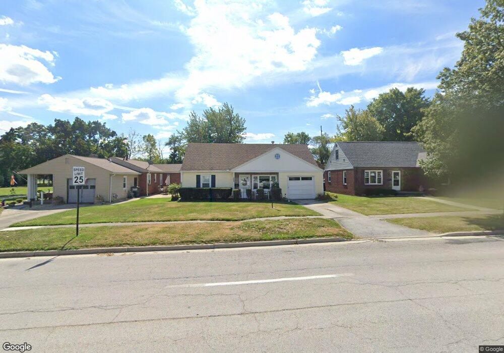
205 W Mcpherson Ave Findlay, OH 45840
Estimated Value: $127,000 - $158,048
2
Beds
1
Bath
888
Sq Ft
$159/Sq Ft
Est. Value
About This Home
This home is located at 205 W Mcpherson Ave, Findlay, OH 45840 and is currently estimated at $141,012, approximately $158 per square foot. 205 W Mcpherson Ave is a home located in Hancock County with nearby schools including Jefferson Elementary School, Chamberlin Hill Elementary School, and Donnell Middle School.
Ownership History
Date
Name
Owned For
Owner Type
Purchase Details
Closed on
Jan 20, 2016
Bought by
Sutton Jill R
Current Estimated Value
Home Financials for this Owner
Home Financials are based on the most recent Mortgage that was taken out on this home.
Interest Rate
3.92%
Purchase Details
Closed on
Apr 13, 1998
Sold by
Cole Jack
Bought by
Sutton Donald and Sutton Jill
Create a Home Valuation Report for This Property
The Home Valuation Report is an in-depth analysis detailing your home's value as well as a comparison with similar homes in the area
Home Values in the Area
Average Home Value in this Area
Purchase History
| Date | Buyer | Sale Price | Title Company |
|---|---|---|---|
| Sutton Jill R | -- | -- | |
| Sutton Donald | $40,000 | -- |
Source: Public Records
Mortgage History
| Date | Status | Borrower | Loan Amount |
|---|---|---|---|
| Closed | Sutton Jill R | -- |
Source: Public Records
Tax History Compared to Growth
Tax History
| Year | Tax Paid | Tax Assessment Tax Assessment Total Assessment is a certain percentage of the fair market value that is determined by local assessors to be the total taxable value of land and additions on the property. | Land | Improvement |
|---|---|---|---|---|
| 2024 | $1,175 | $42,880 | $5,500 | $37,380 |
| 2023 | $1,199 | $42,880 | $5,500 | $37,380 |
| 2022 | $1,210 | $42,880 | $5,500 | $37,380 |
| 2021 | $1,115 | $36,140 | $5,640 | $30,500 |
| 2020 | $1,115 | $36,140 | $5,640 | $30,500 |
| 2019 | $1,092 | $36,140 | $5,640 | $30,500 |
| 2018 | $967 | $30,960 | $3,970 | $26,990 |
| 2017 | $483 | $30,960 | $3,970 | $26,990 |
| 2016 | $962 | $30,960 | $3,970 | $26,990 |
| 2015 | $581 | $22,040 | $3,400 | $18,640 |
| 2014 | $581 | $22,040 | $3,400 | $18,640 |
| 2012 | $589 | $22,040 | $3,400 | $18,640 |
Source: Public Records
Map
Nearby Homes
- 1421 Hurd Ave
- 123 Glendale Ave
- 1621 S Main St
- 1705 S Main St
- 211 Fairlawn Place
- 1115 Liberty St
- 1727 Washington Ave
- 416 1/2 Lima Ave
- 412 Lima Ave
- 1109 Park St
- 905 S West St
- 202 Hancock St
- 225 Lima Ave
- 420 1st St
- 200 E Edgar Ave
- 829 Maple Ave
- 720 S West St
- 419 W Lincoln St
- 242 E Yates Ave
- 527 W Lincoln St
- 201 W Mcpherson Ave
- 211 W Mcpherson Ave
- 215 W Mcpherson Ave
- 1410 Douglas Pkwy
- 223 W Mcpherson Ave
- 1312 Douglas Pkwy
- 200 W Mcpherson Ave
- 1310 Douglas Pkwy
- 125 W Mcpherson Ave
- 212 W Mcpherson Ave
- 1308 Douglas Pkwy
- 123 W Mcpherson Ave
- 130 W Mcpherson Ave
- 1325 S West St
- 121 W Mcpherson Ave
- 1306 Douglas Pkwy
- 300 W Mcpherson Ave
- 1321 S West St
- 126 W Mcpherson Ave