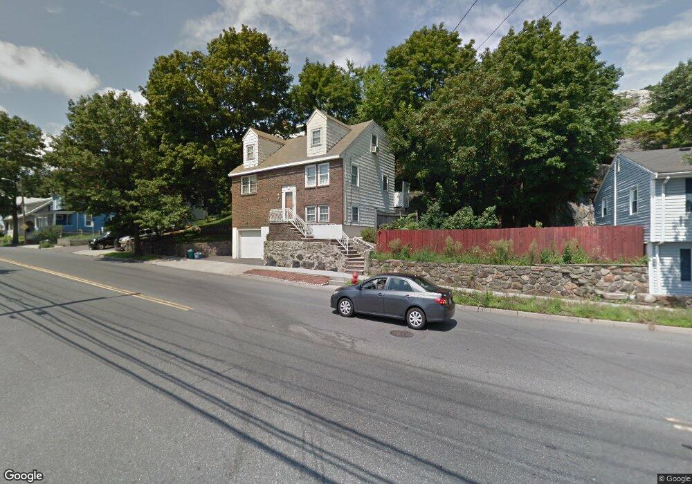
205 Walnut St Lynn, MA 01905
Parkland Avenue NeighborhoodEstimated Value: $574,000 - $597,000
2
Beds
2
Baths
1,428
Sq Ft
$409/Sq Ft
Est. Value
About This Home
This home is located at 205 Walnut St, Lynn, MA 01905 and is currently estimated at $583,478, approximately $408 per square foot. 205 Walnut St is a home located in Essex County with nearby schools including William R. Fallon School, Sewell-Anderson Elementary School, and Breed Middle School.
Ownership History
Date
Name
Owned For
Owner Type
Purchase Details
Closed on
Jul 1, 1987
Sold by
Gronbeck Raymond J
Bought by
Macdonald Robert J
Current Estimated Value
Home Financials for this Owner
Home Financials are based on the most recent Mortgage that was taken out on this home.
Original Mortgage
$123,300
Interest Rate
10.76%
Mortgage Type
Purchase Money Mortgage
Create a Home Valuation Report for This Property
The Home Valuation Report is an in-depth analysis detailing your home's value as well as a comparison with similar homes in the area
Home Values in the Area
Average Home Value in this Area
Purchase History
| Date | Buyer | Sale Price | Title Company |
|---|---|---|---|
| Macdonald Robert J | $137,000 | -- |
Source: Public Records
Mortgage History
| Date | Status | Borrower | Loan Amount |
|---|---|---|---|
| Closed | Macdonald Robert J | $123,300 |
Source: Public Records
Tax History
| Year | Tax Paid | Tax Assessment Tax Assessment Total Assessment is a certain percentage of the fair market value that is determined by local assessors to be the total taxable value of land and additions on the property. | Land | Improvement |
|---|---|---|---|---|
| 2025 | $5,395 | $520,800 | $214,100 | $306,700 |
| 2024 | $4,980 | $472,900 | $188,000 | $284,900 |
| 2023 | $4,999 | $448,300 | $194,200 | $254,100 |
| 2022 | $4,895 | $393,800 | $143,800 | $250,000 |
| 2021 | $4,773 | $366,300 | $132,200 | $234,100 |
| 2020 | $4,657 | $347,500 | $127,300 | $220,200 |
| 2019 | $4,700 | $328,700 | $119,800 | $208,900 |
| 2018 | $4,703 | $310,400 | $132,200 | $178,200 |
| 2017 | $4,218 | $270,400 | $109,900 | $160,500 |
| 2016 | $3,823 | $236,300 | $102,900 | $133,400 |
| 2015 | $3,747 | $223,700 | $102,100 | $121,600 |
Source: Public Records
Map
Nearby Homes
- 268 Walnut St
- 70 Wyman St
- 50-50A Kirtland St
- 46 Wilfred St
- 73 Waterhill St
- 590 Boston St Unit 303
- 32 Birch Brook Rd Unit 13
- 32 Birch Brook Rd Unit 27
- 32 Birch Brook Rd Unit 16
- 32 Birch Brook Rd Unit 1
- 32 Birch Brook Rd Unit 14
- 32 Birch Brook Rd Unit 28
- 32 Birch Brook Landing Unit 23
- 32 Birch Brook Landing Unit 25
- 32 Birch Brook Landing Unit 22
- 16 Salem St
- 78-80 Spencer St
- 34 Grove St
- 20 Murray St
- 99 New Park St
- 207 Walnut St
- 195 Walnut St
- 202 Walnut St
- 213 Walnut St
- 211 Walnut St
- 192 Walnut St
- 187 Walnut St
- 215 Walnut St
- 208 Walnut St Unit 210
- 210 Walnut St
- 139 Wyman St Unit 141
- 139-141 Wyman St
- 139 Wyman St Unit 1
- 139 Wyman St Unit B
- 141 Wyman St Unit 1
- 136 Wyman St
- 212 Walnut St
- 184 Walnut St
- 183 Walnut St Unit 185
- 183-185 Walnut St
Your Personal Tour Guide
Ask me questions while you tour the home.