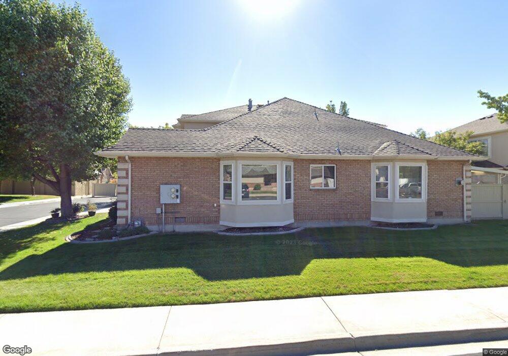
205 Woodside Dr Provo, UT 84604
Riverside NeighborhoodEstimated Value: $564,000 - $580,000
3
Beds
3
Baths
2,231
Sq Ft
$256/Sq Ft
Est. Value
About This Home
This home is located at 205 Woodside Dr, Provo, UT 84604 and is currently estimated at $570,153, approximately $255 per square foot. 205 Woodside Dr is a home located in Utah County with nearby schools including Canyon Crest Elementary School, Centennial Middle School, and Timpview High School.
Ownership History
Date
Name
Owned For
Owner Type
Purchase Details
Closed on
Nov 26, 2019
Sold by
Lindsay Lorna and Lindsay Living Trust
Bought by
Flaten Donald G and Flaten Diane L
Current Estimated Value
Home Financials for this Owner
Home Financials are based on the most recent Mortgage that was taken out on this home.
Original Mortgage
$250,000
Outstanding Balance
$169,260
Interest Rate
3.5%
Mortgage Type
New Conventional
Estimated Equity
$400,893
Purchase Details
Closed on
Jun 26, 1998
Sold by
Lindsay Willard and Lindsay Lorna
Bought by
Lindsay Lorna
Home Financials for this Owner
Home Financials are based on the most recent Mortgage that was taken out on this home.
Original Mortgage
$80,000
Interest Rate
7.06%
Create a Home Valuation Report for This Property
The Home Valuation Report is an in-depth analysis detailing your home's value as well as a comparison with similar homes in the area
Home Values in the Area
Average Home Value in this Area
Purchase History
| Date | Buyer | Sale Price | Title Company |
|---|---|---|---|
| Flaten Donald G | -- | Stewart Title Ins Agcy Of Ut | |
| Lindsay Lorna | -- | Provo Land Title | |
| Lindsay Willard | -- | Provo Land Title |
Source: Public Records
Mortgage History
| Date | Status | Borrower | Loan Amount |
|---|---|---|---|
| Open | Flaten Donald G | $250,000 | |
| Previous Owner | Lindsay Willard | $80,000 |
Source: Public Records
Tax History Compared to Growth
Tax History
| Year | Tax Paid | Tax Assessment Tax Assessment Total Assessment is a certain percentage of the fair market value that is determined by local assessors to be the total taxable value of land and additions on the property. | Land | Improvement |
|---|---|---|---|---|
| 2025 | $2,661 | $267,740 | $88,600 | $398,200 |
| 2024 | $2,661 | $261,965 | $0 | $0 |
| 2023 | $2,959 | $287,100 | $0 | $0 |
| 2022 | $2,981 | $291,665 | $0 | $0 |
| 2021 | $2,372 | $404,800 | $90,000 | $314,800 |
| 2020 | $2,365 | $378,300 | $90,000 | $288,300 |
| 2019 | $2,236 | $372,000 | $90,000 | $282,000 |
| 2018 | $1,986 | $335,200 | $90,000 | $245,200 |
| 2017 | $1,733 | $160,710 | $0 | $0 |
| 2016 | $1,860 | $160,710 | $0 | $0 |
| 2015 | $1,766 | $154,275 | $0 | $0 |
| 2014 | $1,540 | $140,250 | $0 | $0 |
Source: Public Records
Map
Nearby Homes
- 3430 Brookside Dr
- 3477 Brookside Dr
- 3535 N 160 St W
- 3240 Shadowbrook Dr
- 3057 N 100 W
- 404 W 3700 N
- 3013 N 100 W
- 2939 N Marrcrest Dr W
- 2888 Marrcrest W
- 1171 S Carterville Rd
- 1311 S 1100 E
- 2823 N Marrcrest E
- 1237 S 1000 E
- 96 Marrcrest S
- 1360 S Carterville Rd
- 282 W 4020 N
- 1636 N 320 E Unit 5
- 1660 N 320 E Unit 3
- 1648 N 320 E Unit 4
- 1625 N 320 E Unit 1
- 205 Woodside Dr Unit 48
- 201 Woodside Dr Unit 47
- 217 Woodside Dr
- 223 Woodside Dr
- 223 Woodside Dr Unit 50
- 185 Woodside Dr
- 185 Woodside Dr Unit 46
- 191 Woodside Dr
- 202 W 3300 N
- 3410 Brookside Dr
- 241 Woodside Dr
- 235 Woodside Dr
- 3420 Brookside Dr
- 226 W 3300 N
- 173 Woodside Dr
- 180 Woodside Dr
- 180 Woodside Dr Unit 23
- 188 W 3300 N
- 3424 Brookside Dr
- 166 Woodside Dr