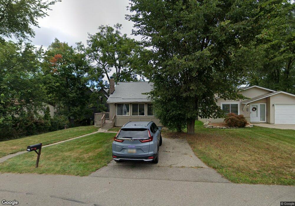
2050 Appoline Dr Unit Bldg-Unit West Bloomfield, MI 48323
Estimated Value: $261,000 - $420,000
3
Beds
2
Baths
855
Sq Ft
$391/Sq Ft
Est. Value
About This Home
This home is located at 2050 Appoline Dr Unit Bldg-Unit, West Bloomfield, MI 48323 and is currently estimated at $334,201, approximately $390 per square foot. 2050 Appoline Dr Unit Bldg-Unit is a home located in Oakland County with nearby schools including Wylie E. Groves High School, West Maple Elementary School, and Berkshire Middle School.
Ownership History
Date
Name
Owned For
Owner Type
Purchase Details
Closed on
Jun 4, 2018
Sold by
Habib Mansoor
Bought by
Goldstein Alisa
Current Estimated Value
Home Financials for this Owner
Home Financials are based on the most recent Mortgage that was taken out on this home.
Original Mortgage
$220,924
Outstanding Balance
$190,630
Interest Rate
4.4%
Mortgage Type
FHA
Estimated Equity
$143,571
Purchase Details
Closed on
Aug 15, 2017
Sold by
Kolachi Investment Llc
Bought by
Habib Mansoor
Purchase Details
Closed on
Mar 9, 2004
Sold by
The Revocable Trust Of Steven Spiegel Pa
Bought by
Spiegel Majdi Patricia
Home Financials for this Owner
Home Financials are based on the most recent Mortgage that was taken out on this home.
Original Mortgage
$100,000
Interest Rate
5.48%
Mortgage Type
New Conventional
Create a Home Valuation Report for This Property
The Home Valuation Report is an in-depth analysis detailing your home's value as well as a comparison with similar homes in the area
Home Values in the Area
Average Home Value in this Area
Purchase History
| Date | Buyer | Sale Price | Title Company |
|---|---|---|---|
| Goldstein Alisa | $225,000 | None Available | |
| Habib Mansoor | -- | None Available | |
| Spiegel Majdi Patricia | -- | Colonial Title Co |
Source: Public Records
Mortgage History
| Date | Status | Borrower | Loan Amount |
|---|---|---|---|
| Open | Goldstein Alisa | $220,924 | |
| Previous Owner | Spiegel Majdi Patricia | $100,000 |
Source: Public Records
Tax History Compared to Growth
Tax History
| Year | Tax Paid | Tax Assessment Tax Assessment Total Assessment is a certain percentage of the fair market value that is determined by local assessors to be the total taxable value of land and additions on the property. | Land | Improvement |
|---|---|---|---|---|
| 2024 | $1,886 | $101,440 | $0 | $0 |
| 2022 | $1,810 | $104,070 | $42,850 | $61,220 |
| 2021 | $4,178 | $98,470 | $0 | $0 |
| 2020 | $1,739 | $97,180 | $42,850 | $54,330 |
| 2018 | $2,574 | $64,330 | $35,650 | $28,680 |
| 2015 | -- | $50,840 | $0 | $0 |
| 2014 | -- | $48,190 | $0 | $0 |
| 2011 | -- | $60,520 | $0 | $0 |
Source: Public Records
Map
Nearby Homes
- 5620 Inkster Rd
- 5620 Eastman Blvd
- 0000 Putnam Dr
- 4783 Quarton Rd
- 5118 Vincennes Ct
- 2149 Sunnycrest Dr
- 4768 Wendrick Dr
- 5605 Woodwind Dr
- 4724 Tara Ct
- 5881 Naneva Ct
- 1907 Raymond Place
- 4776 Walnut Lake Rd
- 5611 Priory Ln
- 2433 Wickfield Rd
- 5897 Sutters Ln
- 5815 Bloomfield Glens Rd
- 1715 Lone Pine Rd
- 4597 Broughton Dr
- 5190 Clarendon Crest St
- 1651 Hoit Tower Dr
- 2050 Appoline Dr
- 2040 Appoline Dr
- 5353 Sunnycrest Dr
- 2066 Appoline Dr
- 2022 Appoline Dr
- 5371 Sunnycrest Dr
- 5349 Sunnycrest Dr
- 5347 Sunnycrest Dr
- 2020 Appoline Dr
- 2061 Appoline Dr
- 2043 Appoline Dr
- 5385 Sunnycrest Dr
- 2067 Appoline Dr
- 5345 Sunnycrest Dr
- 2035 Appoline Dr
- 2075 Appoline Dr
- 2087 Appoline Dr Unit Bldg-Unit
- 2087 Appoline Dr
- 2019 Appoline Dr
- 5354 Sunnycrest Dr