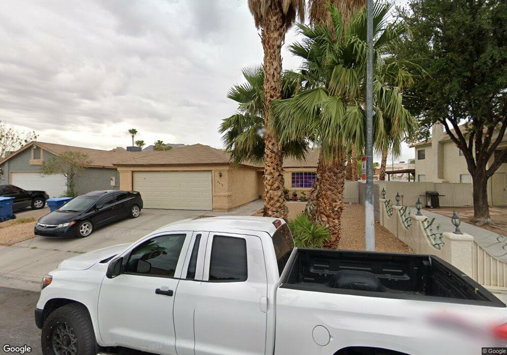
2050 Bowstring Dr Las Vegas, NV 89142
Estimated Value: $325,155 - $341,000
3
Beds
2
Baths
1,025
Sq Ft
$325/Sq Ft
Est. Value
About This Home
This home is located at 2050 Bowstring Dr, Las Vegas, NV 89142 and is currently estimated at $333,289, approximately $325 per square foot. 2050 Bowstring Dr is a home located in Clark County with nearby schools including John F. Mendoza Elementary School, Duane D. Keller Middle School, and Las Vegas High School.
Ownership History
Date
Name
Owned For
Owner Type
Purchase Details
Closed on
Aug 22, 2003
Sold by
Garcia Mirian and Parra Juan
Bought by
Marroquin Carla D
Current Estimated Value
Home Financials for this Owner
Home Financials are based on the most recent Mortgage that was taken out on this home.
Original Mortgage
$130,900
Outstanding Balance
$60,340
Interest Rate
6.75%
Mortgage Type
Unknown
Estimated Equity
$272,949
Purchase Details
Closed on
Jun 18, 1996
Sold by
Lambert Michael Shawn and Lambert Patricia A
Bought by
Garcia Mirian and Garcia Maria A Funes
Home Financials for this Owner
Home Financials are based on the most recent Mortgage that was taken out on this home.
Original Mortgage
$94,236
Interest Rate
8.01%
Mortgage Type
FHA
Create a Home Valuation Report for This Property
The Home Valuation Report is an in-depth analysis detailing your home's value as well as a comparison with similar homes in the area
Home Values in the Area
Average Home Value in this Area
Purchase History
| Date | Buyer | Sale Price | Title Company |
|---|---|---|---|
| Marroquin Carla D | $130,900 | Old Republic Title Co Of Ne | |
| Garcia Mirian | $95,000 | Land Title |
Source: Public Records
Mortgage History
| Date | Status | Borrower | Loan Amount |
|---|---|---|---|
| Open | Marroquin Carla D | $130,900 | |
| Previous Owner | Garcia Mirian | $94,236 |
Source: Public Records
Tax History
| Year | Tax Paid | Tax Assessment Tax Assessment Total Assessment is a certain percentage of the fair market value that is determined by local assessors to be the total taxable value of land and additions on the property. | Land | Improvement |
|---|---|---|---|---|
| 2026 | $1,237 | $52,848 | $23,100 | $29,748 |
| 2025 | $945 | $53,571 | $23,100 | $30,471 |
| 2024 | $1,162 | $53,571 | $23,100 | $30,471 |
| 2023 | $1,162 | $55,526 | $26,250 | $29,276 |
| 2022 | $811 | $48,318 | $21,350 | $26,968 |
| 2021 | $751 | $45,789 | $19,950 | $25,839 |
| 2020 | $694 | $44,728 | $18,900 | $25,828 |
| 2019 | $651 | $39,942 | $14,350 | $25,592 |
| 2018 | $621 | $38,001 | $13,300 | $24,701 |
| 2017 | $1,044 | $35,609 | $10,500 | $25,109 |
| 2016 | $583 | $33,168 | $7,700 | $25,468 |
| 2015 | $832 | $24,826 | $5,600 | $19,226 |
| 2014 | $697 | $20,295 | $5,250 | $15,045 |
Source: Public Records
Map
Nearby Homes
- 1841 Skywood Way
- 5832 Ballinger Dr
- 5539 Ballinger Dr
- 5634 Alcott Ave
- 1689 Foxglove Dr
- 1745 Starridge Way
- 1718 S Christy Ln
- 5650 E Sahara Ave Unit 2026
- 5650 E Sahara Ave Unit 1057
- 5650 E Sahara Ave Unit 2010
- 1919 Niblick Cir
- 5391 Aston Ave
- 5655 E Sahara Ave Unit 1023
- 5984 Emerald Canyon Dr
- 5406 Silverheart Ave
- 1487 Elaine Dr
- 1747 Angel Falls St
- 5915 Woodfield Dr
- 1812 Baden Dr
- 2508 Alfa Cir
- 2040 Bowstring Dr
- 2060 Bowstring Dr
- 5694 Akron Ct
- 2030 Bowstring Dr
- 2070 Bowstring Dr
- 5704 Akron Ct
- 5699 Akron Ct
- 5652 Gazebo Way
- 5695 Ballinger Dr
- 2010 Bowstring Dr
- 2080 Bowstring Dr
- 5712 Akron Ct
- 5709 Akron Ct
- 5703 Ballinger Dr
- 2061 Bowstring Dr
- 5642 Gazebo Way
- 5645 Ballinger Dr
- 5720 Akron Ct
- 5711 Ballinger Dr
- 2090 Bowstring Dr
Your Personal Tour Guide
Ask me questions while you tour the home.