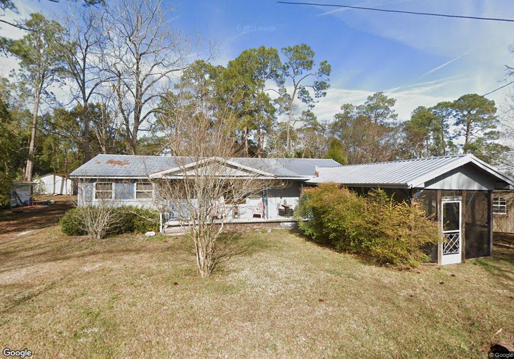
2050 Clark Cir Ochlocknee, GA 31773
Estimated Value: $71,030 - $139,000
--
Bed
2
Baths
1,184
Sq Ft
$92/Sq Ft
Est. Value
About This Home
This home is located at 2050 Clark Cir, Ochlocknee, GA 31773 and is currently estimated at $109,258, approximately $92 per square foot. 2050 Clark Cir is a home located in Thomas County with nearby schools including Hand in Hand Primary School, Cross Creek Elementary School, and Garrison-Pilcher Elementary School.
Ownership History
Date
Name
Owned For
Owner Type
Purchase Details
Closed on
Apr 30, 2019
Sold by
Ricks Wanda G
Bought by
Walden Mona B
Current Estimated Value
Home Financials for this Owner
Home Financials are based on the most recent Mortgage that was taken out on this home.
Original Mortgage
$49,494
Outstanding Balance
$43,338
Interest Rate
4%
Mortgage Type
New Conventional
Estimated Equity
$65,920
Purchase Details
Closed on
Mar 26, 2004
Sold by
Watson James L and Watson Ernestine H
Bought by
Lamb Lester Harrell
Purchase Details
Closed on
Aug 16, 2000
Sold by
Watson James L
Bought by
Watson James L and Watson Ernestine H
Purchase Details
Closed on
Aug 30, 1983
Sold by
Slappy R A
Bought by
Watson James L
Create a Home Valuation Report for This Property
The Home Valuation Report is an in-depth analysis detailing your home's value as well as a comparison with similar homes in the area
Home Values in the Area
Average Home Value in this Area
Purchase History
| Date | Buyer | Sale Price | Title Company |
|---|---|---|---|
| Walden Mona B | $49,000 | -- | |
| Lamb Lester Harrell | $17,300 | -- | |
| Watson James L | -- | -- | |
| Watson James L | -- | -- |
Source: Public Records
Mortgage History
| Date | Status | Borrower | Loan Amount |
|---|---|---|---|
| Open | Walden Mona B | $49,494 |
Source: Public Records
Tax History Compared to Growth
Tax History
| Year | Tax Paid | Tax Assessment Tax Assessment Total Assessment is a certain percentage of the fair market value that is determined by local assessors to be the total taxable value of land and additions on the property. | Land | Improvement |
|---|---|---|---|---|
| 2024 | $389 | $14,776 | $2,172 | $12,604 |
| 2023 | $363 | $14,043 | $2,172 | $11,871 |
| 2022 | $247 | $11,970 | $1,810 | $10,160 |
| 2021 | $233 | $10,528 | $1,810 | $8,718 |
| 2020 | $237 | $10,476 | $1,810 | $8,666 |
| 2019 | $285 | $10,476 | $1,810 | $8,666 |
| 2018 | $294 | $10,749 | $1,810 | $8,939 |
| 2017 | $296 | $10,651 | $1,611 | $9,040 |
| 2016 | $555 | $21,632 | $1,710 | $19,923 |
| 2015 | $368 | $23,740 | $1,594 | $22,146 |
| 2014 | $657 | $23,222 | $1,594 | $21,628 |
| 2013 | -- | $23,222 | $1,594 | $21,628 |
Source: Public Records
Map
Nearby Homes
- 27867 Georgia 3
- 27286 U S Highway 19
- 27286 U S 19
- 23481 U S 19
- 00 Rupp Rd
- 210 Egg and Butter Rd N
- 210 Egg & Butter Rd
- 107 Mossy Creek Way
- 105 Mossy Creek Way
- 5488 Bulloch Rd
- 00 Parcel # 053a313 West Shore Dr Lot 21
- 475 W Shore Dr
- 365 W Shore Dr
- 900 Benton Rd
- 693 W Shore Dr
- 800 N Westshore Dr
- 800 Westshore Dr
- 106 Spiral Rd
- 2064 Clark Cir
- 1086 3rd St
- 2049 Clark Cir
- 2067 Clark Cir
- 2100 Clark Cir
- 6859 Stewart Rd
- 2129 Clark Cir
- 2267 Clark Cir
- 2247 Clark Cir
- 3073 Church St
- 2283 Clark Cir
- 3021 Church St
- 3091 Church St Unit CK
- 3079 Church St Unit CK
- 3079 Church St Unit CK
- 3079 Church St
- 6902 Stewart Rd
- 13.69 Ac Stewart Rd
- 5236 Stewart Rd
- 2290 Stewart Rd