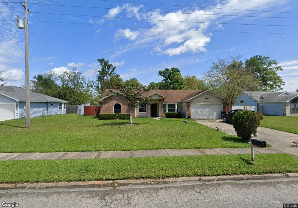
2050 Farm Way Middleburg, FL 32068
Estimated Value: $297,000 - $318,000
3
Beds
2
Baths
1,727
Sq Ft
$178/Sq Ft
Est. Value
About This Home
This home is located at 2050 Farm Way, Middleburg, FL 32068 and is currently estimated at $306,709, approximately $177 per square foot. 2050 Farm Way is a home located in Clay County with nearby schools including Swimming Pen Creek Elementary School, Fleming Island High School, and Lakeside Junior High School.
Ownership History
Date
Name
Owned For
Owner Type
Purchase Details
Closed on
Dec 15, 2004
Sold by
Simmons James B and Simmons Joann P
Bought by
Licea Peter and Licea Adelaida
Current Estimated Value
Home Financials for this Owner
Home Financials are based on the most recent Mortgage that was taken out on this home.
Original Mortgage
$104,600
Outstanding Balance
$52,174
Interest Rate
5.67%
Mortgage Type
Purchase Money Mortgage
Estimated Equity
$254,535
Create a Home Valuation Report for This Property
The Home Valuation Report is an in-depth analysis detailing your home's value as well as a comparison with similar homes in the area
Home Values in the Area
Average Home Value in this Area
Purchase History
| Date | Buyer | Sale Price | Title Company |
|---|---|---|---|
| Licea Peter | $137,000 | Homeguard Title & Trust Of O |
Source: Public Records
Mortgage History
| Date | Status | Borrower | Loan Amount |
|---|---|---|---|
| Open | Licea Peter | $104,600 |
Source: Public Records
Tax History Compared to Growth
Tax History
| Year | Tax Paid | Tax Assessment Tax Assessment Total Assessment is a certain percentage of the fair market value that is determined by local assessors to be the total taxable value of land and additions on the property. | Land | Improvement |
|---|---|---|---|---|
| 2024 | $1,502 | $120,559 | -- | -- |
| 2023 | $1,502 | $117,048 | $0 | $0 |
| 2022 | $1,339 | $113,639 | $0 | $0 |
| 2021 | $1,334 | $110,330 | $0 | $0 |
| 2020 | $1,294 | $108,807 | $0 | $0 |
| 2019 | $1,270 | $106,361 | $0 | $0 |
| 2018 | $1,156 | $104,378 | $0 | $0 |
| 2017 | $1,146 | $102,231 | $0 | $0 |
| 2016 | $1,140 | $100,128 | $0 | $0 |
| 2015 | $1,177 | $99,432 | $0 | $0 |
| 2014 | $1,146 | $98,643 | $0 | $0 |
Source: Public Records
Map
Nearby Homes
- 2500 Ambrosia Dr
- 1946 Apopka Dr
- 2746 Archer St
- 1709 Ashwood Cir
- 2624 Sharpsburg Ct
- 1784 Hollow Glen Dr
- 2058 Manucy Ct
- 2631 Five Forks Ct
- 1990 Eclipse Dr
- 1617 Morningside Dr
- 2891 Woodstone Dr
- 2084 Tickford St
- 2070 Tickford St
- 2742 Woodsdale Dr
- 2136 Creekmont Dr
- 2645 Hastate Ct
- 3001 Nautilus Rd
- 2555 Quail Roost Rd
- 1935 Saint George Ct
- 1936 Moorings Cir
- 2054 Farm Way
- 2046 Farm Way
- 2126 Sahara Place
- 2122 Sahara Place
- 2058 Farm Way
- 1971 Breckenridge Blvd
- 2130 Sahara Place
- 2488 Ambrosia Dr
- 2118 Sahara Place
- 1969 Breckenridge Blvd
- 2484 Ambrosia Dr
- 1967 Breckenridge Blvd
- 1973 Breckenridge Blvd
- 2064 Farm Way Unit 11
- 1965 Breckenridge Blvd
- 2129 Sahara Place
- 2480 Ambrosia Dr
- 2119 Sahara Place
- 2504 Ambrosia Dr
- 2125 Sahara Place