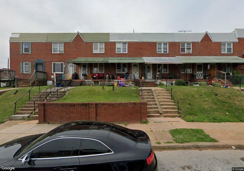
2050 Grinnalds Ave Baltimore, MD 21230
Morrell Park NeighborhoodEstimated Value: $114,043 - $132,000
2
Beds
1
Bath
1,218
Sq Ft
$101/Sq Ft
Est. Value
About This Home
This home is located at 2050 Grinnalds Ave, Baltimore, MD 21230 and is currently estimated at $123,022, approximately $101 per square foot. 2050 Grinnalds Ave is a home located in Baltimore City with nearby schools including Morrell Park Elementary/Middle School, Booker T. Washington Middle School, and Edmondson Westside High School.
Ownership History
Date
Name
Owned For
Owner Type
Purchase Details
Closed on
May 15, 2025
Sold by
Smith Tensia Nicole
Bought by
Schlick John Wayne
Current Estimated Value
Purchase Details
Closed on
Jul 9, 2018
Sold by
Kelly Lillian Patricia
Bought by
Smith Tensia Nicole
Purchase Details
Closed on
Jun 28, 2005
Sold by
Raber Elizabeth F
Bought by
Kelly Lillian Patricia
Purchase Details
Closed on
Oct 25, 1999
Sold by
Raber Elizabeth F
Bought by
Raber Elizabeth F and Raber Kenneth C
Create a Home Valuation Report for This Property
The Home Valuation Report is an in-depth analysis detailing your home's value as well as a comparison with similar homes in the area
Home Values in the Area
Average Home Value in this Area
Purchase History
| Date | Buyer | Sale Price | Title Company |
|---|---|---|---|
| Schlick John Wayne | $30,000 | Elite Home Title | |
| Schlick John Wayne | $30,000 | Elite Home Title | |
| Smith Tensia Nicole | $50,100 | Micasa Title Group Llc | |
| Kelly Lillian Patricia | $76,000 | -- | |
| Raber Elizabeth F | -- | -- |
Source: Public Records
Tax History Compared to Growth
Tax History
| Year | Tax Paid | Tax Assessment Tax Assessment Total Assessment is a certain percentage of the fair market value that is determined by local assessors to be the total taxable value of land and additions on the property. | Land | Improvement |
|---|---|---|---|---|
| 2025 | $1,452 | $68,400 | -- | -- |
| 2024 | $1,452 | $61,800 | $0 | $0 |
| 2023 | $1,303 | $55,200 | $12,000 | $43,200 |
| 2022 | $1,303 | $55,200 | $12,000 | $43,200 |
| 2021 | $1,303 | $55,200 | $12,000 | $43,200 |
| 2020 | $1,075 | $50,100 | $12,000 | $38,100 |
| 2019 | $1,069 | $50,100 | $12,000 | $38,100 |
| 2018 | $1,182 | $50,100 | $12,000 | $38,100 |
| 2017 | $1,399 | $62,800 | $0 | $0 |
| 2016 | $1,682 | $62,800 | $0 | $0 |
| 2015 | $1,682 | $62,800 | $0 | $0 |
| 2014 | $1,682 | $105,700 | $0 | $0 |
Source: Public Records
Map
Nearby Homes
- 2052 Griffis Ave
- 2012 Griffis Ave
- 2006 Grinnalds Ave
- 1919 Grinnalds Ave
- 0 Harman Ave
- 1933 Griffis Ave
- 2104 Whistler Ave
- 1915 Griffis Ave
- 2129 Parksley Ave
- 2507 Washington Blvd
- 2506 Washington Blvd
- 2536 Washington Blvd
- 1918 Parksley Ave
- 1962 Sponson St
- 1715 Spence St
- 1703 - 1707 1/2 Spence St
- 1707 Harman Ave
- 1701 Spence St
- 2305 Herkimer St
- 2410 Huron St
- 2052 Grinnalds Ave
- 2054 Grinnalds Ave
- 2056 Grinnalds Ave
- 2046 Grinnalds Ave
- 2044 Grinnalds Ave
- 2042 Grinnalds Ave
- 2040 Grinnalds Ave
- 2038 Grinnalds Ave
- 2053 Harman Ave
- 2055 Harman Ave
- 2051 Harman Ave
- 2049 Harman Ave
- 2057 Harman Ave
- 2047 Harman Ave
- 2036 Grinnalds Ave
- 2043 Harman Ave
- 2034 Grinnalds Ave
- 2041 Harman Ave
- 2032 Grinnalds Ave