Estimated Value: $726,000 - $786,000
3
Beds
3
Baths
1,702
Sq Ft
$444/Sq Ft
Est. Value
About This Home
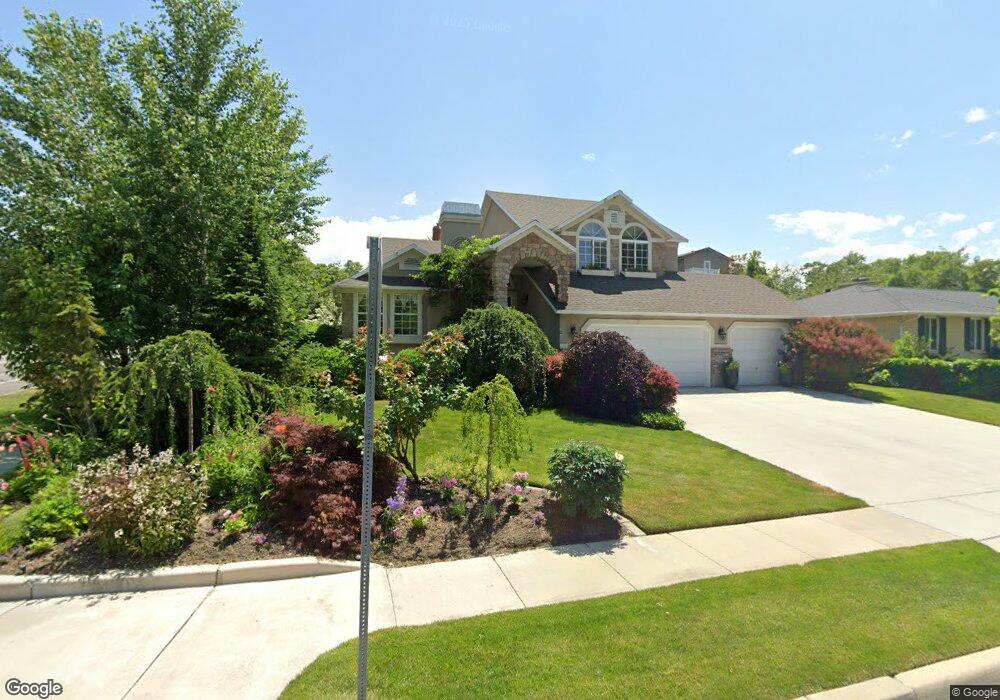
This home is located at 2050 Johnstone Dr, Sandy, UT 84093 and is currently estimated at $756,492, approximately $444 per square foot. 2050 Johnstone Dr is a home located in Salt Lake County with nearby schools including Oakdale School, Albion Middle School, and Hillcrest High School.
Ownership History
Date
Name
Owned For
Owner Type
Purchase Details
Closed on
Jan 31, 2025
Sold by
Curtis Karen B
Bought by
Karen B Curtis Revocable Trust and Curtis
Current Estimated Value
Purchase Details
Closed on
Oct 7, 2021
Sold by
Curtis Karen B and Curtis Karen
Bought by
Curtis Karen B
Purchase Details
Closed on
Aug 23, 2021
Sold by
Curtis Ward and Curtis Courtney
Bought by
Curtis Karen B
Purchase Details
Closed on
Aug 19, 2021
Sold by
Curtis Courtney and Estate Of Ward Curtis
Bought by
Curtis Karen B
Purchase Details
Closed on
Apr 26, 2019
Sold by
Ward Curtis
Bought by
Ward Curtis
Purchase Details
Closed on
Apr 2, 1999
Sold by
Curtis Ward D and Curtis Karen B
Bought by
Curtis Ward and Curtis Karen
Home Financials for this Owner
Home Financials are based on the most recent Mortgage that was taken out on this home.
Original Mortgage
$137,500
Interest Rate
6.54%
Purchase Details
Closed on
May 25, 1995
Sold by
Curtis Ward D and Curtis Karen B
Bought by
Sandy City Corp
Create a Home Valuation Report for This Property
The Home Valuation Report is an in-depth analysis detailing your home's value as well as a comparison with similar homes in the area
Home Values in the Area
Average Home Value in this Area
Purchase History
| Date | Buyer | Sale Price | Title Company |
|---|---|---|---|
| Karen B Curtis Revocable Trust | -- | None Listed On Document | |
| Curtis Karen B | -- | None Available | |
| Curtis Karen B | -- | None Listed On Document | |
| Curtis Karen B | -- | None Listed On Document | |
| Curtis Karen B | -- | None Available | |
| Ward Curtis | -- | None Available | |
| Curtis Ward | -- | Superior Title Company | |
| Sandy City Corp | -- | -- |
Source: Public Records
Mortgage History
| Date | Status | Borrower | Loan Amount |
|---|---|---|---|
| Previous Owner | Curtis Ward | $137,500 |
Source: Public Records
Tax History
| Year | Tax Paid | Tax Assessment Tax Assessment Total Assessment is a certain percentage of the fair market value that is determined by local assessors to be the total taxable value of land and additions on the property. | Land | Improvement |
|---|---|---|---|---|
| 2025 | $3,688 | $741,000 | $256,300 | $484,700 |
| 2024 | $3,688 | $691,300 | $246,700 | $444,600 |
| 2023 | $3,688 | $646,600 | $237,200 | $409,400 |
| 2022 | $0 | $640,400 | $232,600 | $407,800 |
| 2021 | $4,087 | $481,500 | $181,100 | $300,400 |
| 2020 | $2,885 | $426,600 | $181,100 | $245,500 |
| 2019 | $2,492 | $359,600 | $170,800 | $188,800 |
| 2018 | $2,341 | $353,200 | $170,800 | $182,400 |
| 2017 | $2,063 | $297,800 | $170,800 | $127,000 |
| 2016 | $1,904 | $265,600 | $153,900 | $111,700 |
| 2015 | $2,280 | $295,000 | $183,000 | $112,000 |
| 2014 | $2,211 | $280,900 | $178,000 | $102,900 |
Source: Public Records
Map
Nearby Homes
- 8483 S Terrace Dr
- 2152 E Creek Rd
- 1990 E Terra Vista Way
- 8266 S Creek Hollow Cove
- 1924 E Viscounti Cove
- 1780 Julho St
- 2161 E Lorita Way
- 8122 S Willow Creek Cove
- 2238 Cottonwood Cove Ln
- 8638 Piper Ln
- 1627 E Mulberry Way
- 8142 S Newbury Grove Ln
- 8921 S Shady Meadow Dr
- 2614 E Tuxedo Cir
- 8360 El Manicero Way
- 8585 Mount Majestic Rd
- 2670 Bridger Blvd Unit 8
- 8597 Mount Majestic Rd
- 9078 S Daybreak Dr
- 2407 E Bengal Bend Cove
- 2040 Johnstone Dr
- 2040 E Johnstone Dr
- 2045 E Leonard Cir
- 2045 Leonard Cir
- 2037 Leonard Cir
- 2032 Johnstone Dr
- 2049 Johnstone Dr
- 2032 E Johnstone Dr
- 2050 E Leonard Cir
- 2050 Leonard Cir
- 2035 Johnstone Dr
- 2027 Leonard Cir
- 2020 Johnstone Dr
- 2020 E Johnstone Dr
- 8325 Highland Dr
- 2038 Stonewood Ct
- 2046 E Leonard Cir
- 2046 Leonard Cir
- 2038 Leonard Cir
- 2030 Stonewood Ct
Your Personal Tour Guide
Ask me questions while you tour the home.