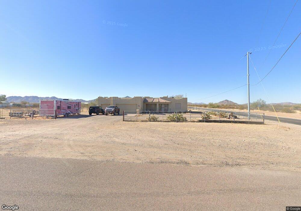
2050 N Ralston Rd Maricopa, AZ 85139
Estimated Value: $387,376 - $478,000
4
Beds
3
Baths
2,298
Sq Ft
$184/Sq Ft
Est. Value
About This Home
This home is located at 2050 N Ralston Rd, Maricopa, AZ 85139 and is currently estimated at $422,844, approximately $184 per square foot. 2050 N Ralston Rd is a home located in Pinal County with nearby schools including Stanfield Elementary School.
Ownership History
Date
Name
Owned For
Owner Type
Purchase Details
Closed on
May 26, 2010
Sold by
Selland John Ri and Selland Julie A
Bought by
Kegley Donald C and Kegley Delores A
Current Estimated Value
Home Financials for this Owner
Home Financials are based on the most recent Mortgage that was taken out on this home.
Original Mortgage
$137,117
Outstanding Balance
$93,149
Interest Rate
5.25%
Mortgage Type
FHA
Estimated Equity
$329,695
Purchase Details
Closed on
Jul 10, 2006
Sold by
Redfield Financial Inc
Bought by
Selland John R and Selland Julie A
Home Financials for this Owner
Home Financials are based on the most recent Mortgage that was taken out on this home.
Original Mortgage
$357,000
Interest Rate
8.75%
Mortgage Type
Purchase Money Mortgage
Create a Home Valuation Report for This Property
The Home Valuation Report is an in-depth analysis detailing your home's value as well as a comparison with similar homes in the area
Home Values in the Area
Average Home Value in this Area
Purchase History
| Date | Buyer | Sale Price | Title Company |
|---|---|---|---|
| Kegley Donald C | $139,000 | Title Security Agency Of Pin | |
| Selland John R | $85,000 | Fidelity National Title Agen |
Source: Public Records
Mortgage History
| Date | Status | Borrower | Loan Amount |
|---|---|---|---|
| Open | Kegley Donald C | $137,117 | |
| Previous Owner | Selland John R | $357,000 |
Source: Public Records
Tax History Compared to Growth
Tax History
| Year | Tax Paid | Tax Assessment Tax Assessment Total Assessment is a certain percentage of the fair market value that is determined by local assessors to be the total taxable value of land and additions on the property. | Land | Improvement |
|---|---|---|---|---|
| 2025 | $1,503 | $22,599 | -- | -- |
| 2024 | $1,501 | $26,772 | -- | -- |
| 2023 | $1,514 | $23,867 | $1,335 | $22,532 |
| 2022 | $1,501 | $18,233 | $900 | $17,333 |
| 2021 | $1,611 | $17,010 | $0 | $0 |
| 2020 | $1,547 | $16,506 | $0 | $0 |
| 2019 | $1,479 | $16,600 | $0 | $0 |
| 2018 | $1,438 | $17,006 | $0 | $0 |
| 2017 | $1,384 | $17,001 | $0 | $0 |
| 2016 | $1,295 | $16,929 | $1,360 | $15,569 |
| 2014 | $1,112 | $10,561 | $480 | $10,082 |
Source: Public Records
Map
Nearby Homes
- 54321 W Century Rd Unit 1
- W W Century Rd
- 0 W Century Rd Lot B 1 99 Acres -- Unit 6889077
- TBD W Century Rd Lot A 1 67 Acres --
- 0 W Century Rd Lot B 1 99 Acres
- 5009X W Jennifer Rd Unit Parcel 4
- 1378 N Ralston Rd
- 2751 N Ralston Rd
- 51405 W Pampas Grass Rd Unit 88
- 51xxx W Whirly Bird Rd
- 51871 W Pampas Grass Rd Unit 86
- 51871 W Pampas Grass Rd
- 0 W Ventada Rd Unit 6883046
- 0 W Ventada Rd Unit 46 6747083
- 000 N Hickory Rd Unit 5
- 0 W Whirlybird Rd Unit 6831134
- 48327 W Pampas Grass Rd
- 50525 W Whirly Bird Rd
- 0 W Century Rd Lot A 1 67 Acres
- TBD W Century Rd Lot D 1 81 Acres --
- 2004 N Redfield Rd
- 51250 La Roca Rd
- 51250 W La Roca Rd
- 51204 W La Roca Rd
- 51296 W Laroca Rd
- 51296 W La Roca Rd
- 51196 W La Roca Rd
- 51348 W La Roca Rd
- 49110 W Century Rd
- 49110 W Century Rd
- 0 W Superior Rd Lot 27 Rd Unit 27 5491206
- 507XX W Century Rd Unit 119
- 1852 N Amanda Dr
- 0 N Alley Rd Unit 1 4534486
- 0 N Alley Rd Unit 1 4350920
- 51487 W Jennifer Rd Unit 111
- 0 W Century Rd Lot A 1 67 Acres -- Unit 6889074
- 0 W Century Rd Lot D 1 81 Acres -- Unit 6889071
- 0 W Century Rd Lot D 1 81 Acres -- Unit 6776126
- 0 W Century Rd Lot C 1 51 Acres -- Unit 6775995