Estimated Value: $175,000 - $230,381
4
Beds
2
Baths
2,160
Sq Ft
$90/Sq Ft
Est. Value
About This Home
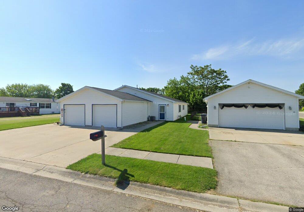
This home is located at 2050 Pear Tree Ln, Delta, OH 43515 and is currently estimated at $193,845, approximately $89 per square foot. 2050 Pear Tree Ln is a home with nearby schools including Delta Elementary School, Pike-Delta-York Middle School, and Pike-Delta-York High School.
Ownership History
Date
Name
Owned For
Owner Type
Purchase Details
Closed on
Mar 2, 2010
Sold by
Delta Industrial Properties Ltd
Bought by
Swartz Jon L and Swartz Gaylene M
Current Estimated Value
Home Financials for this Owner
Home Financials are based on the most recent Mortgage that was taken out on this home.
Original Mortgage
$17,900
Outstanding Balance
$11,894
Interest Rate
5.11%
Mortgage Type
Seller Take Back
Estimated Equity
$181,951
Create a Home Valuation Report for This Property
The Home Valuation Report is an in-depth analysis detailing your home's value as well as a comparison with similar homes in the area
Home Values in the Area
Average Home Value in this Area
Purchase History
| Date | Buyer | Sale Price | Title Company |
|---|---|---|---|
| Swartz Jon L | $18,000 | Attorney |
Source: Public Records
Mortgage History
| Date | Status | Borrower | Loan Amount |
|---|---|---|---|
| Open | Swartz Jon L | $17,900 |
Source: Public Records
Tax History Compared to Growth
Tax History
| Year | Tax Paid | Tax Assessment Tax Assessment Total Assessment is a certain percentage of the fair market value that is determined by local assessors to be the total taxable value of land and additions on the property. | Land | Improvement |
|---|---|---|---|---|
| 2024 | $3,116 | $70,530 | $7,180 | $63,350 |
| 2023 | $3,116 | $70,530 | $7,180 | $63,350 |
| 2022 | $3,131 | $54,710 | $5,990 | $48,720 |
| 2021 | $3,180 | $54,710 | $5,990 | $48,720 |
| 2020 | $3,220 | $54,710 | $5,990 | $48,720 |
| 2019 | $2,469 | $43,020 | $5,990 | $37,030 |
| 2018 | $2,684 | $43,020 | $5,990 | $37,030 |
| 2017 | $2,666 | $43,020 | $5,990 | $37,030 |
| 2016 | $2,448 | $40,710 | $5,990 | $34,720 |
| 2015 | $2,838 | $49,150 | $5,990 | $43,160 |
| 2014 | $2,855 | $49,150 | $5,990 | $43,160 |
| 2013 | $272 | $4,760 | $4,760 | $0 |
Source: Public Records
Map
Nearby Homes
- 908 Fernwood St
- 518 Providence St
- 701 Palmwood St
- 703 Linwood Ave
- 305 Mckinley St
- 413 Fernwood St
- 207 Wood St
- 308 Monroe St
- 201 Elmwood Ave
- 810 Greenview Ave
- 4329 County Road 1 #2
- 6854 County Road 3
- 3121 County Road Ef
- 2121 Holiday Dr
- 7893 County Road 2
- 2076 County Rd E
- 2511 County Road D
- 113 West St
- 0 Waterwood Dr
- 227 Kierra Ln
- 309 Hidden Ridge Dr
- 2058 Pear Tree Ln
- 2049 Redbud Ln
- 2053 Redbud Ln
- 2053 Pear Tree Ln
- 305 Hidden Ridge Dr
- 2057 Redbud Ln
- 2054 Pear Tree Ln
- 310 Hidden Ridge Dr
- 312 Hidden Ridge Dr
- 2062 Pear Tree Ln
- 308 Hidden Ridge Dr
- 314 Hidden Ridge Dr
- 2057 Pear Tree Ln
- 306 Hidden Ridge Dr
- 2054 Redbud Ln
- 2050 Redbud Ln
- 2061 Redbud Ln
- 2064 Redbud Ln
- 2058 Redbud Ln