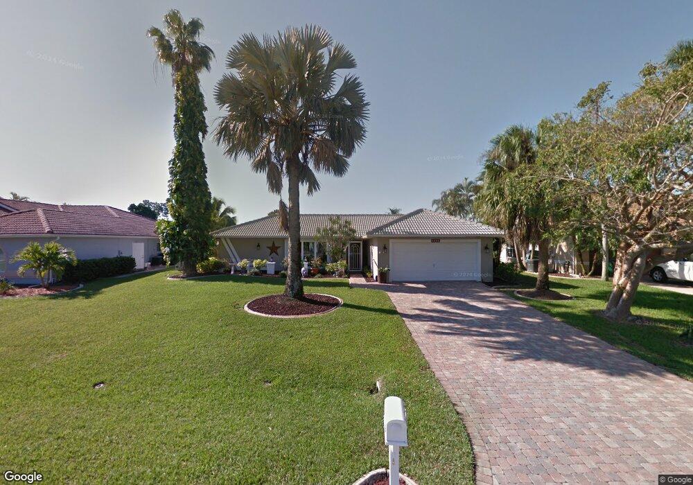
2050 SE 20th Ln Cape Coral, FL 33990
Hancock NeighborhoodEstimated Value: $435,044 - $694,000
3
Beds
2
Baths
2,089
Sq Ft
$274/Sq Ft
Est. Value
About This Home
This home is located at 2050 SE 20th Ln, Cape Coral, FL 33990 and is currently estimated at $573,261, approximately $274 per square foot. 2050 SE 20th Ln is a home located in Lee County with nearby schools including Caloosa Elementary School, Cape Elementary School, and Tropic Isles Elementary School.
Ownership History
Date
Name
Owned For
Owner Type
Purchase Details
Closed on
May 16, 2011
Sold by
Yaciuk Philip and Yaciuk Joni C
Bought by
Connolly Glenn S and Connolly Lillie P
Current Estimated Value
Home Financials for this Owner
Home Financials are based on the most recent Mortgage that was taken out on this home.
Original Mortgage
$100,000
Interest Rate
4.85%
Mortgage Type
New Conventional
Purchase Details
Closed on
May 15, 2009
Sold by
Bruning Harvey and Bruning Sandra
Bought by
Yaciuk Philip and Yaciuk Joni C
Purchase Details
Closed on
Feb 28, 2002
Sold by
Wesley Michelle R and Wesley Randy E
Bought by
Bruning Harvey and Bruning Sandra
Purchase Details
Closed on
Jul 25, 1997
Sold by
Luenneman Clarence E
Bought by
Wesley Randy E and Wesley Michelle R
Home Financials for this Owner
Home Financials are based on the most recent Mortgage that was taken out on this home.
Original Mortgage
$114,622
Interest Rate
7.7%
Mortgage Type
FHA
Create a Home Valuation Report for This Property
The Home Valuation Report is an in-depth analysis detailing your home's value as well as a comparison with similar homes in the area
Home Values in the Area
Average Home Value in this Area
Purchase History
| Date | Buyer | Sale Price | Title Company |
|---|---|---|---|
| Connolly Glenn S | $225,000 | Go Title Inc | |
| Yaciuk Philip | $173,000 | Sunbelt Title Agency | |
| Bruning Harvey | $205,000 | -- | |
| Wesley Randy E | $115,000 | -- |
Source: Public Records
Mortgage History
| Date | Status | Borrower | Loan Amount |
|---|---|---|---|
| Closed | Connolly Glenn S | $100,000 | |
| Previous Owner | Wesley Randy E | $114,622 |
Source: Public Records
Tax History Compared to Growth
Tax History
| Year | Tax Paid | Tax Assessment Tax Assessment Total Assessment is a certain percentage of the fair market value that is determined by local assessors to be the total taxable value of land and additions on the property. | Land | Improvement |
|---|---|---|---|---|
| 2025 | $3,318 | $192,420 | -- | -- |
| 2024 | $3,181 | $196,564 | -- | -- |
| 2023 | $3,181 | $190,839 | $0 | $0 |
| 2022 | $2,955 | $185,281 | $0 | $0 |
| 2021 | $2,994 | $270,131 | $128,098 | $142,033 |
| 2020 | $3,023 | $177,400 | $0 | $0 |
| 2019 | $2,806 | $167,078 | $0 | $0 |
| 2018 | $2,791 | $163,963 | $0 | $0 |
| 2017 | $2,771 | $160,591 | $0 | $0 |
| 2016 | $2,704 | $192,134 | $113,995 | $78,139 |
| 2015 | $2,584 | $175,403 | $107,468 | $67,935 |
| 2014 | -- | $155,400 | $81,967 | $73,433 |
| 2013 | -- | $149,600 | $77,588 | $72,012 |
Source: Public Records
Map
Nearby Homes
- 2027 SE 21st St
- 2031 SE 21st St
- 1952 SE 21st Ct
- 2022 Four Mile Cove Pkwy
- 1944 Four Mile Cove Pkwy
- 1822 SE 20th St
- 2214 SE 19th Place
- 1797 Four Mile Cove Pkwy Unit 1034
- 1797 Four Mile Cove Pkwy Unit 1015
- 1795 Four Mile Cove Pkwy Unit 825
- 1814 Four Mile Cove Pkwy
- 1763 Four Mile Cove Pkwy Unit 611
- 1791 Four Mile Cove Pkwy Unit 624
- 1791 Four Mile Cove Pkwy Unit 612
- 1791 Four Mile Cove Pkwy Unit 625
- 1791 Four Mile Cove Pkwy Unit 644
- 1793 Four Mile Cove Pkwy Unit 733
- 1793 Four Mile Cove Pkwy Unit 724
- 1793 Four Mile Cove Pkwy Unit 723
- 1787 Four Mile Cove Pkwy Unit 431
- 2054 SE 20th Ln
- 2042 SE 20th Ln
- 2102 SE 20th Ln
- 2051 SE 20th Ln
- 2055 SE 20th Ln
- 2047 SE 20th Ln
- 2043 SE 20th Ln
- 2101 SE 20th Ln
- 2036 SE 20th Ln
- 2106 SE 20th Ln
- 2035 SE 21st St
- 2039 SE 20th Ln
- 2023 SE 21st St
- 2101 SE 21st St
- 2105 SE 20th Ln
- 2004 SE 21st Ct
- 2105 SE 21st St
- 2035 SE 20th Ln
- 2010 SE 21st Ct
- 2014 SE 21st Ct