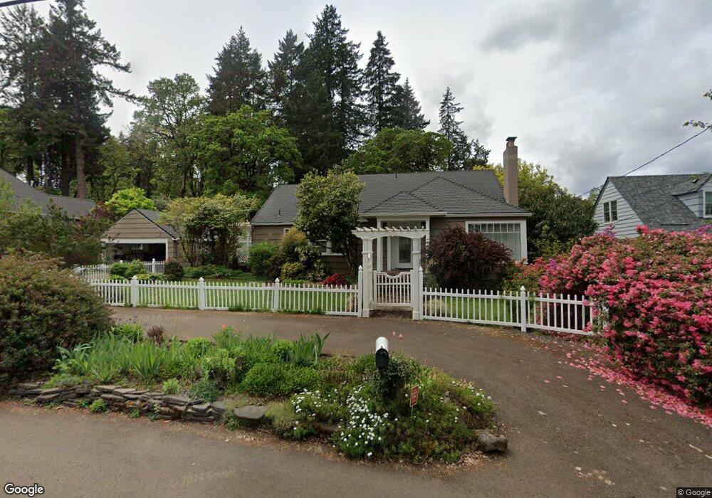
2050 SW Whiteside Dr Corvallis, OR 97333
Southwest Corvallis NeighborhoodEstimated Value: $769,000 - $965,000
3
Beds
2
Baths
2,310
Sq Ft
$363/Sq Ft
Est. Value
About This Home
This home is located at 2050 SW Whiteside Dr, Corvallis, OR 97333 and is currently estimated at $839,313, approximately $363 per square foot. 2050 SW Whiteside Dr is a home located in Benton County with nearby schools including Adams Elementary School, Linus Pauling Middle School, and Corvallis High School.
Ownership History
Date
Name
Owned For
Owner Type
Purchase Details
Closed on
Jul 18, 2006
Sold by
Eliason Georgia
Bought by
Prueitt Gerald and Prueitt Carol A
Current Estimated Value
Home Financials for this Owner
Home Financials are based on the most recent Mortgage that was taken out on this home.
Original Mortgage
$66,150
Outstanding Balance
$53,395
Interest Rate
6.69%
Mortgage Type
Credit Line Revolving
Estimated Equity
$785,918
Create a Home Valuation Report for This Property
The Home Valuation Report is an in-depth analysis detailing your home's value as well as a comparison with similar homes in the area
Home Values in the Area
Average Home Value in this Area
Purchase History
| Date | Buyer | Sale Price | Title Company |
|---|---|---|---|
| Prueitt Gerald | $441,000 | Fidelity Natl Title Co Of Or |
Source: Public Records
Mortgage History
| Date | Status | Borrower | Loan Amount |
|---|---|---|---|
| Open | Prueitt Gerald | $66,150 | |
| Open | Prueitt Gerald | $352,800 |
Source: Public Records
Tax History Compared to Growth
Tax History
| Year | Tax Paid | Tax Assessment Tax Assessment Total Assessment is a certain percentage of the fair market value that is determined by local assessors to be the total taxable value of land and additions on the property. | Land | Improvement |
|---|---|---|---|---|
| 2024 | $6,359 | $331,036 | -- | -- |
| 2023 | $5,988 | $321,394 | $0 | $0 |
| 2022 | $5,813 | $312,033 | $0 | $0 |
| 2021 | $5,620 | $302,945 | $0 | $0 |
| 2020 | $5,590 | $294,121 | $0 | $0 |
| 2019 | $5,152 | $285,554 | $0 | $0 |
| 2018 | $5,179 | $277,237 | $0 | $0 |
| 2017 | $4,792 | $269,162 | $0 | $0 |
| 2016 | $4,771 | $261,322 | $0 | $0 |
| 2015 | $4,670 | $253,711 | $0 | $0 |
| 2014 | $4,550 | $246,321 | $0 | $0 |
| 2012 | -- | $232,182 | $0 | $0 |
Source: Public Records
Map
Nearby Homes
- 2520 SW Whiteside Dr
- 3211 SW Hawkeye Ave
- 2604 SW Wolverine Dr
- 3475 SW Buckeye Place
- 2829 SW Wolverine Dr
- 2632 SW Brooklane Dr
- 3386 SW Badger Place
- 3559 SW Par Place
- 1907 SW Brooklane Dr
- 4149 SW Research Way
- 4624 SW 47th Place
- 4651 SW 47th Place
- 3871 SW Neer Ave
- 1125 SW Cole Place
- 1080 SW 35th St
- 4525 SW Nash Ave
- 4900 SW Hollyhock Cir
- 4942 SW Hollyhock Cir
- TA 421203 SW Philomath Bl
- 0 SW Herbert (57 Acres) Ave
- 2060 SW Whiteside Dr
- 2030 SW Whiteside Dr
- 3600 SW Chintimini Ave
- 2055 SW Whiteside Dr
- 3445 SW Cascade Ave
- 2015 SW Whiteside Dr
- 3630 SW Chintimini Ave
- 2070 SW Whiteside Dr
- 10 SW Whiteside Dr
- 7 SW Whiteside Dr Unit 7
- #10 SW Whiteside Dr
- Lot #7 SW Whiteside Dr
- 0 SW Whiteside Dr Unit 620324
- 3446 SW Cascade Ave
- 3605 SW Chintimini Ave
- 2135 SW Whiteside Dr
- 3613 SW Chintimini Ave
- 1975 SW Whiteside Dr
- 3625 SW Chintimini Ave
- 3428 SW Chintimini Ave