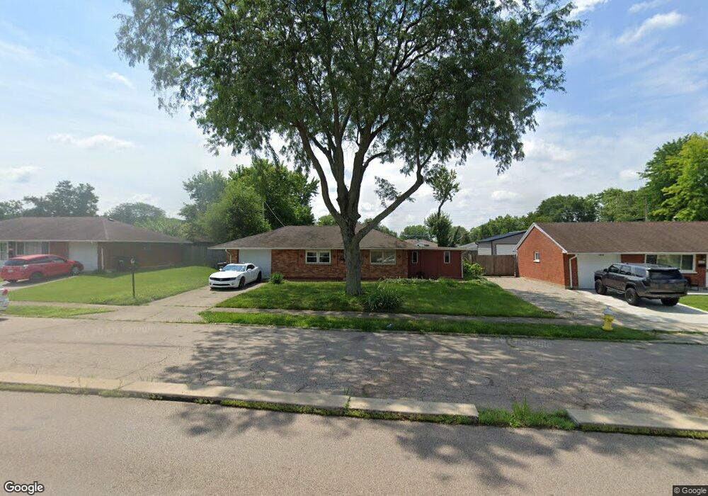
2050 W Stroop Rd Dayton, OH 45439
Woodbourne-Hyde Park NeighborhoodEstimated Value: $144,000 - $192,000
3
Beds
1
Bath
1,080
Sq Ft
$151/Sq Ft
Est. Value
About This Home
This home is located at 2050 W Stroop Rd, Dayton, OH 45439 and is currently estimated at $163,013, approximately $150 per square foot. 2050 W Stroop Rd is a home located in Montgomery County with nearby schools including West Carrollton High School, Miami Valley Academies, and St. Albert the Great Catholic School.
Ownership History
Date
Name
Owned For
Owner Type
Purchase Details
Closed on
Jan 5, 2024
Sold by
Collins David
Bought by
Dayton Handyman Llc
Current Estimated Value
Home Financials for this Owner
Home Financials are based on the most recent Mortgage that was taken out on this home.
Original Mortgage
$100,100
Outstanding Balance
$98,375
Interest Rate
7.03%
Mortgage Type
Construction
Estimated Equity
$64,638
Purchase Details
Closed on
Apr 26, 2007
Sold by
Weber Karin L
Bought by
Collins David
Home Financials for this Owner
Home Financials are based on the most recent Mortgage that was taken out on this home.
Original Mortgage
$17,980
Interest Rate
6.2%
Mortgage Type
Credit Line Revolving
Create a Home Valuation Report for This Property
The Home Valuation Report is an in-depth analysis detailing your home's value as well as a comparison with similar homes in the area
Home Values in the Area
Average Home Value in this Area
Purchase History
| Date | Buyer | Sale Price | Title Company |
|---|---|---|---|
| Dayton Handyman Llc | $90,000 | None Listed On Document | |
| Collins David | $89,900 | Attorney |
Source: Public Records
Mortgage History
| Date | Status | Borrower | Loan Amount |
|---|---|---|---|
| Open | Dayton Handyman Llc | $100,100 | |
| Previous Owner | Collins David | $17,980 | |
| Previous Owner | Collins David | $71,920 |
Source: Public Records
Tax History Compared to Growth
Tax History
| Year | Tax Paid | Tax Assessment Tax Assessment Total Assessment is a certain percentage of the fair market value that is determined by local assessors to be the total taxable value of land and additions on the property. | Land | Improvement |
|---|---|---|---|---|
| 2024 | $3,199 | $45,490 | $7,820 | $37,670 |
| 2023 | $3,199 | $45,490 | $7,820 | $37,670 |
| 2022 | $2,786 | $30,530 | $5,250 | $25,280 |
| 2021 | $2,572 | $30,530 | $5,250 | $25,280 |
| 2020 | $2,572 | $30,530 | $5,250 | $25,280 |
| 2019 | $2,642 | $27,450 | $5,250 | $22,200 |
| 2018 | $2,472 | $27,450 | $5,250 | $22,200 |
| 2017 | $2,456 | $27,450 | $5,250 | $22,200 |
| 2016 | $2,483 | $26,850 | $5,250 | $21,600 |
| 2015 | $2,310 | $26,850 | $5,250 | $21,600 |
| 2014 | $2,310 | $26,850 | $5,250 | $21,600 |
| 2012 | -- | $27,790 | $7,000 | $20,790 |
Source: Public Records
Map
Nearby Homes
- 1692 Hillwood Dr
- 2090 Mattis Dr
- 4301 Tait Rd
- 1905 Tait Circle Rd
- 4051 Ellery Ave
- 1952 Tait Circle Rd
- 4207 S Dixie Dr
- 3720 Ridgeleigh Rd Unit D
- 4629 Richwood Dr
- 2050 William Ln
- 4661 Richwood Dr
- 1349 Tamerlane Rd
- 2639 Blanchard Ave
- 4792 Loxley Dr
- 2571 Cluster Ave
- 1955 Kresswood Cir
- 1314 Ridgeview Ave
- 3225 Southdale Dr Unit 1
- 4400 Royal Ridge Way
- 4447 Royal Ridge Way
- 2062 W Stroop Rd
- 2036 W Stroop Rd
- 4035 Cordell Dr
- 4047 Cordell Dr
- 2074 W Stroop Rd
- 2065 Norway Dr
- 2089 Norway Dr
- 4057 Cordell Dr
- 2090 W Stroop Rd
- 2053 Norway Dr
- 4022 Cordell Dr
- 2101 Norway Dr
- 1701 W Stroop Rd
- 1713 W Stroop Rd
- 1725 W Stroop Rd
- 4040 Cordell Dr
- 1737 W Stroop Rd
- 2064 Norway Dr
- 2041 Mattis Dr
- 2106 W Stroop Rd