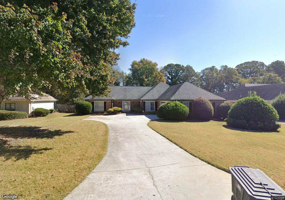
2050 Weatherstone Cir SE Unit 1 Conyers, GA 30094
Estimated Value: $336,170 - $395,000
3
Beds
3
Baths
2,221
Sq Ft
$167/Sq Ft
Est. Value
About This Home
This home is located at 2050 Weatherstone Cir SE Unit 1, Conyers, GA 30094 and is currently estimated at $370,543, approximately $166 per square foot. 2050 Weatherstone Cir SE Unit 1 is a home located in Rockdale County with nearby schools including Flat Shoals Elementary School, Edwards Middle School, and Rockdale County High School.
Ownership History
Date
Name
Owned For
Owner Type
Purchase Details
Closed on
Sep 26, 2012
Sold by
Jenkins Cathy
Bought by
Jenkins Cathy
Current Estimated Value
Purchase Details
Closed on
May 14, 1999
Sold by
Coward Louise
Bought by
Moore Bobby and Moore Estelle
Home Financials for this Owner
Home Financials are based on the most recent Mortgage that was taken out on this home.
Original Mortgage
$80,000
Interest Rate
6.49%
Mortgage Type
New Conventional
Create a Home Valuation Report for This Property
The Home Valuation Report is an in-depth analysis detailing your home's value as well as a comparison with similar homes in the area
Home Values in the Area
Average Home Value in this Area
Purchase History
| Date | Buyer | Sale Price | Title Company |
|---|---|---|---|
| Jenkins Cathy | -- | -- | |
| Moore Bobby | $164,000 | -- |
Source: Public Records
Mortgage History
| Date | Status | Borrower | Loan Amount |
|---|---|---|---|
| Previous Owner | Moore Bobby | $80,000 |
Source: Public Records
Tax History Compared to Growth
Tax History
| Year | Tax Paid | Tax Assessment Tax Assessment Total Assessment is a certain percentage of the fair market value that is determined by local assessors to be the total taxable value of land and additions on the property. | Land | Improvement |
|---|---|---|---|---|
| 2024 | $2,790 | $141,320 | $30,920 | $110,400 |
| 2023 | $2,257 | $126,400 | $30,800 | $95,600 |
| 2022 | $2,053 | $106,160 | $24,960 | $81,200 |
| 2021 | $1,720 | $89,080 | $20,800 | $68,280 |
| 2020 | $1,918 | $78,320 | $17,760 | $60,560 |
| 2019 | $1,752 | $71,360 | $10,800 | $60,560 |
| 2018 | $1,673 | $68,440 | $10,800 | $57,640 |
| 2017 | $1,478 | $61,520 | $10,800 | $50,720 |
| 2016 | $1,365 | $61,520 | $10,800 | $50,720 |
| 2015 | $1,154 | $54,120 | $9,320 | $44,800 |
| 2014 | $874 | $47,920 | $8,000 | $39,920 |
| 2013 | -- | $74,480 | $13,600 | $60,880 |
Source: Public Records
Map
Nearby Homes
- Astrid Plan at Alder Park
- Harrison Plan at Alder Park
- Baker Plan at Alder Park
- Oliver Plan at Alder Park
- 2197 Boxwood Cir
- 660 Kirkus Dr SE
- 1242 Saxony Dr SE
- 1408 Aramore Dr SE
- Boston Plan at Millers Pointe
- Atlanta Plan at Millers Pointe
- Columbus Plan at Millers Pointe
- 1402 Aramore Dr SE
- 1870 Parker Rd SE
- 0 Georgia 20 Unit 10439576
- 1019 Henna Ct SE
- 1000 Silver Summit Dr SE
- 2464 Lennox Rd SE
- 1701 Silver Summit Dr SE
- 1502 Silver Summit Dr SE
- 1503 Silver Summit Dr SE Unit 1503
- 2060 Weatherstone Cir SE
- 2040 Weatherstone Cir SE
- 2070 Weatherstone Cir SE
- 2030 Weatherstone Cir SE Unit 1
- 1001 Boxwood Cir Unit 64
- 2014 Boxwood Cir
- 2080 Weatherstone Cir SE
- 2020 Weatherstone Cir SE Unit 1
- 2021 Weatherstone Cir SE
- 1009 Starmoss Ln
- 2090 Weatherstone Cir SE
- 2041 Weatherstone Cir SE
- 2051 Weatherstone Cir SE Unit 1 / 4
- 2051 Weatherstone Cir SE
- 1002 Starmoss Ln
- 1002 Starmoss Ln
- 1005 Starmoss Ln
- 2010 Weatherstone Cir SE
- 2061 Weatherstone Cir SE
- 2441 Boxwood Cir