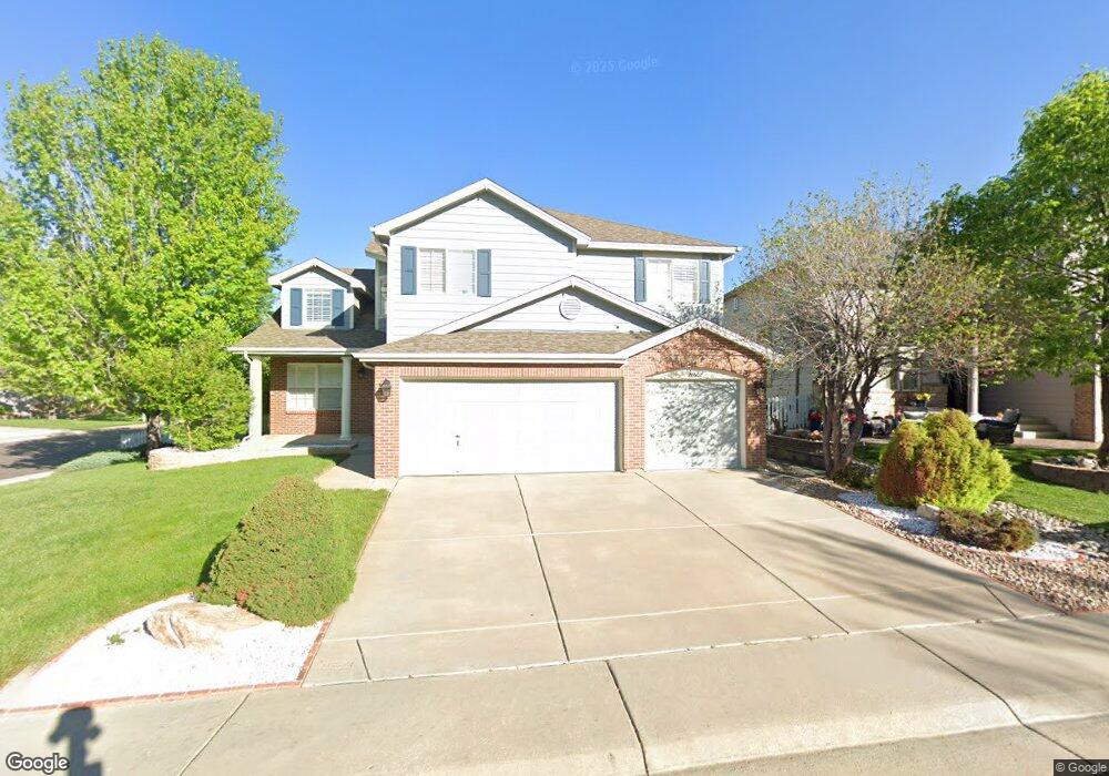
20507 E Weaver Dr Aurora, CO 80016
Greenfield NeighborhoodEstimated Value: $702,633 - $759,000
5
Beds
4
Baths
4,020
Sq Ft
$181/Sq Ft
Est. Value
About This Home
This home is located at 20507 E Weaver Dr, Aurora, CO 80016 and is currently estimated at $726,658, approximately $180 per square foot. 20507 E Weaver Dr is a home located in Arapahoe County with nearby schools including Rolling Hills Elementary School, Falcon Creek Middle School, and Grandview High School.
Ownership History
Date
Name
Owned For
Owner Type
Purchase Details
Closed on
Oct 21, 2022
Sold by
Mspa Trust
Bought by
Mpa Trust
Current Estimated Value
Purchase Details
Closed on
Feb 18, 2022
Sold by
Glenn Seelmeyer Michael
Bought by
Mspa Trust
Purchase Details
Closed on
Dec 27, 2016
Sold by
Thompson Todd A and Thompson Marlene E
Bought by
Seelmeyer Michael
Home Financials for this Owner
Home Financials are based on the most recent Mortgage that was taken out on this home.
Original Mortgage
$301,000
Interest Rate
4.08%
Mortgage Type
VA
Purchase Details
Closed on
Feb 27, 2001
Sold by
Village Homes Of Colorado Inc
Bought by
Thompson Todd A and Thompson Marlene E
Home Financials for this Owner
Home Financials are based on the most recent Mortgage that was taken out on this home.
Original Mortgage
$267,650
Interest Rate
6.97%
Create a Home Valuation Report for This Property
The Home Valuation Report is an in-depth analysis detailing your home's value as well as a comparison with similar homes in the area
Home Values in the Area
Average Home Value in this Area
Purchase History
| Date | Buyer | Sale Price | Title Company |
|---|---|---|---|
| Mpa Trust | -- | -- | |
| Mspa Trust | -- | Nadya Lambert Attorney At Law | |
| Seelmeyer Michael | $435,000 | Canyon Title | |
| Thompson Todd A | $297,420 | Land Title Guarantee Company |
Source: Public Records
Mortgage History
| Date | Status | Borrower | Loan Amount |
|---|---|---|---|
| Previous Owner | Seelmeyer Michael | $301,000 | |
| Previous Owner | Thompson Todd A | $267,650 |
Source: Public Records
Tax History
| Year | Tax Paid | Tax Assessment Tax Assessment Total Assessment is a certain percentage of the fair market value that is determined by local assessors to be the total taxable value of land and additions on the property. | Land | Improvement |
|---|---|---|---|---|
| 2025 | $5,524 | $45,781 | -- | -- |
| 2024 | $5,012 | $43,744 | -- | -- |
| 2023 | $5,012 | $43,744 | $0 | $0 |
| 2022 | $4,265 | $34,882 | $0 | $0 |
| 2021 | $4,300 | $34,882 | $0 | $0 |
| 2020 | $4,231 | $35,064 | $0 | $0 |
| 2019 | $4,110 | $35,064 | $0 | $0 |
| 2018 | $3,867 | $31,543 | $0 | $0 |
| 2017 | $3,808 | $31,543 | $0 | $0 |
| 2016 | $3,731 | $29,587 | $0 | $0 |
| 2015 | $3,621 | $29,587 | $0 | $0 |
| 2014 | $3,326 | $24,541 | $0 | $0 |
| 2013 | -- | $25,020 | $0 | $0 |
Source: Public Records
Map
Nearby Homes
- 20201 E Euclid Ln
- 19971 E Caley Dr
- 6803 S Liverpool St
- 20532 E Lake Cir
- 20568 E Lake Place
- 6776 S Flanders Ct
- 20273 E Lake Cir
- 21324 E Briarwood Dr
- 21405 E Briarwood Dr
- 6834 S Ensenada St
- 20426 E Orchard Place
- 7067 S Malaya Ct
- 6963 S Espana Way
- 21213 E Rowland Dr
- 5849 S Jebel Way
- 19333 E Briarwood Place
- 5821 S Jericho Way
- 5915 S Nepal St
- 5860 S Espana St
- 19221 E Maplewood Place
- 20517 E Weaver Dr
- 20410 E Weaver Ave
- 20537 E Weaver Dr
- 20496 E Euclid Dr
- 20430 E Weaver Ave
- 20466 E Euclid Dr
- 20508 E Weaver Dr
- 20504 E Euclid Dr
- 20538 E Weaver Dr
- 20460 E Weaver Ave
- 20436 E Euclid Dr
- 20557 E Weaver Dr
- 20558 E Weaver Dr
- 20524 E Euclid Dr
- 20480 E Weaver Ave
- 20416 E Euclid Dr
- 20543 E Euclid Dr
- 20419 E Weaver Ave
- 20429 E Weaver Ave
- 20544 E Euclid Dr
Your Personal Tour Guide
Ask me questions while you tour the home.