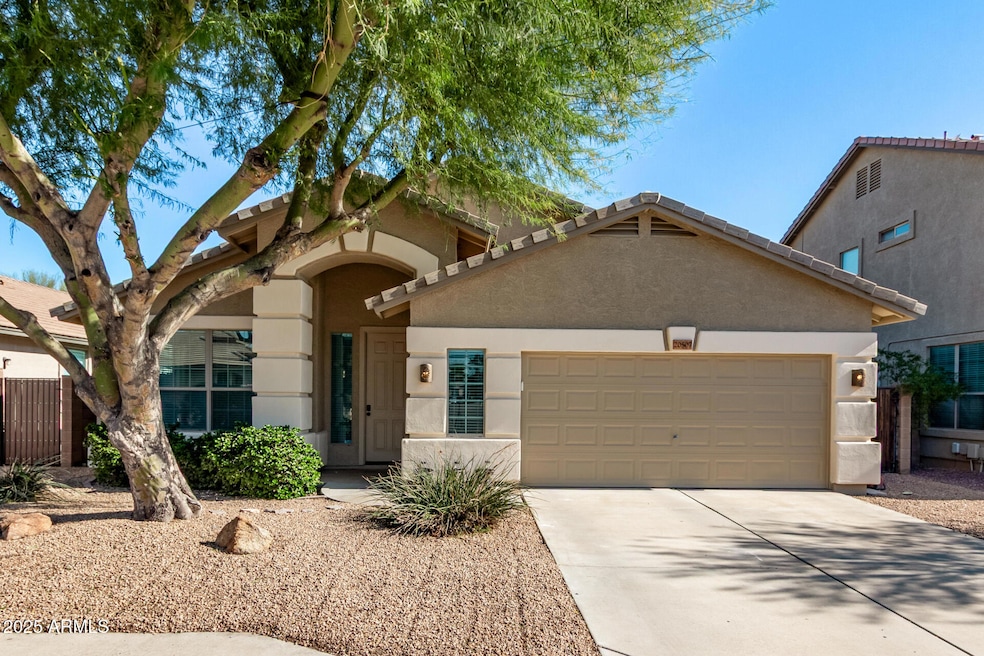
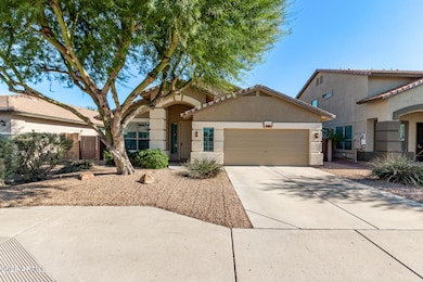
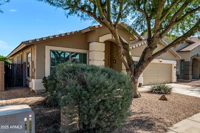
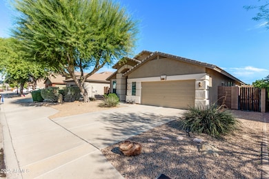
20507 N 89th Dr Peoria, AZ 85382
Estimated payment $2,961/month
Highlights
- Very Popular Property
- Covered Patio or Porch
- Double Pane Windows
- Coyote Hills Elementary School Rated A-
- 2 Car Direct Access Garage
- Soaking Tub
About This Home
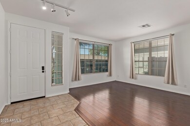
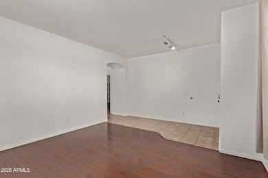
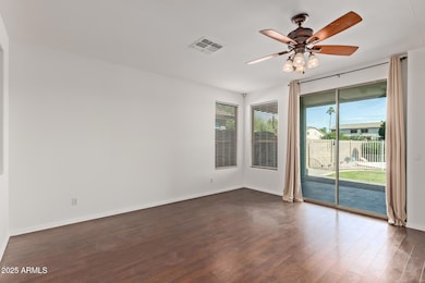
Charming 3-bedroom home with a 2-car garage! Inside, enjoy wood-look tile floors and a welcoming living room that flows effortlessly into the spacious family room perfect for movie nights or hosting friends. The kitchen shines with stainless steel appliances, warm wood cabinetry, ample counters, and a center island with a breakfast bar for casual dining or chatting over coffee. Double doors open to a versatile den, ideal for an office, studio, or creative space. The main bedroom is a true retreat with a private bath featuring dual sinks, a soaking tub, and a walk-in closet. Step outside to a sizable backyard with a paver patio and a fenced pool ready for summer fun. This home backs up to greenbelt Close to parks, shopping, and more. This home truly has it all. Don't miss out
Home Details
Home Type
- Single Family
Est. Annual Taxes
- $2,652
Year Built
- Built in 2002
Lot Details
- 7,313 Sq Ft Lot
- East or West Exposure
- Block Wall Fence
- Grass Covered Lot
HOA Fees
- $65 Monthly HOA Fees
Parking
- 2 Car Direct Access Garage
- Garage Door Opener
Home Design
- Wood Frame Construction
- Tile Roof
- Stucco
Interior Spaces
- 2,077 Sq Ft Home
- 1-Story Property
- Ceiling Fan
- Double Pane Windows
Kitchen
- Breakfast Bar
- Built-In Microwave
- Kitchen Island
- Laminate Countertops
Flooring
- Tile
- Vinyl
Bedrooms and Bathrooms
- 3 Bedrooms
- Primary Bathroom is a Full Bathroom
- 2 Bathrooms
- Dual Vanity Sinks in Primary Bathroom
- Soaking Tub
- Bathtub With Separate Shower Stall
Schools
- Coyote Hills Elementary School
- Sunrise Mountain High School
Utilities
- Central Air
- Heating Available
- High Speed Internet
- Cable TV Available
Additional Features
- No Interior Steps
- Covered Patio or Porch
Listing and Financial Details
- Tax Lot 119
- Assessor Parcel Number 200-17-460
Community Details
Overview
- Association fees include ground maintenance
- Dove Valley Ranch Association, Phone Number (480) 320-2981
- Built by COURTLAND HOMES
- Dove Valley Ranch Parcel 6 Subdivision
Recreation
- Bike Trail
Map
Home Values in the Area
Average Home Value in this Area
Tax History
| Year | Tax Paid | Tax Assessment Tax Assessment Total Assessment is a certain percentage of the fair market value that is determined by local assessors to be the total taxable value of land and additions on the property. | Land | Improvement |
|---|---|---|---|---|
| 2025 | $2,652 | $28,315 | -- | -- |
| 2024 | $2,581 | $26,966 | -- | -- |
| 2023 | $2,581 | $40,920 | $8,180 | $32,740 |
| 2022 | $2,500 | $31,150 | $6,230 | $24,920 |
| 2021 | $2,738 | $28,880 | $5,770 | $23,110 |
| 2020 | $2,755 | $27,950 | $5,590 | $22,360 |
| 2019 | $2,715 | $25,800 | $5,160 | $20,640 |
| 2018 | $2,199 | $24,610 | $4,920 | $19,690 |
| 2017 | $2,561 | $23,020 | $4,600 | $18,420 |
| 2016 | $2,115 | $22,350 | $4,470 | $17,880 |
| 2015 | $2,355 | $22,980 | $4,590 | $18,390 |
Property History
| Date | Event | Price | List to Sale | Price per Sq Ft |
|---|---|---|---|---|
| 12/05/2025 12/05/25 | For Sale | $510,000 | -- | $246 / Sq Ft |
Purchase History
| Date | Type | Sale Price | Title Company |
|---|---|---|---|
| Deed | $188,296 | First American Title |
Mortgage History
| Date | Status | Loan Amount | Loan Type |
|---|---|---|---|
| Previous Owner | $193,950 | New Conventional |
Source: Arizona Regional Multiple Listing Service (ARMLS)
MLS Number: 6954663
APN: 200-17-460
Disclaimer: Certain information contained herein is derived from information provided by parties other than Homes.com. All information provided is deemed reliable, but is not guaranteed to be accurate and should be independently verified.
![]() All information should be verified by the recipient and none is guaranteed as accurate by ARMLS
All information should be verified by the recipient and none is guaranteed as accurate by ARMLS
Listing Information presented by local MLS brokerage: Ten-X, local REALTOR®- Arlene Richardson - (888)-952-6393
- 8862 W Runion Dr
- 8862 W Irma Ln
- 20484 N 88th Ln
- 20855 N 88th Ln
- 8821 W Ross Ave
- 9022 W Ross Ave
- 20477 N 91st Dr
- 20459 N 91st Dr
- 9225 W Runion Dr
- 20140 N 87th Dr
- 9250 W Runion Dr
- 20681 N 93rd Ave
- 8616 W Clara Ln
- 9064 W Marco Polo Rd
- 9248 W Pontiac Dr
- 9031 W Adam Ave
- 9013 W Marco Polo Rd
- 8664 W Marco Polo Rd
- 19812 N 90th Dr
- 9333 W Clara Ln
- 9039 W Clara Ln
- 9214 W Ross Ave
- 8818 W Piute Ave
- 9025 W Marco Polo Rd
- 9158 W Chino Dr
- 9069 W Behrend Dr
- 19518 N 89th Dr
- 9343 W Escuda Dr
- 19429 N 85th Dr
- 9013 W Kerry Ln
- 9539 W Harmony Ln
- 19412 N 85th Dr
- 8374 W Oraibi Dr
- 9567 W Frank Ave
- 8201 W Beardsley Rd
- 19420 N Westbrook Pkwy Unit 526
- 8161 W Pontiac Dr
- 18883 N 88th Dr
- 8135 W Deanna Dr
- 19400 N Westbrook Pkwy Unit 241
