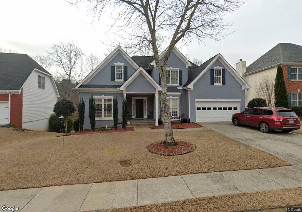
2051 Little River Dr Suwanee, GA 30024
Estimated Value: $409,000 - $470,000
4
Beds
3
Baths
1,895
Sq Ft
$227/Sq Ft
Est. Value
About This Home
This home is located at 2051 Little River Dr, Suwanee, GA 30024 and is currently estimated at $430,415, approximately $227 per square foot. 2051 Little River Dr is a home located in Gwinnett County with nearby schools including Walnut Grove Elementary School, Creekland Middle School, and Collins Hill High School.
Ownership History
Date
Name
Owned For
Owner Type
Purchase Details
Closed on
Oct 14, 2003
Sold by
Anderson Anthony H
Bought by
Long Carl D and Long Tina
Current Estimated Value
Purchase Details
Closed on
May 9, 1997
Sold by
Ccm Properties Inc
Bought by
Anderson Anthony H
Home Financials for this Owner
Home Financials are based on the most recent Mortgage that was taken out on this home.
Original Mortgage
$146,250
Interest Rate
8.13%
Mortgage Type
New Conventional
Create a Home Valuation Report for This Property
The Home Valuation Report is an in-depth analysis detailing your home's value as well as a comparison with similar homes in the area
Home Values in the Area
Average Home Value in this Area
Purchase History
| Date | Buyer | Sale Price | Title Company |
|---|---|---|---|
| Long Carl D | $218,000 | -- | |
| Anderson Anthony H | $162,500 | -- |
Source: Public Records
Mortgage History
| Date | Status | Borrower | Loan Amount |
|---|---|---|---|
| Previous Owner | Anderson Anthony H | $146,250 |
Source: Public Records
Tax History Compared to Growth
Tax History
| Year | Tax Paid | Tax Assessment Tax Assessment Total Assessment is a certain percentage of the fair market value that is determined by local assessors to be the total taxable value of land and additions on the property. | Land | Improvement |
|---|---|---|---|---|
| 2025 | $1,304 | $166,440 | $28,000 | $138,440 |
| 2024 | $1,303 | $159,680 | $42,400 | $117,280 |
| 2023 | $1,303 | $144,360 | $35,600 | $108,760 |
| 2022 | $4,227 | $144,360 | $35,600 | $108,760 |
| 2021 | $3,330 | $98,720 | $22,000 | $76,720 |
| 2020 | $3,352 | $98,720 | $22,000 | $76,720 |
| 2019 | $3,134 | $93,200 | $22,000 | $71,200 |
| 2018 | $3,136 | $93,200 | $22,000 | $71,200 |
| 2016 | $2,918 | $82,160 | $19,600 | $62,560 |
| 2015 | $2,946 | $82,160 | $19,600 | $62,560 |
| 2014 | $2,961 | $82,160 | $19,600 | $62,560 |
Source: Public Records
Map
Nearby Homes
- 2167 Merrymount Dr
- 2265 Wildwood Lake Dr
- 2370 Cape Courage Way
- 2372 Merrymount Dr Unit 2
- 1924 Sidneys Cove
- 2061 Wildcat Cliffs Ln
- 2140 Wildcat Cliffs Way
- 1932 Riverton Dr
- 2067 York River Way
- 1839 Stonebrook Way
- 2140 Deer Trail
- 205 Camden Creek Ct
- 525 Provence Gate Ln
- 2050 Fortuna St
- 83 Russell Rd
- 2205 Parliament Dr
- 81 Russell Rd
- 2315 Prosperity Way Unit 2
- 48 Russell Rd
- 2041 Little River Dr
- 2061 Little River Dr
- 2031 Little River Dr Unit 7
- 0 Little River Dr Unit 7452948
- 0 Little River Dr Unit 8273081
- 0 Little River Dr Unit 7402438
- 0 Little River Dr Unit 7140323
- 0 Little River Dr Unit 2713568
- 2071 Little River Dr Unit 1
- 2062 Little River Dr Unit 1
- 2052 Little River Dr
- 2042 Little River Dr
- 2072 Little River Dr Unit 1
- 2021 Little River Dr
- 2081 Little River Dr
- 2225 Laurel Lake Dr Unit 3
- 2032 Little River Dr
- 2082 Little River Dr Unit 1
- 2215 Laurel Lake Dr
- 2091 Little River Dr