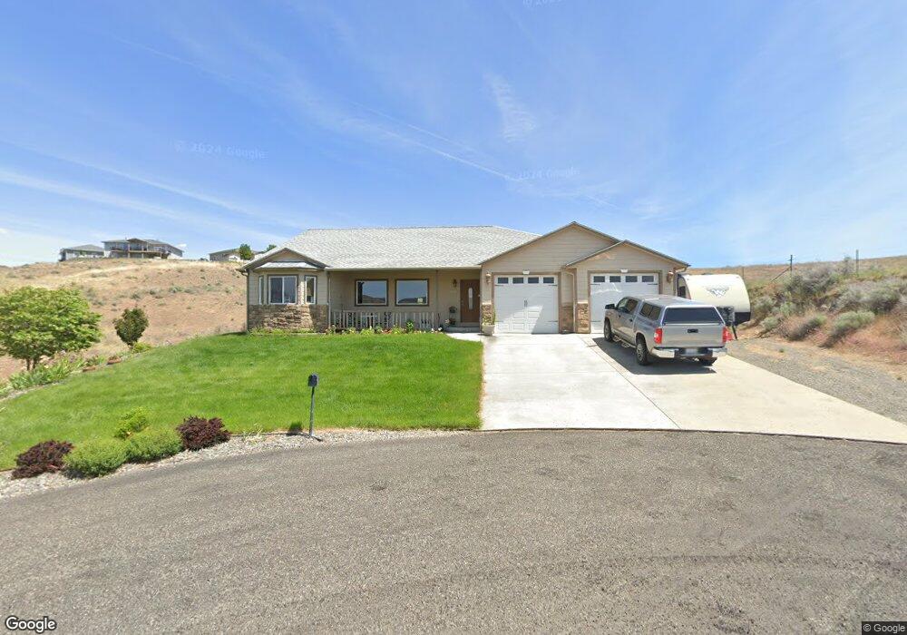
2051 Lolo Ln Unit 2041 Lolo Ln Clarkston, WA 99403
Estimated Value: $506,000 - $587,000
4
Beds
2
Baths
2,492
Sq Ft
$225/Sq Ft
Est. Value
About This Home
This home is located at 2051 Lolo Ln Unit 2041 Lolo Ln, Clarkston, WA 99403 and is currently estimated at $560,874, approximately $225 per square foot. 2051 Lolo Ln Unit 2041 Lolo Ln is a home located in Asotin County with nearby schools including Heights Elementary School, Lincoln Middle School, and Charles Francis Adams High School.
Ownership History
Date
Name
Owned For
Owner Type
Purchase Details
Closed on
May 3, 2019
Sold by
Bayer Jim and Bayer Ina Catherine
Bought by
Bayer Ina Catherine
Current Estimated Value
Home Financials for this Owner
Home Financials are based on the most recent Mortgage that was taken out on this home.
Original Mortgage
$288,000
Outstanding Balance
$253,210
Interest Rate
4.2%
Mortgage Type
New Conventional
Estimated Equity
$307,664
Purchase Details
Closed on
May 1, 2019
Sold by
Stellmacher William and Stellmacher Jenny
Bought by
Bayer Ina Catherine
Home Financials for this Owner
Home Financials are based on the most recent Mortgage that was taken out on this home.
Original Mortgage
$288,000
Outstanding Balance
$253,210
Interest Rate
4.2%
Mortgage Type
New Conventional
Estimated Equity
$307,664
Purchase Details
Closed on
Mar 15, 2012
Sold by
Stellmacher William Roy
Bought by
Stellmacher William Roy and Stellmacher Jenny A
Home Financials for this Owner
Home Financials are based on the most recent Mortgage that was taken out on this home.
Original Mortgage
$200,000
Interest Rate
3.94%
Mortgage Type
New Conventional
Purchase Details
Closed on
Jun 30, 2009
Sold by
Brals Llc
Bought by
Stellmacher William Roy
Home Financials for this Owner
Home Financials are based on the most recent Mortgage that was taken out on this home.
Original Mortgage
$205,000
Interest Rate
4.79%
Mortgage Type
New Conventional
Purchase Details
Closed on
Dec 6, 2007
Sold by
Smith Roy A and Smith Nancy M
Bought by
Brals Llc
Purchase Details
Closed on
May 18, 2007
Sold by
G R M P Llc
Bought by
Smith Roy and Smith Nancy M
Home Financials for this Owner
Home Financials are based on the most recent Mortgage that was taken out on this home.
Original Mortgage
$35,000
Interest Rate
6.17%
Mortgage Type
Credit Line Revolving
Create a Home Valuation Report for This Property
The Home Valuation Report is an in-depth analysis detailing your home's value as well as a comparison with similar homes in the area
Home Values in the Area
Average Home Value in this Area
Purchase History
| Date | Buyer | Sale Price | Title Company |
|---|---|---|---|
| Bayer Ina Catherine | -- | Alliance Title & Escrow | |
| Bayer Ina Catherine | $353,000 | Alliance Title & Escrow | |
| Stellmacher William Roy | -- | Fidelity National Title | |
| Stellmacher William Roy | $245,000 | Alliance Title & Escrow | |
| Brals Llc | -- | None Available | |
| Smith Roy | $46,750 | None Available |
Source: Public Records
Mortgage History
| Date | Status | Borrower | Loan Amount |
|---|---|---|---|
| Open | Bayer Ina Catherine | $288,000 | |
| Previous Owner | Stellmacher William Roy | $200,000 | |
| Previous Owner | Stellmacher William Roy | $205,000 | |
| Previous Owner | Smith Roy | $35,000 |
Source: Public Records
Tax History Compared to Growth
Tax History
| Year | Tax Paid | Tax Assessment Tax Assessment Total Assessment is a certain percentage of the fair market value that is determined by local assessors to be the total taxable value of land and additions on the property. | Land | Improvement |
|---|---|---|---|---|
| 2025 | $4,884 | $468,500 | $59,400 | $409,100 |
| 2023 | $4,884 | $468,500 | $59,400 | $409,100 |
| 2022 | $3,676 | $333,800 | $59,400 | $274,400 |
| 2021 | $3,784 | $333,800 | $59,400 | $274,400 |
| 2020 | $3,511 | $333,800 | $59,400 | $274,400 |
| 2019 | $3,301 | $333,800 | $59,400 | $274,400 |
| 2018 | $4,061 | $333,800 | $59,400 | $274,400 |
| 2017 | $3,675 | $330,200 | $64,400 | $265,800 |
| 2016 | $3,675 | $305,100 | $50,000 | $255,100 |
| 2015 | $341 | $295,300 | $50,000 | $245,300 |
| 2013 | $3,424 | $288,200 | $50,000 | $238,200 |
Source: Public Records
Map
Nearby Homes
- 2510 Westridge Ct
- 2406 Linda Ln
- 2521 Florence Ln
- 2531 Florence Ln
- TBD Evans Rd
- 2222 Deer Pointe Dr
- 2070 Sargent Dr
- TBD Florence Ln
- 2424 Sunset View Ct Unit House & 1 lot
- 2424 Sunset View Ct Unit House and 2 lots
- 2230 Deer Pointe Dr
- 2245 Pitchstone Dr
- 2321 Rolling Hills Dr
- 2390 Rolling Hills Dr
- 2350 Westward ho Dr
- 2335 Valleyview Ct
- Lot 9 Valleyview Dr
- 2600 Valleyview Dr
- 2344 Valleyview Dr
- 2460 Valleyview Dr
- 2051 Lolo Ln
- 2041 Lolo Ln Unit 2051 Lolo Lane
- 2041 Lolo Ln
- 2050 Lolo Ln
- 2520 Westridge Ct
- 2521 Westridge Ct
- 2511 Westridge Ct
- 2511 Westridge Ct Unit Lot 11
- 2510 Westridge Ct Unit off Marilyn Way
- 2510 Westridge Ct Unit Lot 14
- 2621 Remington Way Unit Lot 30 Westridge
- 2040 Marilyn Way
- 2641 Remington Way
- 2501 Westridge Ct
- 2550 Westridge Ct
- 2611 Remington Way
- 2535 Remington Way
- 2028 Marilyn Way
- Lot 34 Westridge View Estates
- Lot 33 Westridge View Estates