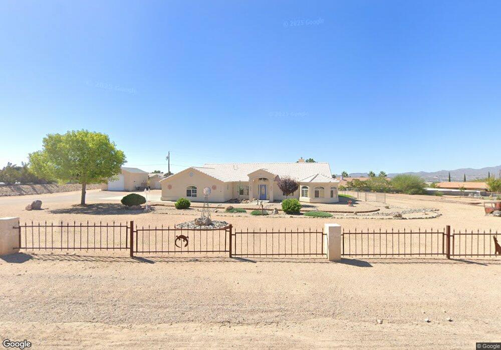
2051 Pawnee Dr Kingman, AZ 86401
Estimated Value: $452,000 - $543,000
4
Beds
3
Baths
2,158
Sq Ft
$226/Sq Ft
Est. Value
About This Home
This home is located at 2051 Pawnee Dr, Kingman, AZ 86401 and is currently estimated at $487,914, approximately $226 per square foot. 2051 Pawnee Dr is a home located in Mohave County with nearby schools including Hualapai Elementary School, White Cliffs Middle School, and Lee Williams High School.
Ownership History
Date
Name
Owned For
Owner Type
Purchase Details
Closed on
Apr 16, 2002
Sold by
Wasserburger Jerome P and Wasserburger Patricia A
Bought by
Wasserburger Jerome P and Wasserburger Patricia A
Current Estimated Value
Purchase Details
Closed on
Apr 5, 1999
Sold by
Baca Ruben and Baca Kim E
Bought by
Wasserburger Jerome P and Wasserburger Patricia A
Home Financials for this Owner
Home Financials are based on the most recent Mortgage that was taken out on this home.
Original Mortgage
$20,000
Outstanding Balance
$5,031
Interest Rate
6.96%
Mortgage Type
New Conventional
Estimated Equity
$482,883
Create a Home Valuation Report for This Property
The Home Valuation Report is an in-depth analysis detailing your home's value as well as a comparison with similar homes in the area
Home Values in the Area
Average Home Value in this Area
Purchase History
| Date | Buyer | Sale Price | Title Company |
|---|---|---|---|
| Wasserburger Jerome P | -- | -- | |
| Wasserburger Jerome P | $27,000 | First American Title |
Source: Public Records
Mortgage History
| Date | Status | Borrower | Loan Amount |
|---|---|---|---|
| Open | Wasserburger Jerome P | $20,000 |
Source: Public Records
Tax History Compared to Growth
Tax History
| Year | Tax Paid | Tax Assessment Tax Assessment Total Assessment is a certain percentage of the fair market value that is determined by local assessors to be the total taxable value of land and additions on the property. | Land | Improvement |
|---|---|---|---|---|
| 2026 | -- | -- | -- | -- |
| 2025 | $1,940 | $38,676 | $0 | $0 |
| 2024 | $1,940 | $42,723 | $0 | $0 |
| 2023 | $1,940 | $36,272 | $0 | $0 |
| 2022 | $1,775 | $31,662 | $0 | $0 |
| 2021 | $1,883 | $29,245 | $0 | $0 |
| 2019 | $1,697 | $24,517 | $0 | $0 |
| 2018 | $1,771 | $24,748 | $0 | $0 |
| 2017 | $1,606 | $24,300 | $0 | $0 |
| 2016 | $1,545 | $23,538 | $0 | $0 |
| 2015 | $1,614 | $20,981 | $0 | $0 |
Source: Public Records
Map
Nearby Homes
- 2124 Blackfoot Dr
- 3811 Dakota Rd
- 3741 Cheyenne Ave
- 2276 Seminole Dr
- 3516 Packsaddle Rd
- 2393 Iroquois Dr
- 2335 Hopi Dr
- 2199 Seneca St
- 00 Cheyenne Ave
- 2414 Seminole Way
- 2488 Iroquois Dr
- 2144 Old Miners Rd
- 3370 Cerritos Ln
- 3376 Motherlode Rd
- 3375 Amanda Ave
- 3316 Producers Mine Rd
- 3405 Cerritos Ln
- 843 S Desert Canyon Way
- 3280 Whitehead Ave
- 3315 Cerritos Ln
- 2059 Pawnee Dr
- 2070 Delaware Dr
- 2045 Pawnee Dr
- 2082 Pawnee Dr
- 2074 Pawnee Dr
- 2054 Delaware Dr
- 2076 Delaware Dr Unit 1
- 2067 Pawnee Dr
- 2090 Pawnee Dr
- 2066 Pawnee Dr
- 2084 Delaware Dr
- 2048 Delaware Dr
- 2090 Pawnee Dr
- 2073 Pawnee Dr
- 2037 Pawnee Dr
- 2058 Pawnee Dr
- 2058 Pawnee Dr
- 2067 Delaware Dr
- 2090 Delaware Dr
- 2059 Delaware Dr