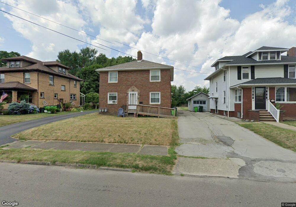
2051 Watson Ave Alliance, OH 44601
Estimated Value: $72,000 - $207,000
4
Beds
3
Baths
2,610
Sq Ft
$62/Sq Ft
Est. Value
About This Home
This home is located at 2051 Watson Ave, Alliance, OH 44601 and is currently estimated at $160,811, approximately $61 per square foot. 2051 Watson Ave is a home located in Stark County with nearby schools including Alliance Elementary School at Rockhill, Alliance Intermediate School at Northside, and Alliance Middle School.
Ownership History
Date
Name
Owned For
Owner Type
Purchase Details
Closed on
Feb 2, 2007
Sold by
Carlile Wendy L
Bought by
Carlile Adam M
Current Estimated Value
Home Financials for this Owner
Home Financials are based on the most recent Mortgage that was taken out on this home.
Original Mortgage
$7,500
Outstanding Balance
$4,500
Interest Rate
6.19%
Mortgage Type
Stand Alone Refi Refinance Of Original Loan
Estimated Equity
$156,311
Purchase Details
Closed on
Oct 24, 2001
Sold by
Krisko Pamela J
Bought by
Carlile Adam M and Carlile Wendy L
Home Financials for this Owner
Home Financials are based on the most recent Mortgage that was taken out on this home.
Original Mortgage
$90,578
Outstanding Balance
$35,430
Interest Rate
6.88%
Mortgage Type
FHA
Estimated Equity
$125,381
Purchase Details
Closed on
Jun 6, 2001
Sold by
Estate Of Annabelle B Strachan
Bought by
Krisko Pamela J
Create a Home Valuation Report for This Property
The Home Valuation Report is an in-depth analysis detailing your home's value as well as a comparison with similar homes in the area
Home Values in the Area
Average Home Value in this Area
Purchase History
| Date | Buyer | Sale Price | Title Company |
|---|---|---|---|
| Carlile Adam M | -- | Attorney | |
| Carlile Adam M | $92,000 | Union Title Company | |
| Krisko Pamela J | -- | -- |
Source: Public Records
Mortgage History
| Date | Status | Borrower | Loan Amount |
|---|---|---|---|
| Open | Carlile Adam M | $7,500 | |
| Open | Carlile Adam M | $90,578 |
Source: Public Records
Tax History Compared to Growth
Tax History
| Year | Tax Paid | Tax Assessment Tax Assessment Total Assessment is a certain percentage of the fair market value that is determined by local assessors to be the total taxable value of land and additions on the property. | Land | Improvement |
|---|---|---|---|---|
| 2025 | -- | $61,820 | $10,610 | $51,210 |
| 2024 | -- | $61,820 | $10,610 | $51,210 |
| 2023 | $1,941 | $47,150 | $8,300 | $38,850 |
| 2022 | $1,954 | $47,150 | $8,300 | $38,850 |
| 2021 | $1,959 | $47,150 | $8,300 | $38,850 |
| 2020 | $1,771 | $39,830 | $7,210 | $32,620 |
| 2019 | $1,748 | $39,840 | $7,210 | $32,630 |
| 2018 | $1,756 | $39,840 | $7,210 | $32,630 |
| 2017 | $1,735 | $38,650 | $5,950 | $32,700 |
| 2016 | $1,464 | $32,350 | $5,950 | $26,400 |
| 2015 | $1,531 | $33,540 | $5,950 | $27,590 |
| 2014 | $1,604 | $33,440 | $5,920 | $27,520 |
| 2013 | $800 | $33,440 | $5,920 | $27,520 |
Source: Public Records
Map
Nearby Homes
- 317 E State St
- 1846 S Freedom Ave
- 2218 S Freedom Ave
- 112 E College St
- 390 E College St
- 2460 S Arch Ave
- 2376 S Seneca Ave
- 236 E Milton St
- 1475 Chatauqua Ct
- 1437 S Linden Ave
- 555 E Milton St
- 815 Grace St
- 729 Waugh St
- 853 Fairway Dr
- 551 South St
- 1395 S Webb Ave
- 1005 S Freedom Ave
- 1515 S Rockhill Ave
- 1233 Woodland Ave
- 1044 S Liberty Ave
- 2029 Watson Ave
- 2057 Watson Ave
- 2115 Watson Ave
- 179 E State St
- 2127 Watson Ave
- 2060 Watson Ave
- 2050 Watson Ave
- 2106 Watson Ave
- 2038 Watson Ave
- 152 E Chestnut St
- 2118 Watson Ave
- 2137 Watson Ave
- 188 E Mill St
- 178 E Mill St
- 245 E State St
- 170 E Mill St
- 2128 Watson Ave
- 160 E Mill St
- 2147 Watson Ave
- 152 E Mill St