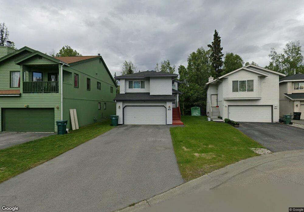
2051 Wenmatt Cir Anchorage, AK 99517
Spenard NeighborhoodEstimated Value: $236,000 - $405,234
3
Beds
2
Baths
1,588
Sq Ft
$202/Sq Ft
Est. Value
About This Home
This home is located at 2051 Wenmatt Cir, Anchorage, AK 99517 and is currently estimated at $321,059, approximately $202 per square foot. 2051 Wenmatt Cir is a home located in Anchorage Municipality with nearby schools including Northwood Elementary School, Romig Middle School, and West High School.
Ownership History
Date
Name
Owned For
Owner Type
Purchase Details
Closed on
Sep 19, 2007
Sold by
Collins Richard and Collins Rene L
Bought by
Mendoza Cesar K and Mendoza Frances P
Current Estimated Value
Home Financials for this Owner
Home Financials are based on the most recent Mortgage that was taken out on this home.
Original Mortgage
$232,750
Interest Rate
6.57%
Mortgage Type
Purchase Money Mortgage
Purchase Details
Closed on
Apr 14, 2000
Sold by
Spinell Homes Inc
Bought by
Collins Richard and Collins Rene L
Home Financials for this Owner
Home Financials are based on the most recent Mortgage that was taken out on this home.
Original Mortgage
$160,140
Interest Rate
8.26%
Mortgage Type
New Conventional
Create a Home Valuation Report for This Property
The Home Valuation Report is an in-depth analysis detailing your home's value as well as a comparison with similar homes in the area
Home Values in the Area
Average Home Value in this Area
Purchase History
| Date | Buyer | Sale Price | Title Company |
|---|---|---|---|
| Mendoza Cesar K | -- | Stewart | |
| Collins Richard | -- | -- | |
| Collins Richard | -- | -- |
Source: Public Records
Mortgage History
| Date | Status | Borrower | Loan Amount |
|---|---|---|---|
| Previous Owner | Mendoza Cesar K | $232,750 | |
| Previous Owner | Collins Richard | $160,140 |
Source: Public Records
Tax History Compared to Growth
Tax History
| Year | Tax Paid | Tax Assessment Tax Assessment Total Assessment is a certain percentage of the fair market value that is determined by local assessors to be the total taxable value of land and additions on the property. | Land | Improvement |
|---|---|---|---|---|
| 2025 | $4,687 | $391,400 | $86,500 | $304,900 |
| 2024 | $4,687 | $365,300 | $86,500 | $278,800 |
| 2023 | $5,564 | $326,700 | $86,500 | $240,200 |
| 2022 | $4,618 | $324,200 | $86,500 | $237,700 |
| 2021 | $5,206 | $288,900 | $86,500 | $202,400 |
| 2020 | $3,912 | $280,400 | $86,500 | $193,900 |
| 2019 | $3,709 | $276,700 | $86,500 | $190,200 |
| 2018 | $3,523 | $264,800 | $68,200 | $196,600 |
| 2017 | $3,935 | $271,300 | $68,200 | $203,100 |
| 2016 | $3,439 | $271,700 | $65,200 | $206,500 |
| 2015 | $3,439 | $266,300 | $65,200 | $201,100 |
| 2014 | $3,439 | $256,500 | $65,200 | $191,300 |
Source: Public Records
Map
Nearby Homes
- 2202 Lincoln Ave
- 4313 Lois Dr
- 2100 W 47th Ave
- 1808 W 47th Ave
- 2105 Mckinley Ave
- 2308 Mckinley Ave
- 5000 Northwood Dr
- NHN Northwood Dr
- 4300 Hayes St
- 3804 Lois Dr
- 1808 Cleveland Ave
- 1806 Cleveland Ave
- 2320 Mcrae Rd Unit 7
- 3913 Barbara Dr
- 4302 Forrest Rd
- 3729 Mccain Loop
- 3731 Mccain Loop
- 3605 Oregon Dr Unit 7
- 3605 Oregon Dr Unit 4
- 3901 Hayes St
- 2061 Wenmatt Cir
- 2031 Wenmatt Cir
- 2021 Wenmatt Cir
- 2011 Wenmatt Cir
- 2001 Wenmatt Cir
- 2101 W 44th Ct
- 2060 Wenmatt Cir
- 2050 Wenmatt Cir
- 2040 Wenmatt Cir
- 2010 Wenmatt Cir
- 2030 Wenmatt Cir
- 2101 W 45th Ave
- 2020 Wenmatt Cir
- 2103 W 44th Ct
- 2200 Roosevelt Dr
- 2103 W 45th Ave
- 2202 Roosevelt Dr
- 2204 Roosevelt Dr
- 2105 W 45th Ave
- 2010 W 45th Ave