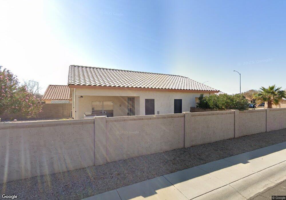
20515 N 95th Dr Peoria, AZ 85382
Estimated Value: $352,032 - $429,000
3
Beds
2
Baths
1,393
Sq Ft
$288/Sq Ft
Est. Value
About This Home
This home is located at 20515 N 95th Dr, Peoria, AZ 85382 and is currently estimated at $401,258, approximately $288 per square foot. 20515 N 95th Dr is a home located in Maricopa County with nearby schools including Parkridge Elementary School and Sunrise Mountain High School.
Ownership History
Date
Name
Owned For
Owner Type
Purchase Details
Closed on
Dec 20, 2016
Sold by
Rodman Stephen L
Bought by
Rodman Stephen L and Stephen L Rodman Revocable Living Trust
Current Estimated Value
Purchase Details
Closed on
Jun 16, 2014
Sold by
Rodman David A
Bought by
The Rodman Family Trust and Rodman Alia M
Purchase Details
Closed on
Jul 23, 2013
Sold by
Rodman David A and Rodman Steohen L
Bought by
Rodman Stephen L
Home Financials for this Owner
Home Financials are based on the most recent Mortgage that was taken out on this home.
Original Mortgage
$172,900
Outstanding Balance
$125,724
Interest Rate
3.92%
Mortgage Type
New Conventional
Estimated Equity
$275,534
Purchase Details
Closed on
Mar 19, 2010
Sold by
Rodman Stephen L and Rodman Cari
Bought by
Rodman Stephen L and Rodman Cari
Purchase Details
Closed on
Aug 14, 2006
Sold by
Rodman Stephen L and Rodman Cari
Bought by
Rodman Stephen L and Rodman Cari
Home Financials for this Owner
Home Financials are based on the most recent Mortgage that was taken out on this home.
Original Mortgage
$169,000
Interest Rate
6.55%
Mortgage Type
Purchase Money Mortgage
Purchase Details
Closed on
Nov 30, 2005
Sold by
Rodman Stephen L and Rodman Cari
Bought by
Rodman Stephen L and Rodman Cari
Purchase Details
Closed on
Jan 26, 2005
Sold by
Smith Deborah A
Bought by
Rodman Stephen L and Rodman Cari
Home Financials for this Owner
Home Financials are based on the most recent Mortgage that was taken out on this home.
Original Mortgage
$156,000
Interest Rate
1.37%
Mortgage Type
New Conventional
Purchase Details
Closed on
Mar 12, 2002
Sold by
Smith John J
Bought by
Smith Deborah A
Purchase Details
Closed on
Nov 24, 1998
Sold by
Continental Homes Inc
Bought by
Smith John J and Smith Deborah A
Home Financials for this Owner
Home Financials are based on the most recent Mortgage that was taken out on this home.
Original Mortgage
$107,800
Interest Rate
6.84%
Mortgage Type
New Conventional
Purchase Details
Closed on
Oct 13, 1998
Sold by
Chi Construction Company
Bought by
Continental Homes Inc
Home Financials for this Owner
Home Financials are based on the most recent Mortgage that was taken out on this home.
Original Mortgage
$107,800
Interest Rate
6.84%
Mortgage Type
New Conventional
Create a Home Valuation Report for This Property
The Home Valuation Report is an in-depth analysis detailing your home's value as well as a comparison with similar homes in the area
Home Values in the Area
Average Home Value in this Area
Purchase History
| Date | Buyer | Sale Price | Title Company |
|---|---|---|---|
| Rodman Stephen L | -- | None Available | |
| The Rodman Family Trust | -- | None Available | |
| Rodman Stephen L | -- | None Available | |
| Rodman Stephen L | -- | None Available | |
| Rodman Stephen L | -- | Lawyers Title Insurance Corp | |
| Rodman Stephen L | -- | Lawyers Title Insurance Corp | |
| Rodman Stephen L | -- | Capital Title Agency Inc | |
| Rodman Stephen L | $205,000 | Capital Title Agency Inc | |
| Smith Deborah A | -- | American Title Insurance | |
| Smith John J | $113,513 | First American Title | |
| Continental Homes Inc | -- | First American Title |
Source: Public Records
Mortgage History
| Date | Status | Borrower | Loan Amount |
|---|---|---|---|
| Open | Rodman Stephen L | $172,900 | |
| Closed | Rodman Stephen L | $169,000 | |
| Previous Owner | Rodman Stephen L | $156,000 | |
| Previous Owner | Smith John J | $107,800 |
Source: Public Records
Tax History Compared to Growth
Tax History
| Year | Tax Paid | Tax Assessment Tax Assessment Total Assessment is a certain percentage of the fair market value that is determined by local assessors to be the total taxable value of land and additions on the property. | Land | Improvement |
|---|---|---|---|---|
| 2025 | $1,685 | $18,024 | -- | -- |
| 2024 | $1,653 | $17,165 | -- | -- |
| 2023 | $1,653 | $29,310 | $5,860 | $23,450 |
| 2022 | $1,621 | $22,360 | $4,470 | $17,890 |
| 2021 | $1,697 | $20,530 | $4,100 | $16,430 |
| 2020 | $1,708 | $19,310 | $3,860 | $15,450 |
| 2019 | $1,657 | $17,650 | $3,530 | $14,120 |
| 2018 | $1,607 | $16,630 | $3,320 | $13,310 |
| 2017 | $1,603 | $15,150 | $3,030 | $12,120 |
| 2016 | $1,584 | $14,500 | $2,900 | $11,600 |
| 2015 | $1,474 | $14,050 | $2,810 | $11,240 |
Source: Public Records
Map
Nearby Homes
- 9529 W Runion Dr
- 20508 N 93rd Ln
- 9651 W Potter Dr
- 20961 N 96th Dr
- 20424 N 96th Ln
- 9331 W Harmony Ln
- 20967 N 96th Ln
- 9541 W Frank Ave
- 9331 W Runion Dr
- 9561 W Frank Ave
- 9321 W Clara Ln
- 9729 W Burnett Rd
- 9457 W Albert Ln
- 9510 W Menadota Dr
- 9250 W Runion Dr
- 9582 W Albert Ln
- 9225 W Runion Dr
- 9627 W Menadota Dr
- 9548 W Quail Ave
- 9574 W Quail Ave
- 20505 N 95th Dr
- 20605 N 95th Dr
- 9536 W Runion Dr
- 9523 W Runion Dr
- 20615 N 95th Dr
- 9535 W Irma Ln
- 20530 N 94th Ln
- 20540 N 94th Ln
- 20520 N 94th Ln
- 9535 W Runion Dr
- 20550 N 94th Ln
- 20510 N 94th Ln
- 9541 W Irma Ln
- 9548 W Runion Dr
- 20560 N 94th Ln
- 20705 N 95th Dr
- 9541 W Runion Dr
- 9536 W Mary Ann Dr
- 9547 W Irma Ln
- 9530 W Mary Ann Dr