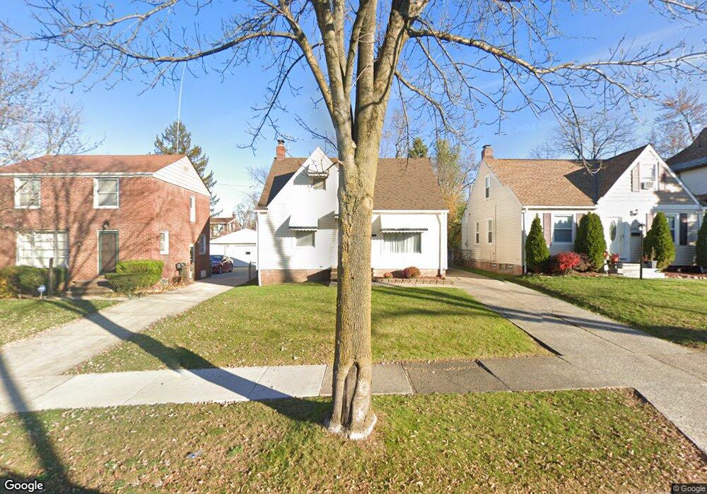
20517 Hillgrove Ave Maple Heights, OH 44137
Estimated Value: $102,000 - $124,000
2
Beds
1
Bath
1,142
Sq Ft
$97/Sq Ft
Est. Value
About This Home
This home is located at 20517 Hillgrove Ave, Maple Heights, OH 44137 and is currently estimated at $110,364, approximately $96 per square foot. 20517 Hillgrove Ave is a home located in Cuyahoga County with nearby schools including Abraham Lincoln Elementary School, Rockside/ J.F. Kennedy School, and Italy High School.
Ownership History
Date
Name
Owned For
Owner Type
Purchase Details
Closed on
Aug 30, 1990
Sold by
Fifik Carol M
Bought by
Battle Debra A
Current Estimated Value
Purchase Details
Closed on
Sep 12, 1985
Sold by
Grabnic Michael
Bought by
Fifik Carol M
Purchase Details
Closed on
Jun 11, 1982
Sold by
Grabnic Michael and Grabnic Mary A
Bought by
Grabnic Michael
Purchase Details
Closed on
Jan 1, 1975
Bought by
Grabnic Michael and Grabnic Mary A
Create a Home Valuation Report for This Property
The Home Valuation Report is an in-depth analysis detailing your home's value as well as a comparison with similar homes in the area
Home Values in the Area
Average Home Value in this Area
Purchase History
| Date | Buyer | Sale Price | Title Company |
|---|---|---|---|
| Battle Debra A | $58,000 | -- | |
| Fifik Carol M | $43,000 | -- | |
| Grabnic Michael | -- | -- | |
| Grabnic Michael | -- | -- |
Source: Public Records
Tax History Compared to Growth
Tax History
| Year | Tax Paid | Tax Assessment Tax Assessment Total Assessment is a certain percentage of the fair market value that is determined by local assessors to be the total taxable value of land and additions on the property. | Land | Improvement |
|---|---|---|---|---|
| 2024 | $2,877 | $31,395 | $6,720 | $24,675 |
| 2023 | $2,171 | $19,990 | $4,060 | $15,930 |
| 2022 | $2,164 | $19,990 | $4,060 | $15,930 |
| 2021 | $2,304 | $19,990 | $4,060 | $15,930 |
| 2020 | $1,975 | $15,160 | $3,080 | $12,080 |
| 2019 | $1,964 | $43,300 | $8,800 | $34,500 |
| 2018 | $1,841 | $15,160 | $3,080 | $12,080 |
| 2017 | $1,872 | $14,070 | $2,870 | $11,200 |
| 2016 | $1,811 | $14,070 | $2,870 | $11,200 |
| 2015 | $1,806 | $14,070 | $2,870 | $11,200 |
| 2014 | $1,806 | $15,470 | $3,150 | $12,320 |
Source: Public Records
Map
Nearby Homes
- 20814 Watson Rd
- 20715 Watson Rd
- 20510 Mountville Dr
- 20701 Kenyon Dr
- 20814 Kenyon Dr
- 20907 Watson Rd
- 21102 Raymond St
- 20107 Libby Rd
- 19807 Gardenview Dr
- 21207 Franklin Rd
- 20120 Mccracken Rd
- 19806 Mountville Dr
- 19520 Maple Heights Blvd
- 19812 Stockton Ave
- 21416 Gardenview Dr
- 19309 Nitra Ave
- 5165 Camden Rd
- 19289 Stafford Ave
- 19221 Stafford Ave
- 20625 Centuryway Rd
- 20601 Hillgrove Ave
- 20513 Hillgrove Ave
- 20605 Hillgrove Ave
- 20509 Hillgrove Ave
- 20609 Hillgrove Ave
- 20505 Hillgrove Ave
- 20516 Franklin Rd
- 20600 Franklin Rd
- 20512 Franklin Rd
- 20604 Franklin Rd
- 20508 Franklin Rd
- 20613 Hillgrove Ave
- 20501 Hillgrove Ave
- 20608 Franklin Rd
- 20516 Hillgrove Ave
- 20600 Hillgrove Ave
- 20512 Hillgrove Ave
- 20502 Franklin Rd
- 20604 Hillgrove Ave
- 20508 Hillgrove Ave