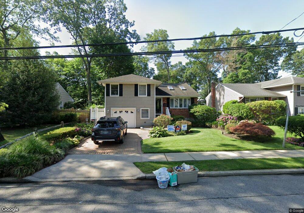
2052 Decker Ave Merrick, NY 11566
Estimated Value: $730,228 - $803,000
--
Bed
2
Baths
1,287
Sq Ft
$596/Sq Ft
Est. Value
About This Home
This home is located at 2052 Decker Ave, Merrick, NY 11566 and is currently estimated at $766,614, approximately $595 per square foot. 2052 Decker Ave is a home located in Nassau County with nearby schools including Burcham Elementary School, Merrick Avenue Middle School, and Waynoka High School.
Ownership History
Date
Name
Owned For
Owner Type
Purchase Details
Closed on
Apr 22, 2010
Sold by
Rapanti Saverio and Pasquariello Giovanna
Bought by
Pasquariello Giovanna and Rapanti Saverio
Current Estimated Value
Purchase Details
Closed on
Apr 12, 2004
Sold by
Riolo John
Bought by
Raspanti Saverio
Purchase Details
Closed on
Mar 1, 1999
Sold by
Deere Cyril J
Bought by
Riolo John and Riolo Marie
Create a Home Valuation Report for This Property
The Home Valuation Report is an in-depth analysis detailing your home's value as well as a comparison with similar homes in the area
Home Values in the Area
Average Home Value in this Area
Purchase History
| Date | Buyer | Sale Price | Title Company |
|---|---|---|---|
| Pasquariello Giovanna | -- | -- | |
| Raspanti Saverio | $460,000 | -- | |
| Riolo John | $252,500 | -- |
Source: Public Records
Tax History Compared to Growth
Tax History
| Year | Tax Paid | Tax Assessment Tax Assessment Total Assessment is a certain percentage of the fair market value that is determined by local assessors to be the total taxable value of land and additions on the property. | Land | Improvement |
|---|---|---|---|---|
| 2025 | $14,075 | $486 | $186 | $300 |
| 2024 | $3,641 | $511 | $196 | $315 |
| 2023 | $12,735 | $536 | $205 | $331 |
| 2022 | $12,735 | $530 | $203 | $327 |
| 2021 | $15,602 | $539 | $207 | $332 |
| 2020 | $11,001 | $525 | $442 | $83 |
| 2019 | $8,371 | $562 | $443 | $119 |
| 2018 | $8,445 | $600 | $0 | $0 |
| 2017 | $5,698 | $637 | $446 | $191 |
| 2016 | $8,548 | $675 | $426 | $249 |
| 2015 | $2,940 | $712 | $449 | $263 |
| 2014 | $2,940 | $712 | $449 | $263 |
| 2013 | $2,893 | $750 | $473 | $277 |
Source: Public Records
Map
Nearby Homes
- 2005 Abbot Ave
- 1580 Little Whaleneck Rd
- 1531 Merrick Ave
- 1680 Lake Ave
- 12 Washington Dr
- 2 Garfield St
- 2207 Van Nostrand Ave
- 1617 Richard Ave
- 2271 Locust St
- 2282 Sycamore Place
- 2245 Van Nostrand Ave
- 37 Orchard St
- 1360 Powell Ave
- 1800 Remson Ave
- 526 Park Ave
- 1448 Dewey Ave
- 1734 Roberta Ln
- 2239 Henry St
- 1750 Henry Rd
- 2327 Cleveland St
- 2048 Decker Ave
- 2058 Decker Ave
- 2038 Decker Ave
- 2049 Decker Ave
- 1570 Bangs Ave
- 2057 Decker Ave
- 2070 Decker Ave
- 2041 Decker Ave
- 2028 Decker Ave
- 1569 Bangs Ave
- 2067 Decker Ave
- 1534 Clark St
- 2061 Abbot Ave
- 2055 Abbot Ave
- 1569 Bascom Ave
- 2073 Decker Ave
- 2047 Abbot Ave
- 1583 Bangs Ave
- 2071 Abbot Ave
- 2080 Decker Ave