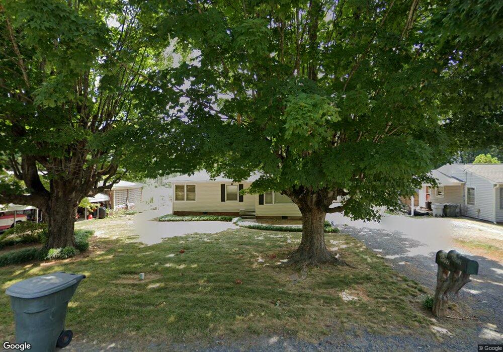
2052 Lamar Dr Asheboro, NC 27203
Estimated Value: $127,429 - $206,000
Studio
1
Bath
1,072
Sq Ft
$151/Sq Ft
Est. Value
About This Home
This home is located at 2052 Lamar Dr, Asheboro, NC 27203 and is currently estimated at $162,357, approximately $151 per square foot. 2052 Lamar Dr is a home located in Randolph County with nearby schools including Balfour Elementary School, North Asheboro Middle School, and Asheboro High School.
Ownership History
Date
Name
Owned For
Owner Type
Purchase Details
Closed on
Dec 21, 2023
Sold by
Snead Wanda Candy and Snead Charles Leon
Bought by
Mills Kyle Bailey
Current Estimated Value
Purchase Details
Closed on
Sep 15, 2021
Sold by
Snead Wanda Canoy and Walls Wanda Carol
Bought by
Snead Wanda Canoy and Snead Charles Leon
Purchase Details
Closed on
Nov 5, 2013
Sold by
Walls James M
Bought by
Walls Wanda Carol
Purchase Details
Closed on
Oct 31, 2007
Sold by
Canoy Harold E and Canoy Judith F
Bought by
Walls James M and Walls Wanda Canoy
Create a Home Valuation Report for This Property
The Home Valuation Report is an in-depth analysis detailing your home's value as well as a comparison with similar homes in the area
Home Values in the Area
Average Home Value in this Area
Purchase History
| Date | Buyer | Sale Price | Title Company |
|---|---|---|---|
| Mills Kyle Bailey | -- | None Listed On Document | |
| Snead Wanda Canoy | -- | None Available | |
| Walls Wanda Carol | -- | None Available | |
| Walls James M | $74,000 | None Available |
Source: Public Records
Tax History
| Year | Tax Paid | Tax Assessment Tax Assessment Total Assessment is a certain percentage of the fair market value that is determined by local assessors to be the total taxable value of land and additions on the property. | Land | Improvement |
|---|---|---|---|---|
| 2025 | $1,265 | $95,080 | $17,470 | $77,610 |
| 2024 | $1,265 | $95,080 | $17,470 | $77,610 |
| 2023 | $1,265 | $95,080 | $17,470 | $77,610 |
| 2022 | $979 | $67,590 | $15,190 | $52,400 |
| 2021 | $979 | $67,590 | $15,190 | $52,400 |
| 2020 | $979 | $67,590 | $15,190 | $52,400 |
| 2019 | $979 | $67,590 | $15,190 | $52,400 |
| 2018 | $732 | $49,640 | $16,560 | $33,080 |
| 2016 | $735 | $49,637 | $16,560 | $33,077 |
| 2015 | $737 | $49,637 | $16,560 | $33,077 |
| 2014 | -- | $49,637 | $16,560 | $33,077 |
Source: Public Records
Map
Nearby Homes
- 203 Sunrise Ave
- 307 Sunrise Ave
- 1931 Greenwood Rd
- 404 Sharon Ave
- 2392 Hickory Forest Dr
- 1962 & 1966 Lakeview Rd
- 2339 Hickory Forest Dr
- 728 Central Falls Rd
- 734 Central Falls Rd
- 1684 Pen Oak Dr
- 2148 Sarina Dr
- 2411 Regency Dr
- 2411 Whirlwind Ln
- 206 Mcknight St
- 1240 Old Liberty Rd
- 00-00 4th Park Ave Unit L20-22
- 00-00 4th Park Ave
- 308 W Beasley St
- 218 Barber Dr
- 421 W Beasley St
- 2056 Lamar Dr
- 2050 Lamar Dr
- 2052 Yancey Ave
- 2100 Lamar Dr
- 2053 Lamar Dr
- 2057 Lamar Dr
- 2044 Yancey Ave
- 2051 Lamar Dr
- 2061 Lamar Dr
- 115 Sunrise Ave
- 207 Sunrise Ave
- 2104 Lamar Dr
- 215 Sunrise Ave
- 111 Sunrise Ave
- 2105 Lamar Dr
- 2108 Lamar Dr
- 218 Eckerd St
- 2046 N Fayetteville St
- 2050 N Fayetteville St
- 219 Sunrise Ave
Your Personal Tour Guide
Ask me questions while you tour the home.