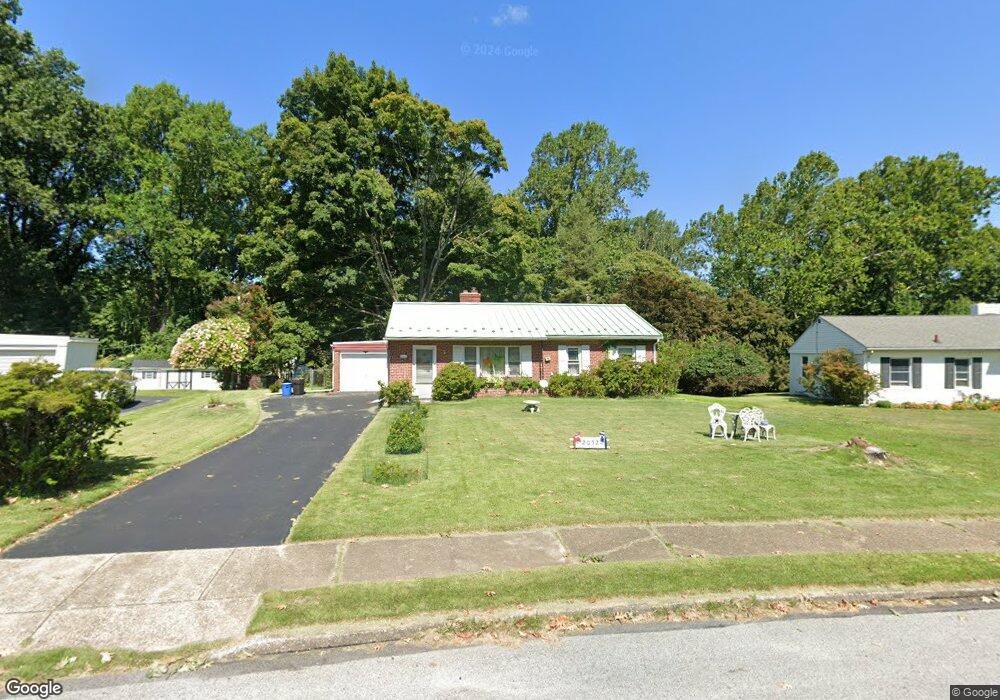
2052 Woodside Ln Broomall, PA 19008
Estimated Value: $334,000 - $486,000
2
Beds
1
Bath
1,040
Sq Ft
$385/Sq Ft
Est. Value
About This Home
This home is located at 2052 Woodside Ln, Broomall, PA 19008 and is currently estimated at $400,881, approximately $385 per square foot. 2052 Woodside Ln is a home located in Delaware County with nearby schools including Loomis Elementary School, Paxon Hollow Middle School, and Marple Newtown Senior High School.
Ownership History
Date
Name
Owned For
Owner Type
Purchase Details
Closed on
Dec 30, 1993
Sold by
Quay Ralph Robert and Quay Marianna H
Bought by
Quay R Robert and Quay Regina
Current Estimated Value
Home Financials for this Owner
Home Financials are based on the most recent Mortgage that was taken out on this home.
Original Mortgage
$77,000
Interest Rate
7%
Mortgage Type
Seller Take Back
Create a Home Valuation Report for This Property
The Home Valuation Report is an in-depth analysis detailing your home's value as well as a comparison with similar homes in the area
Home Values in the Area
Average Home Value in this Area
Purchase History
| Date | Buyer | Sale Price | Title Company |
|---|---|---|---|
| Quay R Robert | $117,000 | T A Title Insurance Company |
Source: Public Records
Mortgage History
| Date | Status | Borrower | Loan Amount |
|---|---|---|---|
| Closed | Quay R Robert | $77,000 |
Source: Public Records
Tax History Compared to Growth
Tax History
| Year | Tax Paid | Tax Assessment Tax Assessment Total Assessment is a certain percentage of the fair market value that is determined by local assessors to be the total taxable value of land and additions on the property. | Land | Improvement |
|---|---|---|---|---|
| 2025 | $5,292 | $306,220 | $125,100 | $181,120 |
| 2024 | $5,292 | $306,220 | $125,100 | $181,120 |
| 2023 | $5,124 | $306,220 | $125,100 | $181,120 |
| 2022 | $5,027 | $306,220 | $125,100 | $181,120 |
| 2021 | $7,586 | $306,220 | $125,100 | $181,120 |
| 2020 | $3,843 | $133,550 | $63,880 | $69,670 |
| 2019 | $3,797 | $133,550 | $63,880 | $69,670 |
| 2018 | $3,757 | $133,550 | $0 | $0 |
| 2017 | $3,759 | $133,550 | $0 | $0 |
| 2016 | $733 | $133,550 | $0 | $0 |
| 2015 | $748 | $133,550 | $0 | $0 |
| 2014 | $748 | $133,550 | $0 | $0 |
Source: Public Records
Map
Nearby Homes
- 312 Rock Run Cir
- 306 Rock Run Cir
- Balvenie Plan at Cedar View
- Petersburg Plan at Cedar View
- Bowmore Plan at Cedar View
- Clayton Plan at Cedar View
- Gilfillan Plan at Cedar View
- 404 Langford Rd
- 63 S Greenhill Rd
- 44 S Greenhill Rd
- 1 Brighton Village Dr
- 510 Concord Rd
- 7 Brighton Village Dr
- 228 S Pkwy
- 362 Swanage Dr
- 88 4th Ave
- 621 S Central Blvd
- 1 Lawrence Rd Unit A3A
- 631 S Central Blvd
- 202 Rolling Rd
- 2056 Woodside Ln
- 2048 Woodside Ln
- 2060 Woodside Ln
- 2044 Woodside Ln
- 2041 Woodside Ln
- 2036 Rose Ln
- 230 Woodside Ln
- 2040 Woodside Ln
- 2037 Woodside Ln
- 226 Woodside Ln
- 2032 Rose Ln
- 289 Langford Rd
- 2036 Woodside Ln
- 2033 Woodside Ln
- 2041 Rose Ln
- 2028 Rose Ln
- 2032 Woodside Ln
- 2037 Rose Ln
- 2029 Woodside Ln
- 2024 Rose Ln