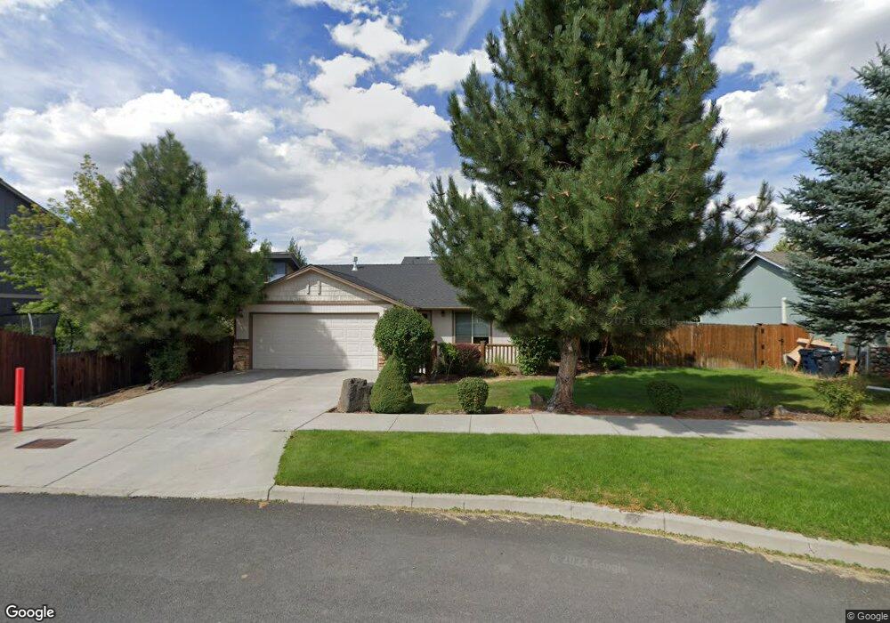
20520 Dylan Loop Bend, OR 97702
Old Farm District NeighborhoodEstimated Value: $498,894 - $529,000
3
Beds
2
Baths
1,346
Sq Ft
$378/Sq Ft
Est. Value
About This Home
This home is located at 20520 Dylan Loop, Bend, OR 97702 and is currently estimated at $509,224, approximately $378 per square foot. 20520 Dylan Loop is a home located in Deschutes County with nearby schools including Silver Rail Elementary School, High Desert Middle School, and Bend Senior High School.
Ownership History
Date
Name
Owned For
Owner Type
Purchase Details
Closed on
Jun 28, 2011
Sold by
Smith Craig A
Bought by
Gayle T Hunt Revocable Trust
Current Estimated Value
Purchase Details
Closed on
Aug 24, 2006
Sold by
Higgins Anna and Russell Brian
Bought by
Smith Craig A
Home Financials for this Owner
Home Financials are based on the most recent Mortgage that was taken out on this home.
Original Mortgage
$176,000
Interest Rate
6.62%
Mortgage Type
Unknown
Purchase Details
Closed on
May 3, 2004
Sold by
Reinhardt Construction & Design Llc
Bought by
Russell Anna and Russell Brian
Home Financials for this Owner
Home Financials are based on the most recent Mortgage that was taken out on this home.
Original Mortgage
$150,220
Interest Rate
5.35%
Mortgage Type
FHA
Create a Home Valuation Report for This Property
The Home Valuation Report is an in-depth analysis detailing your home's value as well as a comparison with similar homes in the area
Home Values in the Area
Average Home Value in this Area
Purchase History
| Date | Buyer | Sale Price | Title Company |
|---|---|---|---|
| Gayle T Hunt Revocable Trust | $110,500 | Deschutes County Title Co | |
| Smith Craig A | $296,300 | Western Title & Escrow Co | |
| Russell Anna | $158,000 | Amerititle |
Source: Public Records
Mortgage History
| Date | Status | Borrower | Loan Amount |
|---|---|---|---|
| Previous Owner | Smith Craig A | $176,000 | |
| Previous Owner | Russell Anna | $150,220 |
Source: Public Records
Tax History Compared to Growth
Tax History
| Year | Tax Paid | Tax Assessment Tax Assessment Total Assessment is a certain percentage of the fair market value that is determined by local assessors to be the total taxable value of land and additions on the property. | Land | Improvement |
|---|---|---|---|---|
| 2025 | $3,275 | $193,800 | -- | -- |
| 2024 | $3,150 | $188,160 | -- | -- |
| 2023 | $2,920 | $182,680 | $0 | $0 |
| 2022 | $2,725 | $172,200 | $0 | $0 |
| 2021 | $2,729 | $167,190 | $0 | $0 |
| 2020 | $2,589 | $167,190 | $0 | $0 |
| 2019 | $2,517 | $162,330 | $0 | $0 |
| 2018 | $2,446 | $157,610 | $0 | $0 |
| 2017 | $2,374 | $153,020 | $0 | $0 |
| 2016 | $2,264 | $148,570 | $0 | $0 |
| 2015 | $2,202 | $144,250 | $0 | $0 |
| 2014 | $2,137 | $140,050 | $0 | $0 |
Source: Public Records
Map
Nearby Homes
- 61429 SE Daybreak Ct Unit Lot 7
- 61441 SE Daybreak Ct Unit Lot 10
- 61433 SE Daybreak Ct Unit Lot 8
- 61405 SE Daybreak Ct
- 61409 SE Daybreak Ct Unit Lot 2
- 20495 SE Bard Ct Unit 7
- 20487 SE Bard Ct Unit 11
- 20580 Klahani Dr
- 20531 Rolen Ave
- 20594 SE Slate Ave
- 20599 Kira Dr Unit 382
- 20603 Kira Dr Unit 383
- 20611 Kira Dr Unit 385
- 61364 SE Matthew St
- 20572 Kira Dr Unit 369
- 20560 Kira Dr Unit 371
- 61467 Kobe St Unit 344
- 20632 Kira Dr
- 61475 Kobe St Unit 342
- 61187 Splendor Ln
- 20519 Peak Ave
- 20524 Dylan Loop
- 61360 SE Kobe St
- 61356 Kobe St
- 20523 Peak Ave
- 61364 Kobe St
- 20528 Dylan Loop
- 20527 Peak Ave
- 20525 Dylan Loop
- 20513 Dylan Loop
- 0 Kobe St Unit 13 201603800
- 0 Kobe St Unit 12 201603797
- 0 Kobe St Unit 2907928
- 0 Kobe St Unit 11 201603801
- 0 Kobe St Unit 201608735
- 20518 Peak Ave
- 20514 Peak Ave
- 20522 Peak Ave
- 20529 Dylan Loop
- 20510 Peak Ave
