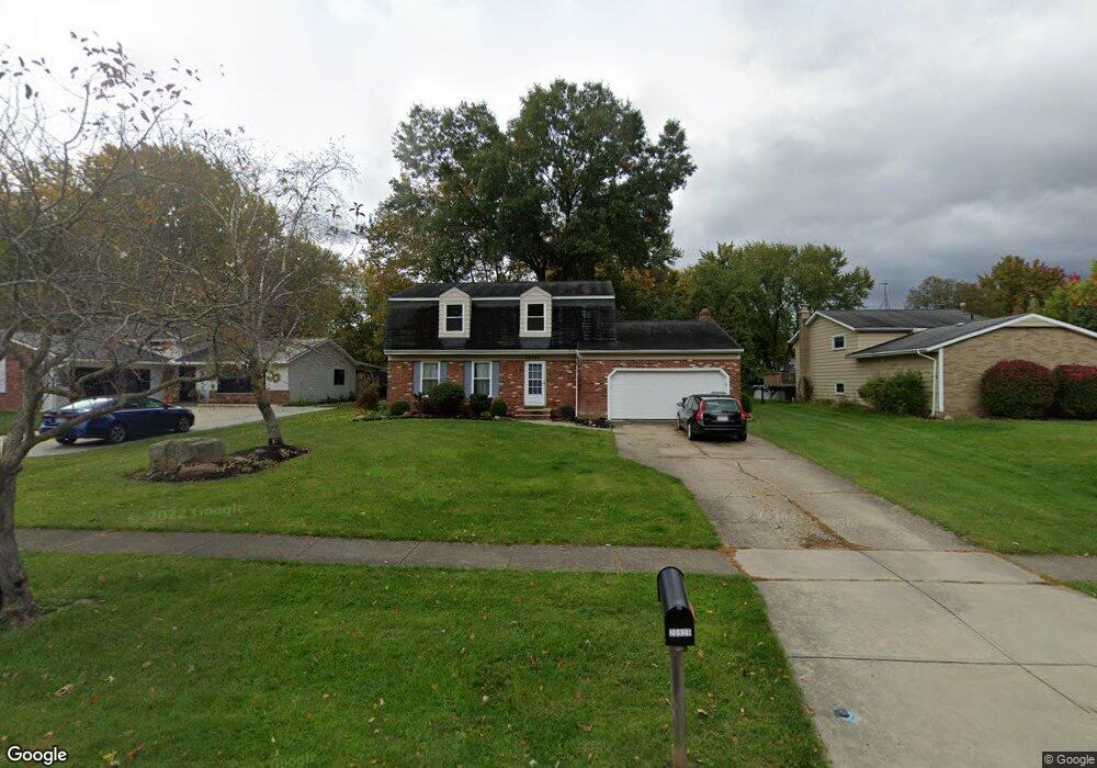
20525 Homestead Park Dr Strongsville, OH 44149
Estimated Value: $325,000 - $386,000
4
Beds
3
Baths
2,124
Sq Ft
$169/Sq Ft
Est. Value
About This Home
This home is located at 20525 Homestead Park Dr, Strongsville, OH 44149 and is currently estimated at $359,976, approximately $169 per square foot. 20525 Homestead Park Dr is a home located in Cuyahoga County with nearby schools including Strongsville High School, Sts Joseph & John Interparochial School, and St Mary School.
Ownership History
Date
Name
Owned For
Owner Type
Purchase Details
Closed on
Feb 18, 2000
Sold by
Fedler James L
Bought by
Cronin Marian E and Felder Marian C
Current Estimated Value
Home Financials for this Owner
Home Financials are based on the most recent Mortgage that was taken out on this home.
Original Mortgage
$104,600
Outstanding Balance
$34,704
Interest Rate
8.21%
Estimated Equity
$325,272
Purchase Details
Closed on
Oct 27, 1988
Sold by
Clause John M
Bought by
Felder James L
Purchase Details
Closed on
Sep 21, 1978
Sold by
Jean W
Bought by
Clause John M
Purchase Details
Closed on
Jan 1, 1975
Bought by
Jean W
Create a Home Valuation Report for This Property
The Home Valuation Report is an in-depth analysis detailing your home's value as well as a comparison with similar homes in the area
Home Values in the Area
Average Home Value in this Area
Purchase History
| Date | Buyer | Sale Price | Title Company |
|---|---|---|---|
| Cronin Marian E | -- | Lawyers Title Ins Corp | |
| Felder James L | $116,000 | -- | |
| Clause John M | $78,000 | -- | |
| Jean W | -- | -- |
Source: Public Records
Mortgage History
| Date | Status | Borrower | Loan Amount |
|---|---|---|---|
| Open | Cronin Marian E | $104,600 |
Source: Public Records
Tax History Compared to Growth
Tax History
| Year | Tax Paid | Tax Assessment Tax Assessment Total Assessment is a certain percentage of the fair market value that is determined by local assessors to be the total taxable value of land and additions on the property. | Land | Improvement |
|---|---|---|---|---|
| 2024 | $4,575 | $97,440 | $20,545 | $76,895 |
| 2023 | $5,006 | $79,950 | $17,400 | $62,550 |
| 2022 | $4,970 | $79,940 | $17,400 | $62,550 |
| 2021 | $4,931 | $79,940 | $17,400 | $62,550 |
| 2020 | $4,568 | $65,520 | $14,250 | $51,280 |
| 2019 | $4,434 | $187,200 | $40,700 | $146,500 |
| 2018 | $4,015 | $65,520 | $14,250 | $51,280 |
| 2017 | $4,080 | $61,500 | $11,620 | $49,880 |
| 2016 | $4,047 | $61,500 | $11,620 | $49,880 |
| 2015 | $3,984 | $61,500 | $11,620 | $49,880 |
| 2014 | $3,984 | $59,710 | $11,270 | $48,440 |
Source: Public Records
Map
Nearby Homes
- 9401 Pheasant Run Place
- 20424 Scotch Pine Way
- 8627 Courtland Dr
- 21176 Hickory Branch Trail
- 20684 Albion Rd
- 19890 Idlewood Trail
- 10839 Prospect Rd
- 21355 Hickory Branch Trail
- 20050 Idlewood Trail
- 10353 Oak Branch Trail
- 84 Sprague Rd
- 19997 Idlewood Trail
- 10986 Fawn Meadow Ln
- 9829 Plum Brook Ln
- 104 Whitehall Dr
- 8036 Fair Rd
- 0 Priem Rd
- 8902 Lincolnshire Blvd
- 11179 Fawn Meadow Ln
- 22300 Rock Creek Cir
- 20575 Homestead Park Dr
- 20493 Homestead Park Dr
- 20593 Homestead Park Dr
- 20469 Homestead Park Dr
- 0 Willow Ln Unit 4003371
- 0 Willow Ln Unit 4104889
- 20607 Homestead Park Dr
- 20447 Homestead Park Dr
- 20542 Village Green Dr
- 20566 Village Green Dr
- 20516 Village Green Dr
- 20532 Homestead Park Dr
- 20504 Homestead Park Dr
- 20488 Village Green Dr
- 20596 Village Green Dr
- 20643 Homestead Park Dr
- 20425 Homestead Park Dr
- 20598 Homestead Park Dr
- 20464 Village Green Dr
- 20456 Homestead Park Dr