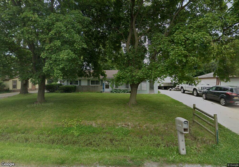
2053 Swaranne Dr West Bloomfield, MI 48324
Estimated Value: $218,050 - $253,000
3
Beds
1
Bath
1,044
Sq Ft
$226/Sq Ft
Est. Value
About This Home
This home is located at 2053 Swaranne Dr, West Bloomfield, MI 48324 and is currently estimated at $236,263, approximately $226 per square foot. 2053 Swaranne Dr is a home located in Oakland County with nearby schools including Haviland Elementary School, Pierce Middle School, and Waterford Mott High School.
Ownership History
Date
Name
Owned For
Owner Type
Purchase Details
Closed on
Oct 29, 2008
Sold by
Federal National Mortgage Association
Bought by
Stevenson Matthew
Current Estimated Value
Purchase Details
Closed on
Mar 5, 2008
Sold by
Central Mortgage Co
Bought by
Federal National Mortgage Association
Purchase Details
Closed on
Mar 4, 2008
Sold by
Christian Kenneth D and Christian Rosemary
Bought by
Central Mortgage Co
Purchase Details
Closed on
Oct 14, 2003
Sold by
Franklin William H
Bought by
Christian Kenneth D and Christian Rosemary
Purchase Details
Closed on
Nov 14, 2002
Sold by
Franklin Karri L
Bought by
Franklin William H
Create a Home Valuation Report for This Property
The Home Valuation Report is an in-depth analysis detailing your home's value as well as a comparison with similar homes in the area
Home Values in the Area
Average Home Value in this Area
Purchase History
| Date | Buyer | Sale Price | Title Company |
|---|---|---|---|
| Stevenson Matthew | $59,500 | Warranty Title Agency Llc | |
| Federal National Mortgage Association | -- | None Available | |
| Central Mortgage Co | $140,800 | None Available | |
| Christian Kenneth D | $140,500 | Lawyers Title Insurance Corp | |
| Franklin William H | -- | -- |
Source: Public Records
Tax History Compared to Growth
Tax History
| Year | Tax Paid | Tax Assessment Tax Assessment Total Assessment is a certain percentage of the fair market value that is determined by local assessors to be the total taxable value of land and additions on the property. | Land | Improvement |
|---|---|---|---|---|
| 2024 | $1,147 | $87,560 | $0 | $0 |
| 2022 | $1,094 | $83,780 | $36,000 | $47,780 |
| 2021 | $1,694 | $71,190 | $0 | $0 |
| 2020 | $1,002 | $67,240 | $26,570 | $40,670 |
| 2018 | $1,619 | $57,090 | $21,000 | $36,090 |
| 2015 | -- | $47,380 | $0 | $0 |
| 2014 | -- | $44,150 | $0 | $0 |
| 2011 | -- | $41,910 | $0 | $0 |
Source: Public Records
Map
Nearby Homes
- 1992 Swaranne Dr
- 6620 Red Cedar Ln Unit 37
- 1837 Henbert Rd
- 1811 Henbert Rd
- 6726 Red Cedar Ln
- 1985 Christopher Ct
- 2112 Keylon Dr
- 2236 Locklin Ln
- 6034 Beachwood Dr
- 6057 Beachwood Dr
- 1604 Petrolia
- VAC Mercedes Ave
- 2140 Timberridge Ct
- 6289 Lindsay Ct
- Lot 94 Hiller Rd
- 5699 Applegrove Dr
- VL Tamson St
- 2110 Peachtree Ct
- 1276 Jay St Unit 6
- 1701 Marylestone Dr
- 6382 Greer Rd
- 2039 Swaranne Dr
- 2054 Sarona Ln
- 6362 Greer Rd
- 2038 Sarona Ln
- 2021 Swaranne Dr
- 6342 Greer Rd
- 2022 Sarona Ln
- 2052 Swaranne Dr
- 6414 Greer Rd
- 2038 Swaranne Dr
- 2007 Swaranne Dr
- 2006 Sarona Ln
- 2020 Swaranne Dr
- 6310 Greer Rd
- 1991 Swaranne Dr
- 2047 Henbert Rd
- 6434 Greer Rd
- 2008 Swaranne Dr
- 1990 Sarona Ln