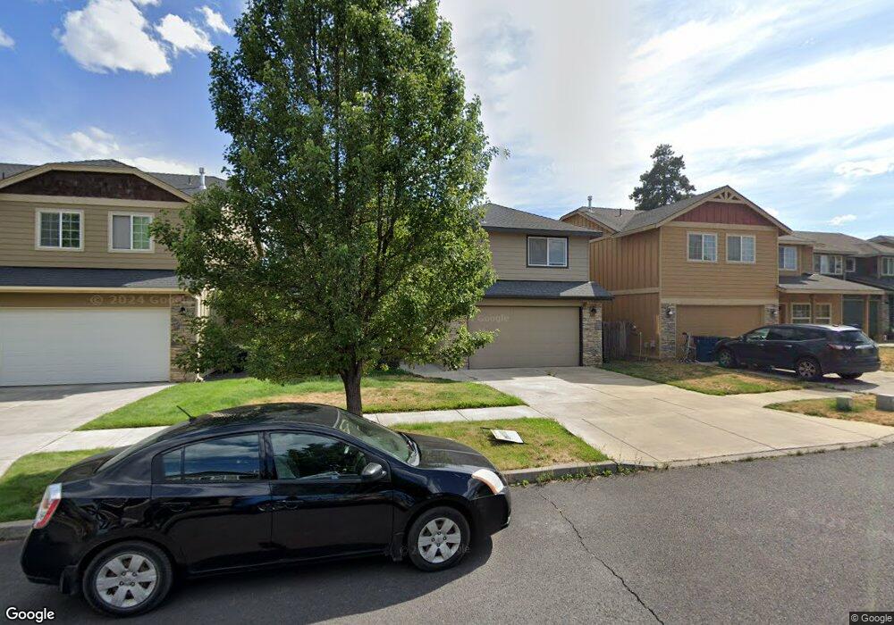
20537 Barrows Ct Bend, OR 97702
Old Farm District NeighborhoodEstimated Value: $622,026 - $717,000
3
Beds
3
Baths
2,334
Sq Ft
$283/Sq Ft
Est. Value
About This Home
This home is located at 20537 Barrows Ct, Bend, OR 97702 and is currently estimated at $660,507, approximately $282 per square foot. 20537 Barrows Ct is a home located in Deschutes County with nearby schools including Silver Rail Elementary School, High Desert Middle School, and Bend Senior High School.
Ownership History
Date
Name
Owned For
Owner Type
Purchase Details
Closed on
Jan 4, 2016
Sold by
Steele Mark N
Bought by
Steelegoingstrong B L Llc
Current Estimated Value
Purchase Details
Closed on
Nov 14, 2005
Sold by
Somerset Development Llc
Bought by
Steele Oliver P and Steele Bonnie Lee
Purchase Details
Closed on
Sep 9, 2005
Sold by
Stevens Kenneth D and Stevens Patricia A
Bought by
Somerset Development Llc
Home Financials for this Owner
Home Financials are based on the most recent Mortgage that was taken out on this home.
Original Mortgage
$214,200
Interest Rate
5.81%
Mortgage Type
Construction
Create a Home Valuation Report for This Property
The Home Valuation Report is an in-depth analysis detailing your home's value as well as a comparison with similar homes in the area
Home Values in the Area
Average Home Value in this Area
Purchase History
| Date | Buyer | Sale Price | Title Company |
|---|---|---|---|
| Steelegoingstrong B L Llc | -- | None Available | |
| Steele Oliver P | -- | Amerititle | |
| Somerset Development Llc | $322,500 | Amerititle |
Source: Public Records
Mortgage History
| Date | Status | Borrower | Loan Amount |
|---|---|---|---|
| Previous Owner | Somerset Development Llc | $214,200 |
Source: Public Records
Tax History
| Year | Tax Paid | Tax Assessment Tax Assessment Total Assessment is a certain percentage of the fair market value that is determined by local assessors to be the total taxable value of land and additions on the property. | Land | Improvement |
|---|---|---|---|---|
| 2025 | $4,806 | $284,470 | -- | -- |
| 2024 | $4,624 | $276,190 | -- | -- |
| 2023 | $4,287 | $268,150 | $0 | $0 |
| 2022 | $4,000 | $252,760 | $0 | $0 |
| 2021 | $4,006 | $245,400 | $0 | $0 |
| 2020 | $3,800 | $245,400 | $0 | $0 |
| 2019 | $3,694 | $238,260 | $0 | $0 |
| 2018 | $3,590 | $231,330 | $0 | $0 |
| 2017 | $3,485 | $224,600 | $0 | $0 |
| 2016 | $3,323 | $218,060 | $0 | $0 |
| 2015 | $3,231 | $211,710 | $0 | $0 |
| 2014 | $3,136 | $205,550 | $0 | $0 |
Source: Public Records
Map
Nearby Homes
- 61407 Kobe St
- 61409 SE Daybreak Ct Unit Lot 2
- 61405 SE Daybreak Ct
- 61425 SE Daybreak Ct Unit Lot 6
- 61433 SE Daybreak Ct Unit Lot 8
- 61429 SE Daybreak Ct Unit Lot 7
- 20560 Kira Dr Unit 371
- 61441 SE Daybreak Ct Unit Lot 10
- 61437 SE Daybreak Ct Unit Lot 9
- 20594 SE Slate Ave
- 20599 Kira Dr Unit 382
- 20608 Rolen Ave
- 20606 SE Slate Ave
- 20600 Kira Dr Unit 362
- 20609 SE Gemstone Ave Unit 131
- 20456 Brentwood Ave
- 20475 Del Coco Ct
- 20632 Kira Dr
- 20456 Del Coco Ct
- 20580 Klahani Dr
- 20541 Barrows Ct
- 20533 Barrows Ct
- 20529 Barrows Ct
- 20536 Rolen Ave
- 20536 SE Rolen
- 20532 SE Rolen
- 20532 Rolen Ave
- 20540 Rolen Ave
- 20534 Barrows Ct
- 20525 Barrows Ct
- 20528 SE Rolen
- 20528 Rolen Ave
- 0 Barrows Ct
- 20538 Barrows Ct
- 20524 Rolen Ave
- 20524 SE Rolen
- 61450 Edro Place
- 61442 Edro Place
- 20530 Barrows Ct
- 61458 Edro Place
Your Personal Tour Guide
Ask me questions while you tour the home.