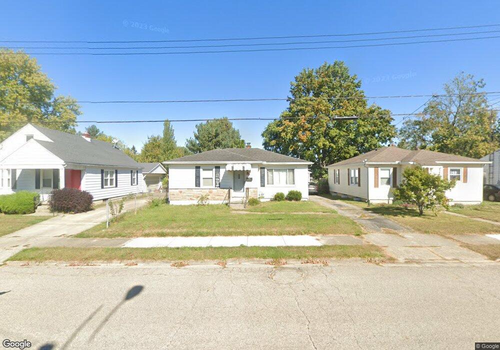
2054 Rutland Ave Springfield, OH 45505
Estimated Value: $118,000 - $132,000
3
Beds
1
Bath
921
Sq Ft
$137/Sq Ft
Est. Value
About This Home
This home is located at 2054 Rutland Ave, Springfield, OH 45505 and is currently estimated at $126,133, approximately $136 per square foot. 2054 Rutland Ave is a home located in Clark County with nearby schools including Kenwood Elementary School, Hayward Middle School, and Springfield High School.
Ownership History
Date
Name
Owned For
Owner Type
Purchase Details
Closed on
Jun 27, 2008
Sold by
Greene Donald T and Greene Amy L
Bought by
Crabtree Erica J
Current Estimated Value
Home Financials for this Owner
Home Financials are based on the most recent Mortgage that was taken out on this home.
Original Mortgage
$51,592
Outstanding Balance
$33,250
Interest Rate
6.05%
Mortgage Type
FHA
Estimated Equity
$92,883
Purchase Details
Closed on
Mar 23, 2001
Sold by
Gladman Douglas C and Wisler Deborah
Bought by
Greene Donald T
Home Financials for this Owner
Home Financials are based on the most recent Mortgage that was taken out on this home.
Original Mortgage
$72,427
Interest Rate
7.02%
Mortgage Type
FHA
Purchase Details
Closed on
Sep 1, 1995
Sold by
Antle David E
Bought by
Gladman Douglas C and Wisler Deborah
Home Financials for this Owner
Home Financials are based on the most recent Mortgage that was taken out on this home.
Original Mortgage
$54,959
Interest Rate
7.55%
Mortgage Type
New Conventional
Create a Home Valuation Report for This Property
The Home Valuation Report is an in-depth analysis detailing your home's value as well as a comparison with similar homes in the area
Home Values in the Area
Average Home Value in this Area
Purchase History
| Date | Buyer | Sale Price | Title Company |
|---|---|---|---|
| Crabtree Erica J | $52,000 | Ohio Real Estate Title | |
| Greene Donald T | $73,000 | -- | |
| Gladman Douglas C | $55,000 | -- |
Source: Public Records
Mortgage History
| Date | Status | Borrower | Loan Amount |
|---|---|---|---|
| Open | Crabtree Erica J | $51,592 | |
| Previous Owner | Greene Donald T | $72,427 | |
| Previous Owner | Gladman Douglas C | $54,959 |
Source: Public Records
Tax History Compared to Growth
Tax History
| Year | Tax Paid | Tax Assessment Tax Assessment Total Assessment is a certain percentage of the fair market value that is determined by local assessors to be the total taxable value of land and additions on the property. | Land | Improvement |
|---|---|---|---|---|
| 2024 | $1,208 | $25,060 | $4,000 | $21,060 |
| 2023 | $1,208 | $25,060 | $4,000 | $21,060 |
| 2022 | $1,237 | $25,060 | $4,000 | $21,060 |
| 2021 | $977 | $18,260 | $2,860 | $15,400 |
| 2020 | $979 | $18,260 | $2,860 | $15,400 |
| 2019 | $981 | $18,260 | $2,860 | $15,400 |
| 2018 | $1,039 | $18,580 | $4,760 | $13,820 |
| 2017 | $1,039 | $18,582 | $4,760 | $13,822 |
| 2016 | $1,040 | $18,582 | $4,760 | $13,822 |
| 2015 | $1,060 | $18,582 | $4,760 | $13,822 |
| 2014 | $1,056 | $18,582 | $4,760 | $13,822 |
| 2013 | $1,044 | $18,582 | $4,760 | $13,822 |
Source: Public Records
Map
Nearby Homes
- 1915 Kenwood Ave
- 1554 S Belmont Ave
- 1810 Kenwood Ave
- 1979 Kenton St
- 1225 Beacon St
- 1714 Kenton St
- 1562 Rutland Ave
- 2229 N Hadley Rd
- 1716 N Sweetbriar Ln
- 1815 Beacon St
- 1210 Burt St
- 1832 Victory Dr
- 1630 S Sweetbriar Ln
- 637 S Arlington Ave
- 875 Gable St
- 603 Linwood Ave Unit 605
- 535 S Hubert Ave
- 2209 Memorial Dr
- 523 Linwood Ave
- 2044 Rutland Ave
- 2068 Rutland Ave
- 2080 Rutland Ave
- 2040 Rutland Ave
- 1317 Skyline Ln
- 2104 Rutland Ave
- 2014 Rutland Ave
- 1314 Skyline Ln
- 2035 Rutland Ave
- 2101 Rutland Ave
- 1309 Skyline Ln
- 2012 Rutland Ave
- 2112 Rutland Ave
- 2103 Rutland Ave
- 1310 Skyline Ln
- 1307 Skyline Ln
- 2029 Rutland Ave
- 2105 Rutland Ave
- 2010 Rutland Ave
- 2118 Rutland Ave