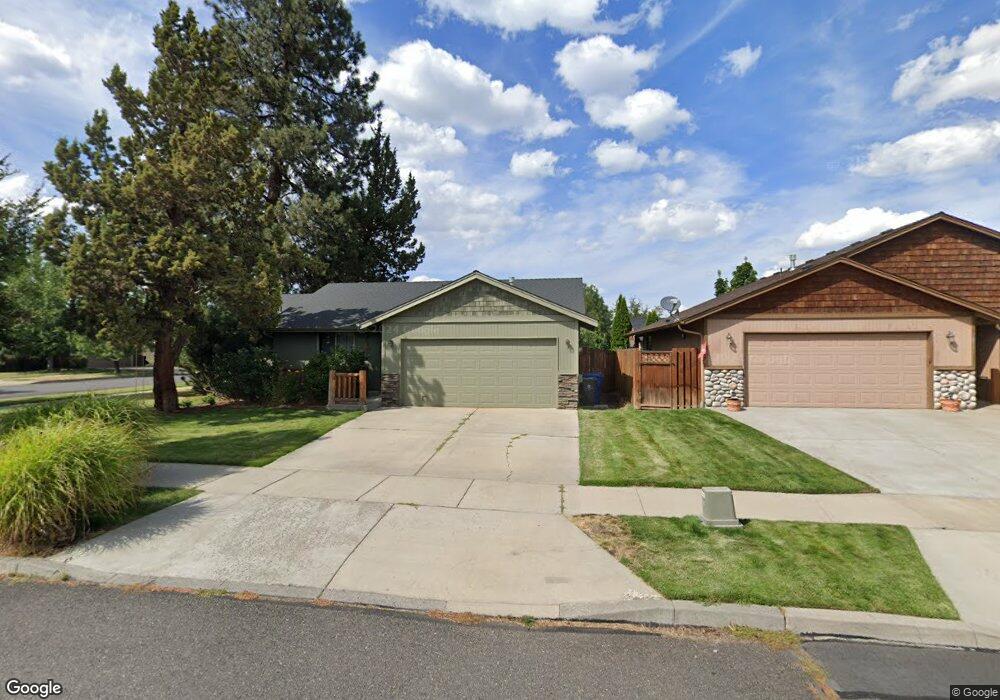
20540 Peak Ave Bend, OR 97702
Old Farm District NeighborhoodEstimated Value: $511,524 - $541,000
3
Beds
2
Baths
1,250
Sq Ft
$419/Sq Ft
Est. Value
About This Home
This home is located at 20540 Peak Ave, Bend, OR 97702 and is currently estimated at $523,881, approximately $419 per square foot. 20540 Peak Ave is a home located in Deschutes County with nearby schools including Silver Rail Elementary School, High Desert Middle School, and Bend Senior High School.
Ownership History
Date
Name
Owned For
Owner Type
Purchase Details
Closed on
Jul 3, 2013
Sold by
Schoessler Van and Schoessler Kari
Bought by
Danos Joshua T and Danos Kyla M
Current Estimated Value
Home Financials for this Owner
Home Financials are based on the most recent Mortgage that was taken out on this home.
Original Mortgage
$140,000
Outstanding Balance
$99,605
Interest Rate
3.57%
Mortgage Type
New Conventional
Estimated Equity
$424,276
Purchase Details
Closed on
Sep 14, 2011
Sold by
Price Lydia
Bought by
Schoessler Van and Schoessler Kari
Purchase Details
Closed on
Apr 24, 2006
Sold by
Sunderman Larry M and Sunderman Nancy E
Bought by
Price Lydia
Home Financials for this Owner
Home Financials are based on the most recent Mortgage that was taken out on this home.
Original Mortgage
$201,600
Interest Rate
6.73%
Mortgage Type
Negative Amortization
Purchase Details
Closed on
Apr 21, 2004
Sold by
Sunderman Larry M and Sunderman Nancy E
Bought by
Sunderman Larry M and Sunderman Nancy F
Create a Home Valuation Report for This Property
The Home Valuation Report is an in-depth analysis detailing your home's value as well as a comparison with similar homes in the area
Home Values in the Area
Average Home Value in this Area
Purchase History
| Date | Buyer | Sale Price | Title Company |
|---|---|---|---|
| Danos Joshua T | $175,000 | Deschutes County Title Co | |
| Schoessler Van | $129,000 | First American Title | |
| Price Lydia | $288,000 | Western Title & Escrow Co | |
| Sunderman Larry M | -- | -- |
Source: Public Records
Mortgage History
| Date | Status | Borrower | Loan Amount |
|---|---|---|---|
| Open | Danos Joshua T | $140,000 | |
| Previous Owner | Price Lydia | $201,600 |
Source: Public Records
Tax History Compared to Growth
Tax History
| Year | Tax Paid | Tax Assessment Tax Assessment Total Assessment is a certain percentage of the fair market value that is determined by local assessors to be the total taxable value of land and additions on the property. | Land | Improvement |
|---|---|---|---|---|
| 2025 | $3,420 | $202,430 | -- | -- |
| 2024 | $3,291 | $196,540 | -- | -- |
| 2023 | $3,051 | $190,820 | $0 | $0 |
| 2022 | $2,846 | $179,880 | $0 | $0 |
| 2021 | $2,851 | $174,650 | $0 | $0 |
| 2020 | $2,705 | $174,650 | $0 | $0 |
| 2019 | $2,629 | $169,570 | $0 | $0 |
| 2018 | $2,555 | $164,640 | $0 | $0 |
| 2017 | $2,480 | $159,850 | $0 | $0 |
| 2016 | $2,365 | $155,200 | $0 | $0 |
| 2015 | $2,300 | $150,680 | $0 | $0 |
| 2014 | $2,232 | $146,300 | $0 | $0 |
Source: Public Records
Map
Nearby Homes
- 20528 Dylan Loop
- 20572 Conifer Ave
- 20575 Conifer Ave
- 20580 Klahani Dr
- 20606 SE Slate Ave
- 20495 SE Bard Ct Unit 7
- 20615 Kira Dr Unit 386
- 20603 Kira Dr Unit 383
- 20599 Kira Dr Unit 382
- 20487 SE Bard Ct Unit 11
- 61429 SE Daybreak Ct Unit Lot 7
- 61441 SE Daybreak Ct Unit Lot 10
- 20657 Couples Ln
- 61433 SE Daybreak Ct Unit Lot 8
- 61405 SE Daybreak Ct
- 61413 SE Daybreak
- 61409 SE Daybreak Ct Unit Lot 2
- 20572 Kira Dr Unit 369
- 20560 Kira Dr Unit 371
- 61467 Kobe St Unit 344
- 20541 Peak Ave
- 20509 Prospector Loop
- 61381 Whitetail St
- 61385 Whitetail St
- 20513 Prospector Loop
- 61375 Whitetail St
- 20545 Peak Ave
- 20548 Peak Ave
- 20548 Peak Dr
- 61382 Peak Ave
- 61370 Peak Ave
- 61391 Whitetail St
- 61369 Whitetail St
- 20549 Peak Ave
- 20593 Prospector Loop
- 20557 Dylan Loop
- 20517 Prospector Loop
- 20552 Peak Ave
- 20561 Dylan Loop
- 61395 Whitetail St