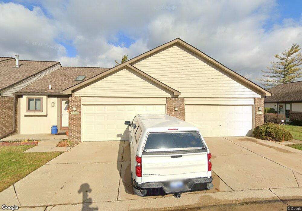
20543 Brandonwood Dr Unit 72 Clinton Township, MI 48038
Estimated Value: $204,000 - $218,000
2
Beds
2
Baths
1,000
Sq Ft
$210/Sq Ft
Est. Value
About This Home
This home is located at 20543 Brandonwood Dr Unit 72, Clinton Township, MI 48038 and is currently estimated at $210,449, approximately $210 per square foot. 20543 Brandonwood Dr Unit 72 is a home located in Macomb County with nearby schools including Cherokee Elementary School, Wyandot Middle School, and Chippewa Valley High School.
Ownership History
Date
Name
Owned For
Owner Type
Purchase Details
Closed on
Apr 18, 2023
Sold by
Graessle Mary K
Bought by
Graessle Mary K
Current Estimated Value
Purchase Details
Closed on
Aug 10, 2017
Sold by
Graessle Clement F
Bought by
Graessle Clement F and Graessle Mary K
Purchase Details
Closed on
Aug 29, 2008
Sold by
Gregorich George and Gregorich Anne Marie
Bought by
Graessle Clement
Purchase Details
Closed on
May 8, 2007
Sold by
Gregorich Ann
Bought by
Gregorich George and Gregorich Anne Marie
Create a Home Valuation Report for This Property
The Home Valuation Report is an in-depth analysis detailing your home's value as well as a comparison with similar homes in the area
Home Values in the Area
Average Home Value in this Area
Purchase History
| Date | Buyer | Sale Price | Title Company |
|---|---|---|---|
| Graessle Mary K | -- | None Listed On Document | |
| Graessle Clement F | -- | None Available | |
| Graessle Clement | $90,000 | Title Express Llc | |
| Gregorich George | -- | None Available |
Source: Public Records
Tax History Compared to Growth
Tax History
| Year | Tax Paid | Tax Assessment Tax Assessment Total Assessment is a certain percentage of the fair market value that is determined by local assessors to be the total taxable value of land and additions on the property. | Land | Improvement |
|---|---|---|---|---|
| 2025 | $1,922 | $89,900 | $0 | $0 |
| 2024 | $1,145 | $91,400 | $0 | $0 |
| 2023 | $1,086 | $86,700 | $0 | $0 |
| 2022 | $1,741 | $74,400 | $0 | $0 |
| 2021 | $1,694 | $67,400 | $0 | $0 |
| 2020 | $996 | $62,200 | $0 | $0 |
| 2019 | $1,578 | $62,600 | $0 | $0 |
| 2018 | $1,545 | $62,600 | $0 | $0 |
| 2017 | $1,531 | $53,300 | $10,000 | $43,300 |
| 2016 | $1,522 | $53,300 | $0 | $0 |
| 2015 | -- | $45,100 | $0 | $0 |
| 2014 | -- | $39,100 | $0 | $0 |
| 2011 | -- | $40,900 | $0 | $40,900 |
Source: Public Records
Map
Nearby Homes
- 20561 Longwood Dr Unit 64
- 20654 Dunham Rd Unit 24
- 20465 Saint Laurence Dr
- 44130 Cadburry Dr
- 20757 Cueter Ln
- 44000 Dunham Ct
- 43377 Rivergate Dr
- 0 Clinton River Rd Unit 20251013874
- 43363 Herring Dr
- 20784 Cannon Dr
- 20387 Villa Grande Cir Unit 19
- 43373 Brooks Dr
- 20445 Villa Grande Cir Unit 48
- 43673 Welland Dr
- 20194 Calumet Dr
- 20947 Riverbend Dr S Unit 87
- 43440 Riverbend Blvd
- 43274 Hillsboro Dr
- 19790 Westchester Dr Unit 11
- 43378 Riverbend Blvd
- 20539 Brandonwood Dr
- 20535 Brandonwood Dr
- 20531 Brandonwood Dr
- 20530 Brandonwood Dr Unit 68
- 20536 Brandonwood Dr
- 20540 Brandonwood Dr Unit 66
- 20544 Brandonwood Dr
- 20563 Brandonwood Dr Unit 76
- 20555 Brandonwood Dr Unit 74
- 20551 Brandonwood Dr
- 20557 Longwood Dr
- 20549 Longwood Dr
- 43762 Robinson Ridge
- 20558 Longwood Dr
- 20511 Brandonwood Dr
- 20513 Longwood Dr Unit 12, 46
- 20521 Longwood Dr Unit 48
- 20517 Longwood Dr
- 20513 Longwood Dr Unit 46
- 20509 Longwood Dr