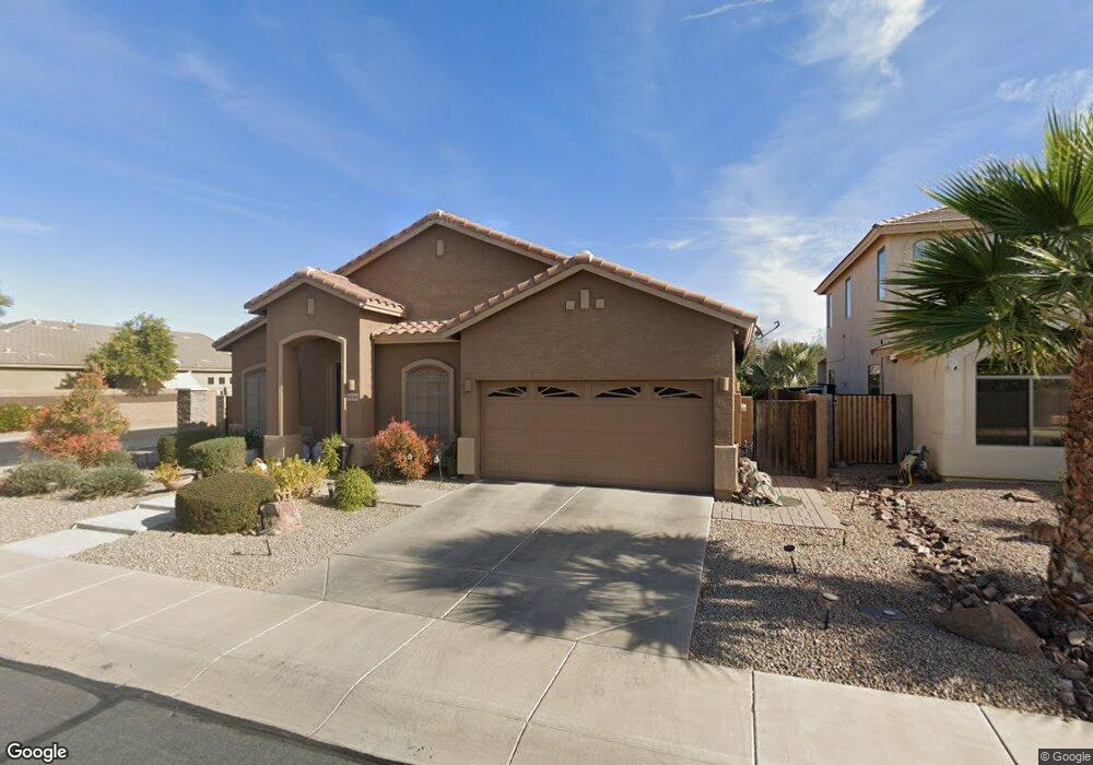
20549 N Ryans Trail Maricopa, AZ 85138
Rancho El Dorado NeighborhoodEstimated Value: $347,754 - $407,000
--
Bed
--
Bath
2,367
Sq Ft
$163/Sq Ft
Est. Value
About This Home
This home is located at 20549 N Ryans Trail, Maricopa, AZ 85138 and is currently estimated at $385,189, approximately $162 per square foot. 20549 N Ryans Trail is a home located in Pinal County with nearby schools including Butterfield Elementary School, Maricopa High School, and Maricopa Wells Middle School.
Ownership History
Date
Name
Owned For
Owner Type
Purchase Details
Closed on
Jul 1, 2024
Sold by
Dela Vega Robert and Dela Yolanda
Bought by
Robert De La Vega Sr Family Trust and De La Vega
Current Estimated Value
Purchase Details
Closed on
Dec 13, 2005
Sold by
Engle/Sunbelt Llc
Bought by
Delavega Robert and Delavega Yolanda
Home Financials for this Owner
Home Financials are based on the most recent Mortgage that was taken out on this home.
Original Mortgage
$194,154
Interest Rate
6.35%
Mortgage Type
Fannie Mae Freddie Mac
Purchase Details
Closed on
Sep 24, 2004
Sold by
Lancelot El Dorado Llc
Bought by
Tousa Homes Inc
Create a Home Valuation Report for This Property
The Home Valuation Report is an in-depth analysis detailing your home's value as well as a comparison with similar homes in the area
Home Values in the Area
Average Home Value in this Area
Purchase History
| Date | Buyer | Sale Price | Title Company |
|---|---|---|---|
| Robert De La Vega Sr Family Trust | -- | None Listed On Document | |
| Delavega Robert | $284,154 | Universal Land Title Agency | |
| Tousa Homes Inc | $200,415 | First American Title |
Source: Public Records
Mortgage History
| Date | Status | Borrower | Loan Amount |
|---|---|---|---|
| Previous Owner | Delavega Robert | $194,154 |
Source: Public Records
Tax History Compared to Growth
Tax History
| Year | Tax Paid | Tax Assessment Tax Assessment Total Assessment is a certain percentage of the fair market value that is determined by local assessors to be the total taxable value of land and additions on the property. | Land | Improvement |
|---|---|---|---|---|
| 2025 | $2,497 | $29,488 | -- | -- |
| 2024 | $2,362 | $36,241 | -- | -- |
| 2023 | $2,431 | $28,127 | $0 | $0 |
| 2022 | $2,362 | $21,244 | $2,788 | $18,456 |
| 2021 | $2,255 | $19,615 | $0 | $0 |
| 2020 | $2,153 | $18,094 | $0 | $0 |
| 2019 | $2,070 | $16,789 | $0 | $0 |
| 2018 | $2,043 | $15,763 | $0 | $0 |
| 2017 | $1,946 | $16,004 | $0 | $0 |
| 2016 | $1,752 | $16,413 | $1,250 | $15,163 |
| 2014 | $1,673 | $10,754 | $1,000 | $9,754 |
Source: Public Records
Map
Nearby Homes
- 43502 W Kramer Ln
- 43557 W Roth Rd
- 43507 W Cydnee Dr
- 43525 W Cydnee Dr
- 43641 W Kramer Ln
- 20652 N Donithan Way
- 43561 W Snow Dr
- 43531 W Bailey Dr
- 43460 W Caven Dr
- 20443 N Santa Cruz Dr
- 20786 N Donithan Way
- 20226 N Madison Dr
- 43319 W Delia Blvd
- 43228 W Knauss Dr
- 43884 W Kramer Ln
- 43851 W Griffis Dr
- 20200 N Donithan Way
- 43936 W Kramer Ln
- 43413 W Wallner Dr
- 20139 N Bustos Way
- 20531 N Ryans Trail
- 20511 N Ryans Trail
- 43483 W Roth Rd
- 20601 N Ryans Trail
- 20493 N Ryans Trail
- 43474 W Roth Rd
- 43484 W Kramer Ln
- 20530 N Madison Dr
- 43501 W Roth Rd
- 20552 N Madison Dr
- 20508 N Madison Dr
- 20619 N Ryans Trail
- 43494 W Roth Rd
- 20576 N Madison Dr
- 43521 W Roth Rd
- 20486 N Madison Dr
- 43473 W Askew Dr
- 43514 W Roth Rd
- 20598 N Madison Dr
- 20637 N Ryans Trail