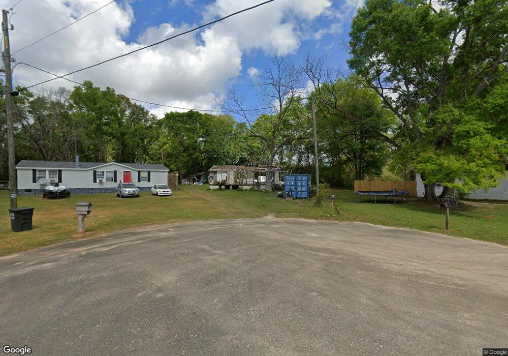
2055 Ashton Rd Mobile, AL 36608
Outer West Mobile NeighborhoodEstimated Value: $45,000
4
Beds
2
Baths
1,582
Sq Ft
$28/Sq Ft
Est. Value
About This Home
This home is located at 2055 Ashton Rd, Mobile, AL 36608 and is currently estimated at $45,000, approximately $28 per square foot. 2055 Ashton Rd is a home located in Mobile County with nearby schools including Taylor White Elementary School, Bernice J Causey Middle School, and Baker High School.
Ownership History
Date
Name
Owned For
Owner Type
Purchase Details
Closed on
Nov 16, 2009
Sold by
The United States Department Of Housing
Bought by
Booker Theressa W
Current Estimated Value
Purchase Details
Closed on
Apr 10, 2009
Sold by
U S Bank National Association
Bought by
The Secretary Of Housing & Urban Develop
Purchase Details
Closed on
Jan 16, 2009
Sold by
Mabe Jackie L and Cummins Kelly
Bought by
U S Bank Na
Create a Home Valuation Report for This Property
The Home Valuation Report is an in-depth analysis detailing your home's value as well as a comparison with similar homes in the area
Home Values in the Area
Average Home Value in this Area
Purchase History
| Date | Buyer | Sale Price | Title Company |
|---|---|---|---|
| Booker Theressa W | $33,000 | None Available | |
| The Secretary Of Housing & Urban Develop | -- | None Available | |
| U S Bank Na | $101,601 | None Available |
Source: Public Records
Tax History
| Year | Tax Paid | Tax Assessment Tax Assessment Total Assessment is a certain percentage of the fair market value that is determined by local assessors to be the total taxable value of land and additions on the property. | Land | Improvement |
|---|---|---|---|---|
| 2025 | $130 | $1,240 | $1,240 | $0 |
| 2024 | $130 | $1,240 | $1,240 | $0 |
| 2023 | $130 | $4,130 | $1,250 | $2,880 |
| 2022 | $135 | $4,130 | $1,250 | $2,880 |
| 2021 | $124 | $3,920 | $1,250 | $2,670 |
| 2020 | $124 | $3,920 | $1,250 | $2,670 |
| 2019 | $115 | $3,720 | $0 | $0 |
| 2018 | $115 | $3,720 | $0 | $0 |
| 2017 | $185 | $3,720 | $0 | $0 |
| 2016 | $162 | $4,720 | $0 | $0 |
| 2013 | $143 | $4,300 | $0 | $0 |
Source: Public Records
Map
Nearby Homes
- 2119 Lumpkin Grove Ln Unit 2
- 11900 Liberty Dr S
- 2201 Liberty Dr E
- 12171 Yancey Glen Dr
- 2978 Branson Park Ct
- 13045 Oak Forge Dr
- 3137 Busby Rd
- 2750 Oakridge West Dr
- 13205 Hackberry Dr
- 13163 Buckthorn Ct
- 2865 Barlett Dr
- 0 Newman Rd Unit 25399577
- 0 Newman Rd Unit 7652668
- 0 Newman Rd Unit 7670125
- 0 Newman Rd Unit 25537843
- 2995 Barlett Dr
- 3221 Deer Crest Ct
- 13346 Deer Crest Ln
- 1778 Trail Side Way
- 1762 Trail Side Way
- 2055 Ashton Place
- 2055 Ashton Place Unit 1
- 2053 Ashton Place Ct
- 2082 Ashton Place Ct
- 2092 Ashton Rd
- 12432 Ashton Rd
- 12464 Ashton Rd
- 12331 Ashton Rd
- 12496 Ashton Rd
- 12151 Ashton Rd
- 12311 Ashton Rd
- 12131 Ashton Rd
- 12121 Ashton Rd
- 0 Ashton Rd
- 12220 Airport Blvd
- 11950 Pace Nursery Rd
- 2120 Lumpkin Grove Ln
- 2132 Lumpkin Grove Ln
- 2168 Wolf Branch Dr N
- 2160 Wolf Branch Dr N Unit 65
Your Personal Tour Guide
Ask me questions while you tour the home.