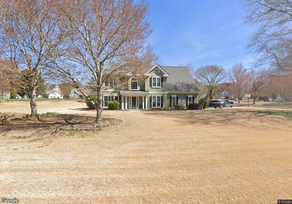
2055 Cedar Point Ln Cumming, GA 30041
Big Creek NeighborhoodEstimated Value: $558,518 - $782,000
5
Beds
3
Baths
2,708
Sq Ft
$243/Sq Ft
Est. Value
About This Home
This home is located at 2055 Cedar Point Ln, Cumming, GA 30041 and is currently estimated at $657,380, approximately $242 per square foot. 2055 Cedar Point Ln is a home located in Forsyth County with nearby schools including Daves Creek Elementary School, South Forsyth Middle School, and South Forsyth High School.
Ownership History
Date
Name
Owned For
Owner Type
Purchase Details
Closed on
Jul 31, 2006
Sold by
Daly Christine O
Bought by
Mcintosh Michael D and Mcintosh Donna K
Current Estimated Value
Home Financials for this Owner
Home Financials are based on the most recent Mortgage that was taken out on this home.
Original Mortgage
$179,900
Outstanding Balance
$107,892
Interest Rate
6.74%
Mortgage Type
New Conventional
Estimated Equity
$549,488
Purchase Details
Closed on
Sep 24, 1993
Sold by
William Byers Construction Corp
Bought by
Daly Christine O
Create a Home Valuation Report for This Property
The Home Valuation Report is an in-depth analysis detailing your home's value as well as a comparison with similar homes in the area
Home Values in the Area
Average Home Value in this Area
Purchase History
| Date | Buyer | Sale Price | Title Company |
|---|---|---|---|
| Mcintosh Michael D | $224,900 | -- | |
| Daly Christine O | $150,000 | -- |
Source: Public Records
Mortgage History
| Date | Status | Borrower | Loan Amount |
|---|---|---|---|
| Open | Mcintosh Michael D | $179,900 |
Source: Public Records
Tax History Compared to Growth
Tax History
| Year | Tax Paid | Tax Assessment Tax Assessment Total Assessment is a certain percentage of the fair market value that is determined by local assessors to be the total taxable value of land and additions on the property. | Land | Improvement |
|---|---|---|---|---|
| 2025 | $524 | $194,044 | $68,000 | $126,044 |
| 2024 | $524 | $177,476 | $60,000 | $117,476 |
| 2023 | $438 | $177,384 | $60,000 | $117,384 |
| 2022 | $536 | $114,712 | $32,000 | $82,712 |
| 2021 | $505 | $114,712 | $32,000 | $82,712 |
| 2020 | $502 | $111,216 | $32,000 | $79,216 |
| 2019 | $506 | $110,644 | $32,000 | $78,644 |
| 2018 | $522 | $108,668 | $24,000 | $84,668 |
| 2017 | $528 | $105,028 | $24,000 | $81,028 |
| 2016 | $525 | $103,028 | $22,000 | $81,028 |
| 2015 | $492 | $80,028 | $18,000 | $62,028 |
| 2014 | $454 | $74,856 | $0 | $0 |
Source: Public Records
Map
Nearby Homes
- 2040 Orr Rd
- 1330 Rogers Mill Ln
- 1120 Beech Ct
- 2420 Bronze Ct
- 2325 Melrose Trace
- 8355 Ainsworth Dr
- 3711 Melody Mizer Ln
- 4965 Cheltenham Place
- 2550 Wellsley Ln
- 7047 Bennington Ln
- 8930 Cobblestone Ln
- 4865 Cheltenham Place
- 7030 Bennington Ln
- 3930 Medley Way
- 1255 Bookhout Dr
- 3635 Crowchild Dr
- 1460 Badingham Dr
- 2071 Vicki Ln
- 3935 Silver Springs Rd
- 3945 Medley Way
- 2085 Cedar Point Ln
- 2005 Cedar Point Ln
- 1925 Bethany Spring Trace
- 2095 Cedar Point Ln
- 2030 Cedar Point Ln
- 2040 Cedar Point Ln
- 2020 Cedar Point Ln
- 2070 Cedar Point Ln
- 2010 Cedar Point Ln
- 2050 Cedar Point Ln
- 1940 Quail Hollow Dr
- 2090 Cedar Point Ln
- 2110 Cedar Point Ln
- 1930 Quail Hollow Dr
- 2060 Cedar Point Ln
- 1950 Quail Hollow Dr
- 2035 Bethany Spring Trace
- 1930 Bethany Spring Trace
- 1950 Bethany Spring Trace
- 1960 Quail Hollow Dr