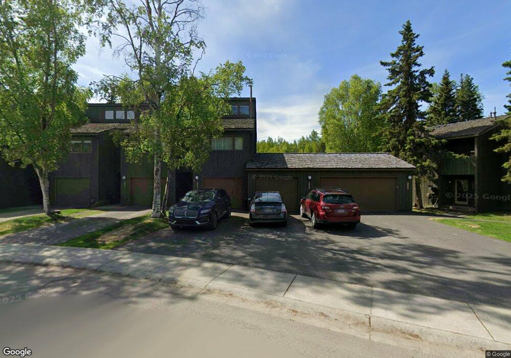
2055 Cliffside Dr Unit 14 Anchorage, AK 99501
Airport Heights NeighborhoodEstimated Value: $240,000 - $327,000
3
Beds
3
Baths
1,567
Sq Ft
$189/Sq Ft
Est. Value
About This Home
This home is located at 2055 Cliffside Dr Unit 14, Anchorage, AK 99501 and is currently estimated at $296,709, approximately $189 per square foot. 2055 Cliffside Dr Unit 14 is a home located in Anchorage Municipality with nearby schools including Airport Heights Elementary School, Wendler Middle School, and Bettye Davis East Anchorage High School.
Ownership History
Date
Name
Owned For
Owner Type
Purchase Details
Closed on
Nov 12, 2009
Sold by
Hitchcock Richard W
Bought by
Beebee Robin A and Potter Dean B
Current Estimated Value
Purchase Details
Closed on
Oct 20, 2003
Sold by
Jackson Marsha L
Bought by
Hitchcock Richard W
Home Financials for this Owner
Home Financials are based on the most recent Mortgage that was taken out on this home.
Original Mortgage
$112,000
Interest Rate
6.4%
Mortgage Type
Purchase Money Mortgage
Purchase Details
Closed on
Oct 10, 2003
Sold by
Jackson Marsha L
Bought by
Hitchcock Richard W
Home Financials for this Owner
Home Financials are based on the most recent Mortgage that was taken out on this home.
Original Mortgage
$112,000
Interest Rate
6.4%
Mortgage Type
Purchase Money Mortgage
Create a Home Valuation Report for This Property
The Home Valuation Report is an in-depth analysis detailing your home's value as well as a comparison with similar homes in the area
Home Values in the Area
Average Home Value in this Area
Purchase History
| Date | Buyer | Sale Price | Title Company |
|---|---|---|---|
| Beebee Robin A | -- | Atga | |
| Hitchcock Richard W | -- | -- | |
| Hitchcock Richard W | -- | Alyeska Title Guaranty Agenc |
Source: Public Records
Mortgage History
| Date | Status | Borrower | Loan Amount |
|---|---|---|---|
| Previous Owner | Hitchcock Richard W | $112,000 | |
| Previous Owner | Hitchcock Richard W | $112,000 |
Source: Public Records
Tax History Compared to Growth
Tax History
| Year | Tax Paid | Tax Assessment Tax Assessment Total Assessment is a certain percentage of the fair market value that is determined by local assessors to be the total taxable value of land and additions on the property. | Land | Improvement |
|---|---|---|---|---|
| 2025 | $5,095 | $320,600 | -- | $320,600 |
| 2024 | $5,095 | $315,600 | $0 | $315,600 |
| 2023 | $4,605 | $270,400 | $0 | $270,400 |
| 2022 | $4,141 | $245,900 | $0 | $245,900 |
| 2021 | $4,518 | $250,700 | $0 | $250,700 |
| 2020 | $4,090 | $240,600 | $0 | $240,600 |
| 2019 | $4,213 | $257,500 | $0 | $257,500 |
| 2018 | $3,723 | $227,000 | $0 | $227,000 |
| 2017 | $3,885 | $248,100 | $0 | $248,100 |
| 2016 | $3,502 | $259,500 | $0 | $259,500 |
| 2015 | $3,502 | $254,900 | $0 | $254,900 |
| 2014 | $3,502 | $240,000 | $0 | $240,000 |
Source: Public Records
Map
Nearby Homes
- 2068 Cliffside Dr Unit 11
- 1833 Parkside Dr
- 1803 Parkside Dr
- 2124 Sorbus Way
- 1760 Eastridge Dr
- 2215 Sunburst Cir
- 1625 Sitka St Unit 103
- 2028 Shepherdia Dr
- 1811 Talkeetna St
- 2553 Lovejoy Dr
- 1826 E 27th Ave
- 2456 Cottonwood St
- 1421 E 17th Ave Unit 3
- 1701 Aleutian St
- 2624 Darby Cir
- 1201 Elegante Ln
- 1220 E 16th Ave Unit 15
- 1403 Nelchina St
- 1504 Medfra St
- 000 Tr A Thurston
- 2065 Cliffside Dr Unit 19
- 2063 Cliffside Dr Unit 18
- 2061 Cliffside Dr Unit 17
- 2059 Cliffside Dr Unit 16
- 2057 Cliffside Dr Unit 15
- 2051 Cliffside Dr Unit 12
- 2041 Cliffside Dr Unit 7
- 2037 Cliffside Dr Unit 5
- 2035 Cliffside Dr Unit 4
- 2033 Cliffside Dr Unit 3
- 2031 Cliffside Dr Unit 2
- 2033 Cliffside Dr Unit 1
- 2063 Cliffside Dr Unit B4
- 2041 Cliffside Dr Unit 7B2
- 2061 Cliffside Dr Unit B4
- 2063 Cliffside Dr Unit 7
- 2033 Cliffside Dr Unit 3B1
- 2061 Cliffside Dr Unit 17 B-4
- 2039 Cliffside Dr Unit 6B-2
- 2033 Cliffside Dr Unit B-1