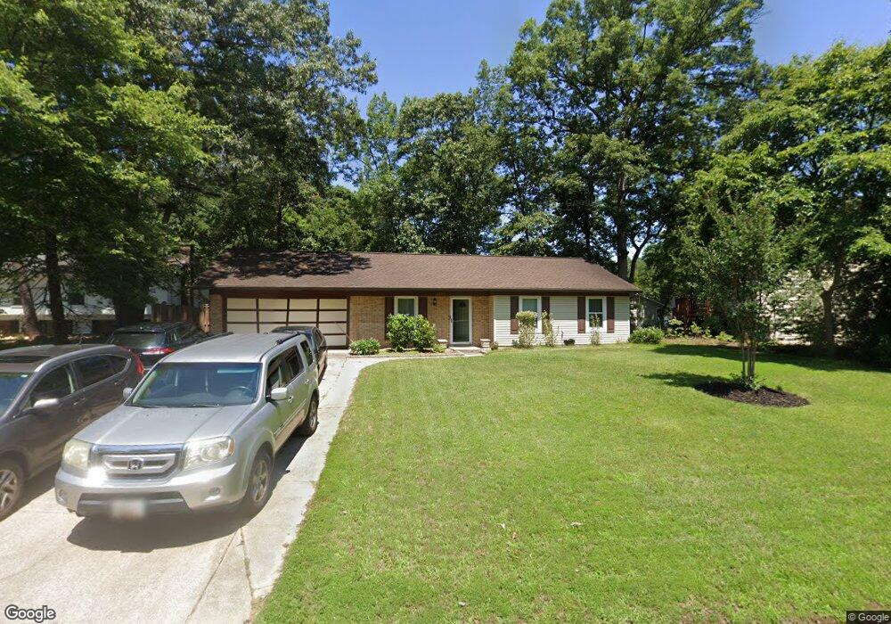
2055 Davis Ct Waldorf, MD 20602
Estimated Value: $337,000 - $371,000
Studio
1
Bath
1,106
Sq Ft
$318/Sq Ft
Est. Value
About This Home
This home is located at 2055 Davis Ct, Waldorf, MD 20602 and is currently estimated at $352,226, approximately $318 per square foot. 2055 Davis Ct is a home located in Charles County with nearby schools including Eva Turner Elementary School, Benjamin Stoddert Middle School, and St. Charles High School.
Ownership History
Date
Name
Owned For
Owner Type
Purchase Details
Closed on
Jan 9, 2001
Sold by
Colledge Stacey L
Bought by
Watkins Daniel E
Current Estimated Value
Purchase Details
Closed on
Jun 3, 1994
Sold by
Jm Salisbury
Bought by
Colledge Stacey L
Home Financials for this Owner
Home Financials are based on the most recent Mortgage that was taken out on this home.
Original Mortgage
$90,440
Interest Rate
8.49%
Purchase Details
Closed on
Sep 16, 1986
Sold by
Tarbox Robert R and Tarbox Mary T
Bought by
Salisbury John M
Home Financials for this Owner
Home Financials are based on the most recent Mortgage that was taken out on this home.
Original Mortgage
$83,974
Interest Rate
9.96%
Create a Home Valuation Report for This Property
The Home Valuation Report is an in-depth analysis detailing your home's value as well as a comparison with similar homes in the area
Home Values in the Area
Average Home Value in this Area
Purchase History
| Date | Buyer | Sale Price | Title Company |
|---|---|---|---|
| Watkins Daniel E | $120,499 | -- | |
| Colledge Stacey L | $90,500 | -- | |
| Salisbury John M | $82,900 | -- |
Source: Public Records
Mortgage History
| Date | Status | Borrower | Loan Amount |
|---|---|---|---|
| Previous Owner | Colledge Stacey L | $90,440 | |
| Previous Owner | Salisbury John M | $83,974 | |
| Closed | Watkins Daniel E | -- |
Source: Public Records
Tax History
| Year | Tax Paid | Tax Assessment Tax Assessment Total Assessment is a certain percentage of the fair market value that is determined by local assessors to be the total taxable value of land and additions on the property. | Land | Improvement |
|---|---|---|---|---|
| 2025 | $8,341 | $264,667 | -- | -- |
| 2024 | $3,554 | $245,400 | $125,100 | $120,300 |
| 2023 | $3,296 | $230,633 | $0 | $0 |
| 2022 | $3,102 | $215,867 | $0 | $0 |
| 2021 | $2,755 | $201,100 | $95,100 | $106,000 |
| 2020 | $2,755 | $192,333 | $0 | $0 |
| 2019 | $2,623 | $183,567 | $0 | $0 |
| 2018 | $2,468 | $174,800 | $90,100 | $84,700 |
| 2017 | $2,401 | $170,300 | $0 | $0 |
| 2016 | -- | $165,800 | $0 | $0 |
| 2015 | $2,187 | $161,300 | $0 | $0 |
| 2014 | $2,187 | $161,300 | $0 | $0 |
Source: Public Records
Map
Nearby Homes
- 2103 Gibbons Ct
- 2409 Ferrell Ct
- 2620 Ferguson Ct
- 1736 Brightwell Ct
- 1050 Dorset Dr
- 11613 Bardmoor Ct
- 1020 Dorset Dr
- 1010 Victoria Place
- 1111 Stone Ct
- 5213 Vaughan Ct
- 6 Stratford Ct
- 4504C Ruston Place Unit 41-M
- 4504 Ruston Place Unit B
- 4635 Sheffield Cir
- 4818 Underwood Ct
- 4444 Quillen Cir
- 14 Greystone Cir
- 1180 Bannister Cir
- 3425 Milstead Ct
- 3608 Osborne Ct
- 2053 Davis Ct
- 2010 Darnell Ct
- 2008 Darnell Ct
- 0 Davis Unit CH7628912
- 2006 Darnell Ct
- 2051 Davis Ct
- 2054 Davis Ct
- 2056 Davis Ct
- 2052 Davis Ct
- 2004 Darnell Ct
- 2050 Davis Ct
- 2009 Darnell Ct
- 2012 Darnell Ct
- 2005 Darnell Ct
- 2011 Darnell Ct
- 2049 Davis Ct
- 1801 Cooper Ct
- 1803 Cooper Ct
- 2048 Davis Ct
- 2002 Darnell Ct
Your Personal Tour Guide
Ask me questions while you tour the home.