Estimated Value: $478,000 - $579,000
3
Beds
2
Baths
1,834
Sq Ft
$280/Sq Ft
Est. Value
About This Home
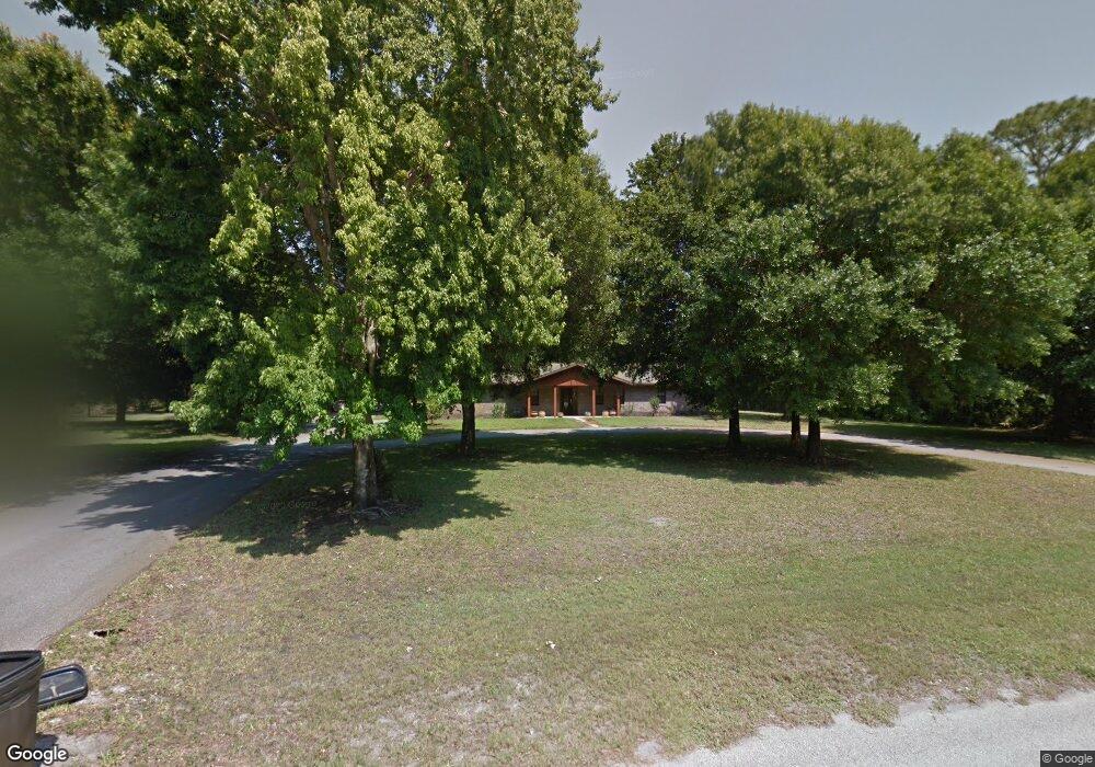
This home is located at 2055 Devonshire Ave, Cocoa, FL 32926 and is currently estimated at $512,667, approximately $279 per square foot. 2055 Devonshire Ave is a home located in Brevard County with nearby schools including Saturn Elementary School and Cocoa High School.
Ownership History
Date
Name
Owned For
Owner Type
Purchase Details
Closed on
Jan 26, 2011
Sold by
Sorey Randall C and Sorey Debra M
Bought by
Sorey Randall C
Current Estimated Value
Home Financials for this Owner
Home Financials are based on the most recent Mortgage that was taken out on this home.
Original Mortgage
$91,600
Interest Rate
4.82%
Create a Home Valuation Report for This Property
The Home Valuation Report is an in-depth analysis detailing your home's value as well as a comparison with similar homes in the area
Home Values in the Area
Average Home Value in this Area
Purchase History
| Date | Buyer | Sale Price | Title Company |
|---|---|---|---|
| Sorey Randall C | -- | Nationallink |
Source: Public Records
Mortgage History
| Date | Status | Borrower | Loan Amount |
|---|---|---|---|
| Closed | Sorey Randall C | $91,600 |
Source: Public Records
Tax History
| Year | Tax Paid | Tax Assessment Tax Assessment Total Assessment is a certain percentage of the fair market value that is determined by local assessors to be the total taxable value of land and additions on the property. | Land | Improvement |
|---|---|---|---|---|
| 2025 | $2,066 | $152,370 | -- | -- |
| 2024 | $2,025 | $148,080 | -- | -- |
| 2023 | $2,025 | $143,770 | -- | -- |
| 2022 | $1,894 | $139,590 | $0 | $0 |
| 2021 | $1,914 | $135,530 | $0 | $0 |
| 2020 | $1,843 | $133,660 | $0 | $0 |
| 2019 | $1,784 | $130,660 | $0 | $0 |
| 2018 | $1,780 | $128,230 | $0 | $0 |
| 2017 | $1,783 | $125,600 | $0 | $0 |
| 2016 | $1,799 | $123,020 | $35,700 | $87,320 |
| 2015 | $1,817 | $122,170 | $35,700 | $86,470 |
| 2014 | $1,818 | $121,200 | $28,050 | $93,150 |
Source: Public Records
Map
Nearby Homes
- 5070 Junedale Dr
- 4641 Talbot Blvd
- 5121 Dalehurst Dr
- 5101 Craig Rd
- 2150 Winston Dr
- 4901 Talbot Blvd
- 4412 Talbot Blvd
- 2524 Trotters Trail
- 1709 Morely Dr
- 6331 Quarterhorse Cir
- 5092 Talbot Blvd
- 931 Unknown
- 365 Outer Dr
- 495 Outer Dr Unit 201
- 336 Horseshoe Bend Cir Unit 197
- 425 Outer Dr Unit 208
- 5954 Orsino Ln
- 4920 Shade Tree St
- 427 Horseshoe Bend Cir Unit 151
- 694 Outer Dr Unit 184
- 2065 Devonshire Ave
- 2045 Devonshire Ave
- 2050 Devonshire Ave
- 0 Devonshire Ave Unit 532659
- 0 Devonshire Ave Unit 631529
- 0 Devonshire Ave Unit O5427563
- 0 Devonshire Ave Unit J648857
- 0 Devonshire Ave Unit O5756937
- 5088 Junedale Dr
- 2060 Devonshire Ave
- 2040 Devonshire Ave
- 2035 Devonshire Ave
- 5195 Dalehurst Dr Unit 2
- 2070 Devonshire Ave
- 5185 Dalehurst Dr
- 5205 Dalehurst Dr
- 5215 Dalehurst Dr
- 2025 Devonshire Ave
- Devonshire
- 5165 Dalehurst Dr
Your Personal Tour Guide
Ask me questions while you tour the home.