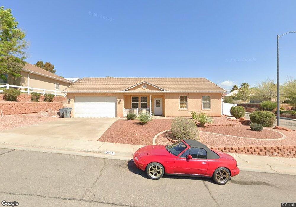
2055 E 180 Cir S St. George, UT 84790
Estimated Value: $412,000 - $448,000
3
Beds
2
Baths
1,428
Sq Ft
$301/Sq Ft
Est. Value
About This Home
This home is located at 2055 E 180 Cir S, St. George, UT 84790 and is currently estimated at $429,146, approximately $300 per square foot. 2055 E 180 Cir S is a home located in Washington County with nearby schools including Panorama School, Fossil Ridge Intermediate School, and Pine View Middle School.
Ownership History
Date
Name
Owned For
Owner Type
Purchase Details
Closed on
Jan 14, 2021
Sold by
Holliday Robert Alan and Holliday Catherine Ann
Bought by
Holliday Robert Alan and Holliday Catherine Ann
Current Estimated Value
Purchase Details
Closed on
Oct 16, 2012
Sold by
Holliday Robert H and Holliday Catherine A
Bought by
Holliday Robert Alan and Holliday Catherine Ann
Purchase Details
Closed on
Sep 25, 2012
Sold by
Wells Fargo Bank Na
Bought by
Holliday Robert A and Hollliday Catheine A
Purchase Details
Closed on
Jun 26, 2012
Sold by
Baker Angela M and Spencer Matt D
Bought by
Wells Fargo Bank Na
Purchase Details
Closed on
Oct 27, 2006
Sold by
Taylor Steven Christopher and Taylor Lisa M
Bought by
Baker Angela M and Spencer Matt D
Home Financials for this Owner
Home Financials are based on the most recent Mortgage that was taken out on this home.
Original Mortgage
$47,300
Interest Rate
6.3%
Mortgage Type
Credit Line Revolving
Create a Home Valuation Report for This Property
The Home Valuation Report is an in-depth analysis detailing your home's value as well as a comparison with similar homes in the area
Purchase History
| Date | Buyer | Sale Price | Title Company |
|---|---|---|---|
| Holliday Robert Alan | -- | None Available | |
| Holliday Robert Alan | -- | Skyview Title Insurance Agen | |
| Holliday Robert A | -- | Metro National Title | |
| Wells Fargo Bank Na | $216,953 | None Available | |
| Baker Angela M | -- | Southern Utah Title Co |
Source: Public Records
Mortgage History
| Date | Status | Borrower | Loan Amount |
|---|---|---|---|
| Previous Owner | Baker Angela M | $47,300 | |
| Previous Owner | Baker Angela M | $189,430 |
Source: Public Records
Tax History
| Year | Tax Paid | Tax Assessment Tax Assessment Total Assessment is a certain percentage of the fair market value that is determined by local assessors to be the total taxable value of land and additions on the property. | Land | Improvement |
|---|---|---|---|---|
| 2025 | $1,478 | $216,975 | $59,400 | $157,575 |
| 2023 | $1,530 | $228,525 | $52,800 | $175,725 |
| 2022 | $1,625 | $228,360 | $52,250 | $176,110 |
| 2021 | $1,454 | $304,700 | $80,000 | $224,700 |
| 2020 | $1,307 | $257,900 | $60,000 | $197,900 |
| 2019 | $1,285 | $247,700 | $60,000 | $187,700 |
| 2018 | $1,246 | $120,450 | $0 | $0 |
| 2017 | $1,121 | $108,295 | $0 | $0 |
| 2016 | $1,164 | $104,005 | $0 | $0 |
| 2015 | $1,123 | $96,305 | $0 | $0 |
| 2014 | $1,043 | $89,980 | $0 | $0 |
Source: Public Records
Map
Nearby Homes
- 201 S 2020 East Cir
- 77 S 2000 E
- 232 S Acantilado Cir
- 4204 S Crimson Cir Unit 10
- 4186 S Crimson Cir Unit 13
- 145 N Mall Dr Unit 57
- 86 S Acantilado Dr
- 0 S Mall Dr
- 210 N Mall Dr Unit 85
- 210 N Mall Dr Unit 27
- 5664 S Carnelian Pkwy
- 24 S Arroyo Dr
- 0 Null Unit 26-269072
- 316 S 2450 E Unit 41
- 1684 E 290 S
- 1646 E 90 Cir S
- 2721 E Riverside Dr
- 0 Paisley Way Unit 26-269155
- 0 Paisley Way Unit 24-253758
- 345 N 2450 E Unit 152
- 2055 E 180 South Cir
- 2049 E 180 South Cir
- 2049 E 180 Cir S
- 196 S 2060 E
- 2042 E 140 S
- 2056 E 180 Cir S
- 2056 E 180 South Cir
- 163 S 2060 E
- 2037 E 180 South Cir
- 177 S 2060 E
- 2048 E 180 South Cir
- 2037 E 180 Cir S
- 2048 E 180 Cir S
- 2072 E 140 S
- 191 S 2060 E
- 2030 E 140 S
- 2040 E 180 South Cir
- 2051 E 140 S
- 208 S 2060 E
- 2031 E 180 South Cir
Your Personal Tour Guide
Ask me questions while you tour the home.