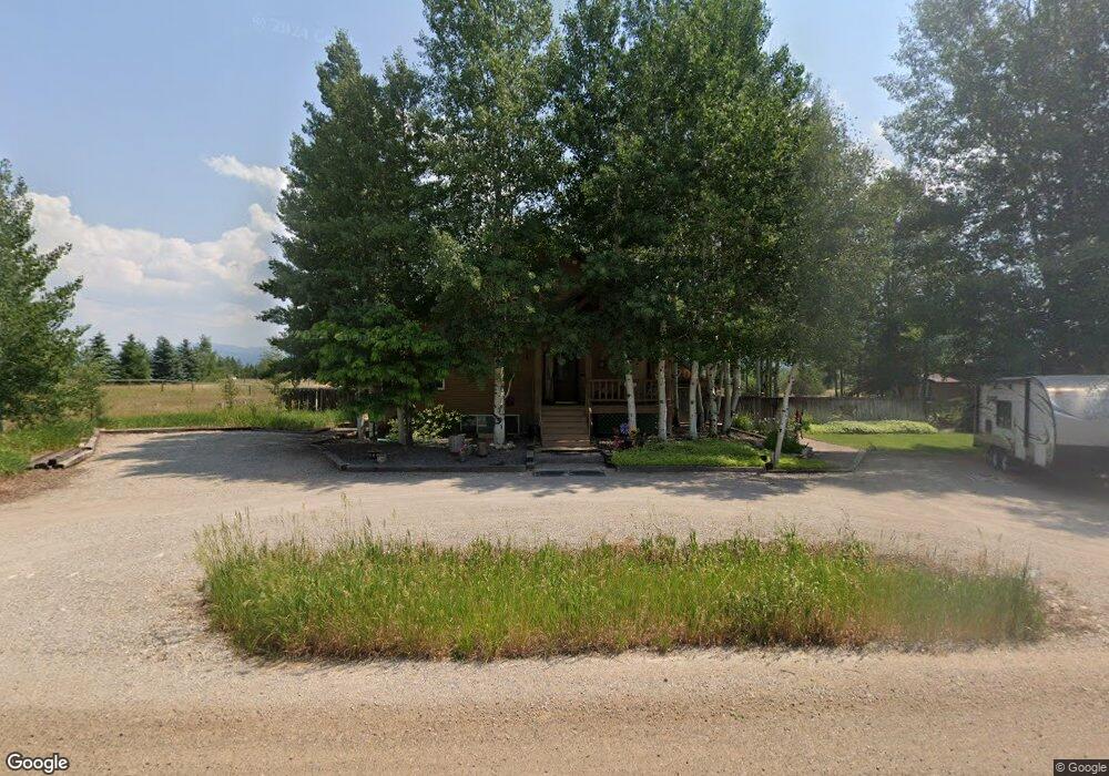
2055 Mount Davidson Dr Driggs, ID 83422
Estimated Value: $1,207,000
5
Beds
3
Baths
3,596
Sq Ft
$336/Sq Ft
Est. Value
About This Home
This home is located at 2055 Mount Davidson Dr, Driggs, ID 83422 and is currently estimated at $1,207,000, approximately $335 per square foot. 2055 Mount Davidson Dr is a home located in Teton County with nearby schools including Driggs Elementary School and Teton High School.
Ownership History
Date
Name
Owned For
Owner Type
Purchase Details
Closed on
Dec 16, 2022
Sold by
Teton Land Group Llc
Bought by
Targhee Hill Estates Pud Llc
Current Estimated Value
Purchase Details
Closed on
Jul 11, 2016
Sold by
Leake William H and Leake Debbie
Bought by
Leake William H and Leake Deborah
Home Financials for this Owner
Home Financials are based on the most recent Mortgage that was taken out on this home.
Original Mortgage
$125,000
Interest Rate
3.66%
Mortgage Type
New Conventional
Create a Home Valuation Report for This Property
The Home Valuation Report is an in-depth analysis detailing your home's value as well as a comparison with similar homes in the area
Purchase History
| Date | Buyer | Sale Price | Title Company |
|---|---|---|---|
| Targhee Hill Estates Pud Llc | -- | Alliance Title | |
| Leake William H | -- | Alliance Title Driggs |
Source: Public Records
Mortgage History
| Date | Status | Borrower | Loan Amount |
|---|---|---|---|
| Previous Owner | Leake William H | $125,000 |
Source: Public Records
Tax History
| Year | Tax Paid | Tax Assessment Tax Assessment Total Assessment is a certain percentage of the fair market value that is determined by local assessors to be the total taxable value of land and additions on the property. | Land | Improvement |
|---|---|---|---|---|
| 2025 | $2,821 | $1,002,548 | $235,000 | $767,548 |
| 2024 | $2,672 | $967,589 | $200,000 | $767,589 |
| 2023 | $2,672 | $967,589 | $200,000 | $767,589 |
| 2022 | $3,055 | $861,284 | $190,000 | $671,284 |
| 2021 | $2,990 | $566,406 | $95,000 | $471,406 |
| 2020 | $2,875 | $446,392 | $58,571 | $387,821 |
| 2019 | $2,852 | $450,373 | $58,571 | $391,802 |
| 2018 | $2,802 | $417,665 | $58,571 | $359,094 |
| 2017 | $2,541 | $417,665 | $58,571 | $359,094 |
| 2016 | $2,358 | $366,843 | $45,907 | $320,936 |
| 2015 | $2,392 | $328,684 | $45,907 | $282,777 |
| 2011 | -- | $293,909 | $52,239 | $241,670 |
Source: Public Records
Map
Nearby Homes
- 1918 Targhee Ridge Dr
- LOT 4 Powder Day Ln
- 1864 Pioneer Trail
- 1422 Whitetail Dr
- 1313 Whitetail Dr
- 2470 Falcon Creek Dr
- 1629 Jackrabbit Ln
- 1601 Jackrabbit Ln
- 2007 Creek Resort Cir
- 2740 Shadowmoon Ln Unit 314
- 2740 Shadowmoon Ln Unit 221
- 1772 Cottonwood Dr
- 1772 Foxtail Dr
- 1169 Prairie Dog Way
- TBD 10 AC. Stateline Rd
- TBD Ski Hill Rd
- 50 Altamont Rd
- 1260 Sorensen Way
- 2625 Goldshire Dr
- 2525 N 1000 E
- 2212 Mount Davidson Dr
- 192 N Mount Davidson Dr
- 2101 Mount Davidson Dr
- 2244 Mount Davidson Dr
- 2205 Mount Davidson Dr
- 2163 Mount Davidson Dr
- 2237 Mount Davidson Dr
- 1955 Mount Davidson Dr
- 2266 Mount Davidson Dr
- 222 E Falcon Dr
- LOT 4 Mount Davidson Dr
- 1931 Mount Davidson Dr
- 2263 Mount Davidson Dr
- 1554 Pioneer Trail
- 2298 Mount Davidson Dr
- 1888 Mount Davidson Dr
- 1464 Pioneer Trail
- 1988 Targhee Ridge Dr
- 1907 S Mount Davidson Dr
- 146 Pioneer Trail
Your Personal Tour Guide
Ask me questions while you tour the home.