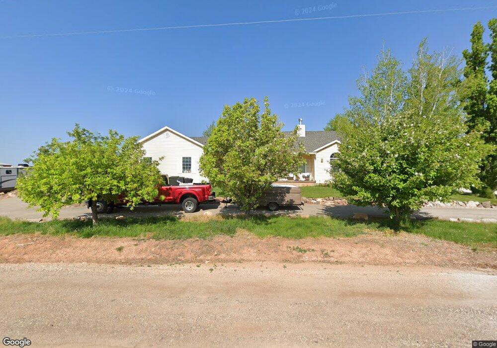
2055 N State St Sigurd, UT 84657
Estimated Value: $350,000 - $567,922
--
Bed
--
Bath
2,258
Sq Ft
$209/Sq Ft
Est. Value
About This Home
This home is located at 2055 N State St, Sigurd, UT 84657 and is currently estimated at $470,981, approximately $208 per square foot. 2055 N State St is a home with nearby schools including Pahvant School, Ashman School, and Red Hills Middle School.
Ownership History
Date
Name
Owned For
Owner Type
Purchase Details
Closed on
May 24, 2021
Sold by
Ashley Valley Industrial Park Llc
Bought by
Poulsen Troy
Current Estimated Value
Purchase Details
Closed on
Mar 4, 2021
Sold by
Cj Houchin Transport Llc
Bought by
Ashley Valley Industrial Park Llc
Purchase Details
Closed on
Sep 2, 2005
Sold by
Perkins Wendy
Bought by
Houchin Chad
Home Financials for this Owner
Home Financials are based on the most recent Mortgage that was taken out on this home.
Original Mortgage
$168,000
Interest Rate
5.76%
Mortgage Type
New Conventional
Create a Home Valuation Report for This Property
The Home Valuation Report is an in-depth analysis detailing your home's value as well as a comparison with similar homes in the area
Home Values in the Area
Average Home Value in this Area
Purchase History
| Date | Buyer | Sale Price | Title Company |
|---|---|---|---|
| Poulsen Troy | -- | Professional Title | |
| Ashley Valley Industrial Park Llc | $185,212 | None Available | |
| Houchin Chad | -- | First American Title Co | |
| Mouchin Chad | -- | First American Title Co |
Source: Public Records
Mortgage History
| Date | Status | Borrower | Loan Amount |
|---|---|---|---|
| Previous Owner | Mouchin Chad | $168,000 |
Source: Public Records
Tax History Compared to Growth
Tax History
| Year | Tax Paid | Tax Assessment Tax Assessment Total Assessment is a certain percentage of the fair market value that is determined by local assessors to be the total taxable value of land and additions on the property. | Land | Improvement |
|---|---|---|---|---|
| 2024 | $2,332 | $280,371 | $23,125 | $257,246 |
| 2023 | $2,448 | $295,921 | $21,993 | $273,928 |
| 2022 | $2,594 | $243,106 | $18,278 | $224,828 |
| 2021 | $3,017 | $238,868 | $18,278 | $220,590 |
| 2020 | $2,069 | $149,271 | $11,189 | $138,082 |
| 2019 | $2,114 | $146,360 | $11,190 | $135,170 |
| 2018 | $1,740 | $129,540 | $10,660 | $118,880 |
| 2017 | $1,697 | $120,920 | $10,660 | $110,260 |
| 2016 | $1,327 | $116,130 | $0 | $0 |
| 2015 | $1,327 | $116,130 | $0 | $0 |
| 2014 | $1,327 | $117,200 | $0 | $0 |
Source: Public Records
Map
Nearby Homes
- 2220 N State St Unit 14
- 305 E 2690 N
- 180 N State St
- 330 W 800 S Unit 105
- 680 E 300 S Unit 110
- 310 W 800 S Unit 106
- 2200 N Hwy 260 (Approximately) W
- 2203 S 1770 W Unit 1
- 79 S 250 E
- 122 S 500 W
- 770 N 300 W Unit 102
- 675 N 300 W Unit 111
- 695 N 300 W Unit 112
- 725 N 300 W Unit 113
- 750 N 300 W Unit 101
- 70 N Main
- 1800 N Vermillion Canal Rd
- 390 N 300 W
- 575 S 205 W
- 1526 N Black Knoll Rd
- 2095 N State St
- 2090 N State St
- 2103 N State St
- 2125 N State St
- 2120 N State St
- 1965 N State St
- 2140 N State St
- 2220 N State Approx
- 2025 N State St
- 155 Lariat Dr
- 2160 N State St
- 2125 N Sr 24
- 2180 N State St
- 85 Vermillion Dr
- 2070 N Alvey Ln
- 129 E Lariat Dr
- 120 E Lariat Dr
- 160 E Lariat Dr
- 70 W 2030 N
- 2210 N State St