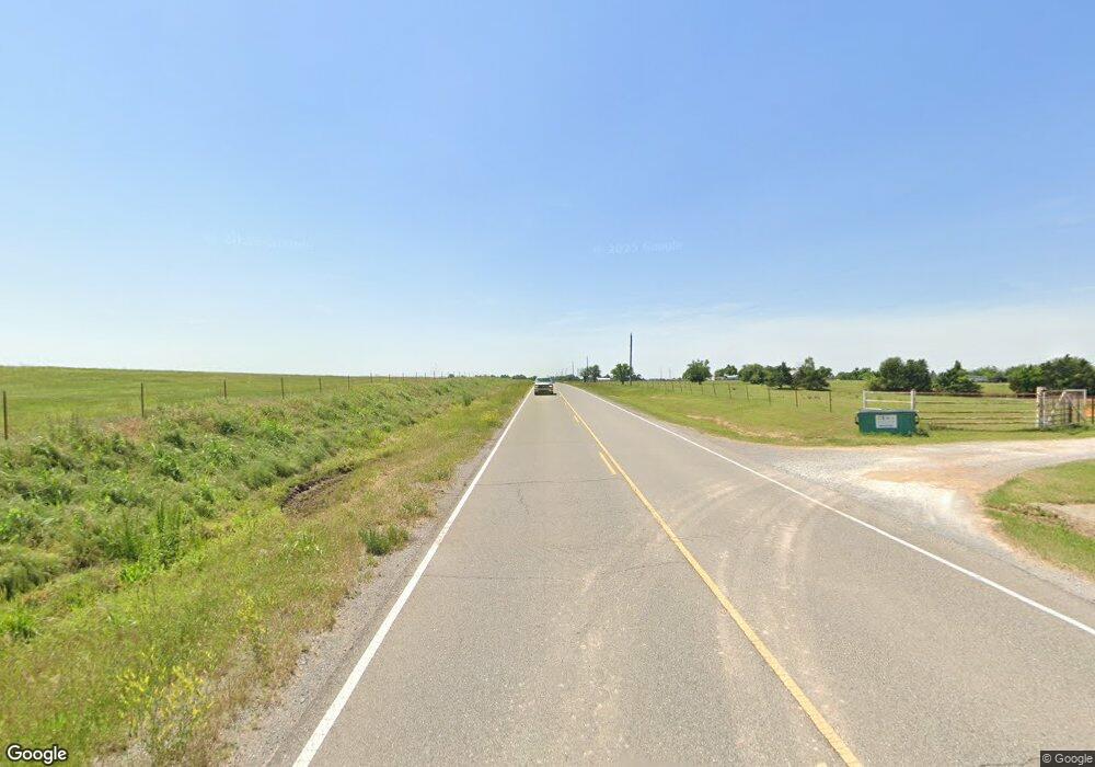
2055 S Banner Rd El Reno, OK 73036
Estimated Value: $590,000 - $658,000
6
Beds
6
Baths
4,181
Sq Ft
$150/Sq Ft
Est. Value
About This Home
This home is located at 2055 S Banner Rd, El Reno, OK 73036 and is currently estimated at $628,805, approximately $150 per square foot. 2055 S Banner Rd is a home located in Canadian County with nearby schools including Banner School.
Ownership History
Date
Name
Owned For
Owner Type
Purchase Details
Closed on
Jul 2, 2018
Sold by
Crossley D Scott and D Scott Crossley Living Trust
Bought by
Cheri Fine Homes & Storm Shelte
Current Estimated Value
Purchase Details
Closed on
Jun 13, 2008
Sold by
Crossley Sherri D and Crossley Sherri Diane
Bought by
Crossley D Scott and Crossley David Scott
Purchase Details
Closed on
Jan 7, 2003
Sold by
Crossley Harry J Sr~ and Obbie Et
Purchase Details
Closed on
Feb 26, 2002
Sold by
Hunters Crossing Dev Co
Purchase Details
Closed on
Aug 25, 1998
Sold by
Mcdowell Raymond W and Mcdowell Charlotte
Create a Home Valuation Report for This Property
The Home Valuation Report is an in-depth analysis detailing your home's value as well as a comparison with similar homes in the area
Home Values in the Area
Average Home Value in this Area
Purchase History
| Date | Buyer | Sale Price | Title Company |
|---|---|---|---|
| Cheri Fine Homes & Storm Shelte | $32,000 | Old Republic Title | |
| Homes Cheri Fine | $32,000 | Old Republic Title | |
| Crossley D Scott | -- | None Available | |
| -- | -- | -- | |
| -- | -- | -- | |
| -- | $160,000 | -- |
Source: Public Records
Tax History Compared to Growth
Tax History
| Year | Tax Paid | Tax Assessment Tax Assessment Total Assessment is a certain percentage of the fair market value that is determined by local assessors to be the total taxable value of land and additions on the property. | Land | Improvement |
|---|---|---|---|---|
| 2024 | $5,479 | $75,000 | $2,584 | $72,416 |
| 2023 | $5,479 | $72,815 | $2,382 | $70,433 |
| 2022 | $5,364 | $70,695 | $2,382 | $68,313 |
| 2021 | $5,232 | $68,636 | $2,382 | $66,254 |
| 2020 | $5,220 | $69,311 | $2,382 | $66,929 |
| 2019 | $5,104 | $67,437 | $2,382 | $65,055 |
| 2018 | $5,027 | $65,473 | $2,383 | $63,090 |
| 2017 | $4,917 | $63,566 | $2,383 | $61,183 |
| 2016 | $4,677 | $63,566 | $2,504 | $61,062 |
| 2015 | -- | $56,730 | $2,193 | $54,537 |
| 2014 | -- | $56,730 | $2,193 | $54,537 |
Source: Public Records
Map
Nearby Homes
- 2858 Fields Rd
- 3490 Manning St
- 3850 S Banner Rd
- 920 S Gregory Rd
- 15821 SW 26th St
- 000 SW 15th St
- 7465 Legacy Pointe Cir
- 4800 Old Farm Rd
- 4850 Old Farm Rd
- 15900 SW 44th St
- 3530 S Manning Rd
- 6220 S Banner Rd
- 4747 Dutton Cir
- 8576 Kayce St
- 8595 Kayce St
- 8626 Kayce St
- 8625 Kayce St
- 8655 Kayce St
- 8545 Kayce St
- 8565 Kayce St
- 17170 15th St SE
- 1630 SW Bobbie Ln
- 17100 15th St SE
- 2350 S Banner Rd
- 2251 Brandi Ln
- 2250 Brandi Ln
- 2351 Brandi Ln
- 2801 S Banner Rd
- 2350 Brandi Ln
- 16780 SW 15th St
- 2401 S Banner Rd
- 16825 SW 23rd St
- 16940 SW 23rd St
- 2510 S Banner Rd
- 17150 SW 15th St
- 20515 SW 15th St
- 2400 Lindsay Ln
- 17435 15th St SE
- 2451 Lindsay Ln
- 2450 Lindsay Ln
