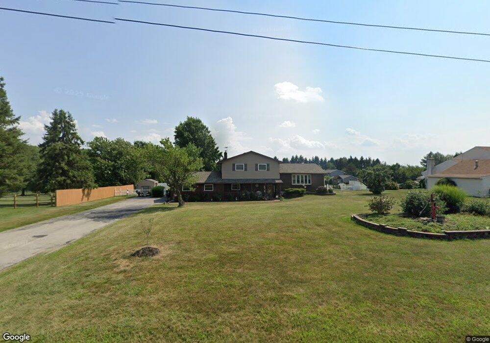
2055 Trolley Bridge Rd Quakertown, PA 18951
Milford-Quakertown NeighborhoodEstimated Value: $376,000 - $475,000
4
Beds
2
Baths
1,178
Sq Ft
$374/Sq Ft
Est. Value
About This Home
This home is located at 2055 Trolley Bridge Rd, Quakertown, PA 18951 and is currently estimated at $440,851, approximately $374 per square foot. 2055 Trolley Bridge Rd is a home located in Bucks County with nearby schools including Pfaff Elementary School, Quakertown Community Senior High School, and Providence Hybrid Academy.
Ownership History
Date
Name
Owned For
Owner Type
Purchase Details
Closed on
Dec 7, 1983
Bought by
Vicente Donald R and Vicente Christine R
Current Estimated Value
Create a Home Valuation Report for This Property
The Home Valuation Report is an in-depth analysis detailing your home's value as well as a comparison with similar homes in the area
Home Values in the Area
Average Home Value in this Area
Purchase History
| Date | Buyer | Sale Price | Title Company |
|---|---|---|---|
| Vicente Donald R | $22,000 | -- |
Source: Public Records
Tax History Compared to Growth
Tax History
| Year | Tax Paid | Tax Assessment Tax Assessment Total Assessment is a certain percentage of the fair market value that is determined by local assessors to be the total taxable value of land and additions on the property. | Land | Improvement |
|---|---|---|---|---|
| 2025 | $6,372 | $31,600 | $4,000 | $27,600 |
| 2024 | $6,372 | $31,600 | $4,000 | $27,600 |
| 2023 | $6,309 | $31,600 | $4,000 | $27,600 |
| 2022 | $6,202 | $31,600 | $4,000 | $27,600 |
| 2021 | $6,202 | $31,600 | $4,000 | $27,600 |
| 2020 | $6,202 | $31,600 | $4,000 | $27,600 |
| 2019 | $6,031 | $31,600 | $4,000 | $27,600 |
| 2018 | $5,821 | $31,600 | $4,000 | $27,600 |
| 2017 | $5,641 | $31,600 | $4,000 | $27,600 |
| 2016 | $5,641 | $31,600 | $4,000 | $27,600 |
| 2015 | -- | $31,600 | $4,000 | $27,600 |
| 2014 | -- | $31,600 | $4,000 | $27,600 |
Source: Public Records
Map
Nearby Homes
- 0 Trolley Bridge Rd
- 7338 Grant Rd
- 3421 Old Bethlehem Pike
- 6551 Blue Church Rd S
- 2565 Allentown Rd
- 1483 Gable Dr
- 1500 Gable Dr
- 7512 S Main St
- 6667 Blue Church Rd S
- 1525 Clay Ave
- 7555 Clayton Ave
- 0 Glen Rd Unit 755784
- 1770 Joanne Dr
- 5895 Glen Rd
- 7302 Leh St
- 173 Ashford Dr
- 167 Ashford Dr
- 168 Ashford Dr
- 5871 Applebutter Hill
- 132 Ashford Dr Unit HOMESITE 0001
- 47 Trolley Bridge Rd
- 1 Trolley Bridge Rd
- 2065 Trolley Bridge Rd
- 826 Trolley Bridge Rd
- 2075 Trolley Bridge Rd
- 850 Trolley Bridge Rd
- 2975 Allentown Rd
- 2080 Trolley Bridge Rd
- 2965 Allentown Rd
- 7974 Locust Valley Rd
- 2955 Allentown Rd
- 8012 Locust Valley Rd
- 2970 Allentown Rd
- 7926 Locust Valley Rd
- 2088 Trolley Bridge Rd
- 2945 Allentown Rd
- 2960 Allentown Rd
- 7898 Locust Valley Rd
- 969 Natalie Ln
- 2950 Allentown Rd