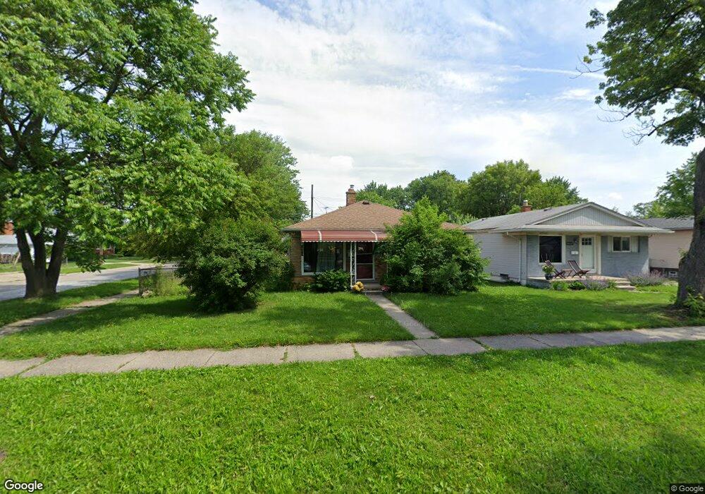
20550 Powers Ave Unit Bldg-Unit Dearborn Heights, MI 48125
Estimated Value: $144,390 - $167,000
3
Beds
1
Bath
980
Sq Ft
$157/Sq Ft
Est. Value
About This Home
This home is located at 20550 Powers Ave Unit Bldg-Unit, Dearborn Heights, MI 48125 and is currently estimated at $154,098, approximately $157 per square foot. 20550 Powers Ave Unit Bldg-Unit is a home located in Wayne County with nearby schools including Polk Elementary School, Bedford School, and Pardee School.
Ownership History
Date
Name
Owned For
Owner Type
Purchase Details
Closed on
Jun 15, 2009
Sold by
Reo Properties Corporation
Bought by
Mazioum Hussein
Current Estimated Value
Purchase Details
Closed on
Feb 26, 2009
Sold by
Federal National Mortgage Association
Bought by
Db Structured Products Inc
Purchase Details
Closed on
Feb 28, 2008
Sold by
Gerathy David and Gerathy Sandra
Bought by
Federal National Mortgage Association
Purchase Details
Closed on
Jul 2, 2007
Sold by
Woolsey Richard and Woolsey Rebecca
Bought by
Gerathy David
Purchase Details
Closed on
Feb 24, 2005
Sold by
Kocsis William R
Bought by
Wells Fargo Bank Minnesota Na
Purchase Details
Closed on
Jan 5, 2005
Sold by
Kocsis William and Kocsis William R
Bought by
1St Trust Bank For Savings
Purchase Details
Closed on
Dec 21, 1987
Sold by
Va
Bought by
Roosevelt Edna H and Stong Richard
Create a Home Valuation Report for This Property
The Home Valuation Report is an in-depth analysis detailing your home's value as well as a comparison with similar homes in the area
Home Values in the Area
Average Home Value in this Area
Purchase History
| Date | Buyer | Sale Price | Title Company |
|---|---|---|---|
| Mazioum Hussein | -- | None Available | |
| Reo Properties Corporation | $26,000 | None Available | |
| Db Structured Products Inc | -- | None Available | |
| Federal National Mortgage Association | $125,545 | None Available | |
| Gerathy David | $145,000 | Lts Title Agency | |
| Wells Fargo Bank Minnesota Na | $22,588 | -- | |
| 1St Trust Bank For Savings | $73,807 | -- | |
| Roosevelt Edna H | -- | -- |
Source: Public Records
Tax History Compared to Growth
Tax History
| Year | Tax Paid | Tax Assessment Tax Assessment Total Assessment is a certain percentage of the fair market value that is determined by local assessors to be the total taxable value of land and additions on the property. | Land | Improvement |
|---|---|---|---|---|
| 2025 | $1,516 | $72,000 | $0 | $0 |
| 2024 | $1,516 | $63,600 | $0 | $0 |
| 2023 | $1,435 | $55,800 | $0 | $0 |
| 2022 | $2,567 | $48,200 | $0 | $0 |
| 2021 | $3,154 | $41,900 | $0 | $0 |
| 2019 | $2,046 | $33,800 | $0 | $0 |
| 2018 | $1,286 | $30,100 | $0 | $0 |
| 2017 | $1,419 | $29,000 | $0 | $0 |
| 2016 | $1,953 | $28,400 | $0 | $0 |
| 2015 | $2,640 | $26,400 | $0 | $0 |
| 2013 | $2,660 | $27,200 | $0 | $0 |
| 2010 | -- | $36,300 | $0 | $0 |
Source: Public Records
Map
Nearby Homes
- 20425 Powers Ave
- 5381 Merrick St
- 5455 Mayfair St
- 5648 Hipp St
- 4679 Mayfair St
- 5621 Merrick St
- 5660 Hipp St
- 5642 Weddel St
- 4641 Weddell St
- 5709 Weddell St
- 4705 Jackson St
- 4924 Ziegler St
- 4455 Hipp St
- 4476 Weddel St
- 4913 Campbell St
- 4644 Gertrude St
- 20001 Annapolis St
- 5873 Merrick St
- 4630 Pelham St
- 21302 Powers Ave
- 20550 Powers Ave
- 20540 Powers Ave
- 20532 Powers Ave
- 4995 Hipp St
- 20602 Powers Ave
- 20524 Powers Ave Unit Bldg-Unit
- 20524 Powers Ave
- 4981 Hipp St
- 20616 Powers Ave
- 20551 Powers Ave
- 20535 Powers Ave
- 4994 Huron St
- 4973 Hipp St
- 20624 Powers Ave
- 20527 Powers Ave
- 20516 Powers Ave
- 20502 Powers Ave
- 4994 Hipp St
- 20519 Powers Ave
- 4965 Hipp St