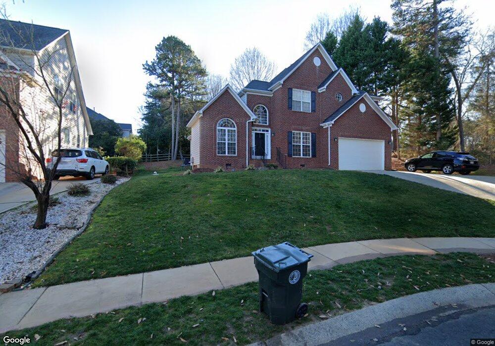
20551 Southshore Dr Cornelius, NC 28031
Estimated Value: $693,000 - $1,201,000
4
Beds
4
Baths
2,667
Sq Ft
$317/Sq Ft
Est. Value
About This Home
This home is located at 20551 Southshore Dr, Cornelius, NC 28031 and is currently estimated at $845,319, approximately $316 per square foot. 20551 Southshore Dr is a home located in Mecklenburg County with nearby schools including Cornelius Elementary School, Bailey Middle School, and William Amos Hough High School.
Ownership History
Date
Name
Owned For
Owner Type
Purchase Details
Closed on
Aug 26, 2015
Sold by
Hickman David Timothy and Hickman Sherry Kronjaeger
Bought by
Hickman Sherry K
Current Estimated Value
Home Financials for this Owner
Home Financials are based on the most recent Mortgage that was taken out on this home.
Original Mortgage
$208,600
Outstanding Balance
$157,798
Interest Rate
2.87%
Mortgage Type
Adjustable Rate Mortgage/ARM
Estimated Equity
$687,521
Purchase Details
Closed on
Oct 8, 1998
Sold by
The Ryland Group Inc
Bought by
Hickman David Timothy and Hickman Sherry Kronjaeger
Home Financials for this Owner
Home Financials are based on the most recent Mortgage that was taken out on this home.
Original Mortgage
$238,100
Interest Rate
6.5%
Create a Home Valuation Report for This Property
The Home Valuation Report is an in-depth analysis detailing your home's value as well as a comparison with similar homes in the area
Home Values in the Area
Average Home Value in this Area
Purchase History
| Date | Buyer | Sale Price | Title Company |
|---|---|---|---|
| Hickman Sherry K | -- | Premier Title & Escrow Compa | |
| Hickman David Timothy | $251,000 | -- |
Source: Public Records
Mortgage History
| Date | Status | Borrower | Loan Amount |
|---|---|---|---|
| Open | Hickman Sherry K | $208,600 | |
| Closed | Hickman David Timothy | $238,100 |
Source: Public Records
Tax History Compared to Growth
Tax History
| Year | Tax Paid | Tax Assessment Tax Assessment Total Assessment is a certain percentage of the fair market value that is determined by local assessors to be the total taxable value of land and additions on the property. | Land | Improvement |
|---|---|---|---|---|
| 2025 | $4,158 | $626,100 | $175,000 | $451,100 |
| 2024 | $4,158 | $626,100 | $175,000 | $451,100 |
| 2023 | $4,090 | $626,100 | $175,000 | $451,100 |
| 2022 | $3,053 | $355,000 | $70,000 | $285,000 |
| 2021 | $3,018 | $355,000 | $70,000 | $285,000 |
| 2020 | $3,018 | $355,000 | $70,000 | $285,000 |
| 2019 | $3,012 | $355,000 | $70,000 | $285,000 |
| 2018 | $2,780 | $255,300 | $60,000 | $195,300 |
| 2017 | $2,758 | $255,300 | $60,000 | $195,300 |
| 2016 | $2,754 | $255,300 | $60,000 | $195,300 |
| 2015 | $2,712 | $255,300 | $60,000 | $195,300 |
| 2014 | $2,710 | $0 | $0 | $0 |
Source: Public Records
Map
Nearby Homes
- 20517 Queensdale Dr
- 20711 Bethel Church Rd
- 20845 Lagoona Dr
- 19934 Walter Henderson Rd
- 20305 Queensdale Dr
- 20338 Christofle Dr
- 20324 Middletown Rd
- 20314 Colony Point Ln
- 20200 Rainbow Cir
- 18937 Southport Dr
- 19040 Mary Ardrey Cir
- 20400 Marblehead Ct
- 20015 N Cove Rd
- 19307 Beaufain St Unit 14
- 20114 Norman Colony Rd
- 19525 Mary Ardrey Cir
- 20028 Northport Dr
- 19506 Mary Ardrey Cir
- 19005 Northport Dr
- 20105 Chapel Point Ln
- 20549 Southshore Dr
- 19725 Outermark Ln
- 20624 Bethel Church Rd
- 19717 Outermark Ln
- 20700 Bethel Church Rd
- 20552 Southshore Dr
- 19724 Outermark Ln
- 20548 Southshore Dr
- 20542 Southshore Dr
- 19709 Outermark Ln
- 20704 Bethel Church Rd
- 20536 Southshore Dr
- 19716 Outermark Ln
- 20318 Bethelwood Ln
- 20530 Southshore Dr
- 19708 Outermark Ln
- 20712 Bethel Church Rd
- 20523 Southshore Dr
- 20524 Southshore Dr
- 20326 Bethelwood Ln