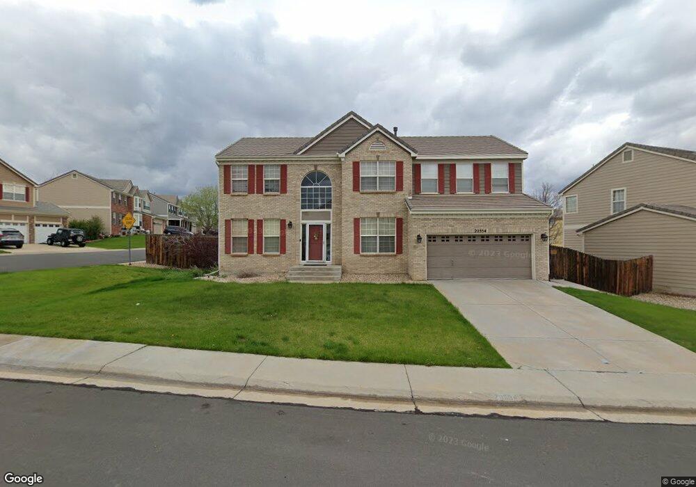
20554 E Union Cir Aurora, CO 80015
Willow Trace NeighborhoodEstimated Value: $634,369 - $658,000
4
Beds
3
Baths
2,684
Sq Ft
$241/Sq Ft
Est. Value
About This Home
This home is located at 20554 E Union Cir, Aurora, CO 80015 and is currently estimated at $646,092, approximately $240 per square foot. 20554 E Union Cir is a home located in Arapahoe County with nearby schools including Aspen Crossing Elementary School, Sky Vista Middle School, and Eaglecrest High School.
Ownership History
Date
Name
Owned For
Owner Type
Purchase Details
Closed on
Jul 8, 2020
Sold by
Snyder Steven M and Snyder Patricia A
Bought by
Elmadani Abdelgadir and Kassis Asma
Current Estimated Value
Home Financials for this Owner
Home Financials are based on the most recent Mortgage that was taken out on this home.
Original Mortgage
$451,250
Outstanding Balance
$397,452
Interest Rate
3.1%
Mortgage Type
New Conventional
Estimated Equity
$248,640
Purchase Details
Closed on
Aug 23, 2002
Sold by
Richmond American Homes Of Colorado Inc
Bought by
Snyder Patricia A and Snyder Steven M
Home Financials for this Owner
Home Financials are based on the most recent Mortgage that was taken out on this home.
Original Mortgage
$246,250
Interest Rate
4.75%
Create a Home Valuation Report for This Property
The Home Valuation Report is an in-depth analysis detailing your home's value as well as a comparison with similar homes in the area
Home Values in the Area
Average Home Value in this Area
Purchase History
| Date | Buyer | Sale Price | Title Company |
|---|---|---|---|
| Elmadani Abdelgadir | $475,000 | Guardian Title | |
| Snyder Patricia A | $307,861 | -- |
Source: Public Records
Mortgage History
| Date | Status | Borrower | Loan Amount |
|---|---|---|---|
| Open | Elmadani Abdelgadir | $451,250 | |
| Previous Owner | Snyder Patricia A | $246,250 |
Source: Public Records
Tax History
| Year | Tax Paid | Tax Assessment Tax Assessment Total Assessment is a certain percentage of the fair market value that is determined by local assessors to be the total taxable value of land and additions on the property. | Land | Improvement |
|---|---|---|---|---|
| 2025 | $5,744 | $39,613 | -- | -- |
| 2024 | $5,254 | $41,922 | -- | -- |
| 2023 | $5,254 | $41,922 | $0 | $0 |
| 2022 | $4,247 | $31,679 | $0 | $0 |
| 2021 | $4,290 | $31,679 | $0 | $0 |
| 2020 | $4,291 | $31,439 | $0 | $0 |
| 2019 | $4,208 | $31,439 | $0 | $0 |
| 2018 | $4,011 | $27,670 | $0 | $0 |
| 2017 | $3,962 | $27,670 | $0 | $0 |
| 2016 | $3,829 | $25,735 | $0 | $0 |
| 2015 | $3,732 | $25,735 | $0 | $0 |
| 2014 | -- | $20,760 | $0 | $0 |
| 2013 | -- | $22,750 | $0 | $0 |
Source: Public Records
Map
Nearby Homes
- 20431 E Union Cir
- 20541 E Union Ave
- 4632 S Malaya Ct
- 20528 E Grand Ln
- 4655 S Odessa St
- 4468 S Malaya Ct
- 20004 E Tufts Dr
- 20021 E Bellewood Dr
- 4778 S Picadilly Ct
- 20970 E Quincy Dr
- 21761 E Layton Dr
- 4366 S Nepal St
- 5295 S Liverpool Way
- 4865 S Espana Ln
- 4346 S Netherland St
- 4331 S Gibraltar St
- 5305 S Ireland Way
- 4363 S Genoa Ct
- 4947 S Espana Way
- 4304 S Genoa Ct
- 20483 E Layton Ave
- 20482 E Union Cir
- 20494 E Layton Ave
- 20553 E Union Cir
- 20573 E Union Cir
- 20543 E Union Cir
- 20474 E Layton Ave
- 20462 E Union Cir
- 20523 E Union Cir
- 20593 E Union Cir
- 20452 E Union Cir
- 4806 S Jericho Ct
- 20463 E Layton Ave
- 20464 E Layton Ave
- 20503 E Union Cir
- 20442 E Union Cir
- 4775 S Killarney Ct
- 4785 S Killarney Ct
- 20485 E Layton Place
- 4795 S Killarney Ct
Your Personal Tour Guide
Ask me questions while you tour the home.